| |
|
Excel
Flight Log - Internationl Version A very simple freeware
logbook that is perfect for flight simulation. All you need
is Excel. In this version you can input hours and minutes,
the standard for log books for ICAO. By: CJ Starr. 193K
|
|
 |
|
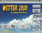
Wetter
2000 will create enroute weather with departure and
destination airports, weather for enroute waypoints and destination
airports and start at the location of a saved flight file,
world weather for pre-defined areas (Europe, Africa, Asia,
Australia, Ocean weather), world weather for your own desired
areas, weather from a FS2000 flight plan, following the waypoints,
changing weather, even if you stay in one area, real weather,
if you want to use METAR or SAO files. The weather is created
depending on your current location, season, time of day. You
may preset special weather settings or create random weather.
By Klaus Prichatz. 1.2MB
|
|
|
|
U.S.
Nav Aids now includes Alaska, New York, Northern Pennsylvania,
Northern New Jersey, Central and Western Connecticut, Central
and Western Massachusetts and Vermont. U.S. Nav Aids was
made with Paint Shop Pro. Some of the maps require you Rotate
the map 90 degrees to print the full size map. The Cities
on the map are Navigation Points, but most of them have airports
as well. All maps display VOR's, NDB's and Elevations. All
maps are the latest versions with additional Nav Aids or corrections.
Created by Bob Baker. 121K
|
|
| |
| NAV:
A Flight Simulator scenery file viewer and flight planner.
NAV is a Microsoft Flight Simulator (versions 5, 95, 98, and
2000) compatible scenery file (BGL) viewer and flight planner.
NAV will show (and print) a map of all the navigational aids,
runways and airports in your scenery files, let you measure
distances between places, search the files for specific items,
create a flight plan showing navigational aid frequencies and
distance, fuel, and estimated time between references points,
link to Flight Simulator to show your map position updated in
real time, and control your autopilot to help you navigate.
1.7MB |
|
 |
| FS98/FS2000
FS Meteo v4.75 will set cloud layers, wind speed, gusty
wind,rain, upper wind (ALOFT),snow,thunder,wind direction, temperature,altimeter
and visibility through an Internet connection in online mode
or in offline mode. It will check where your plane will be and
set the parameters to the real weather where you fly and will
give you up to date information during flight. FSMeteo can also
request airport weather! By Marc Philibert. 708K |
|
 |
|
FLiCK
v1 - Flight Conversion Kit A small Utility I wrote
to convert airspeed, fuel consumption, distance, Bank angles,
Descent rates, just about everything. Bu Stephen Davey 158K
|
|
| APLC
V1.32 Version 1.32 works in conjunction with FSUIPC
(here) by Peter Dowson
to provide some extra weather facilities For Flight Simulator
2000. Downloading and installing FSUIPC also fixes the weather
problems caused by Flight Simulator 2000. 787K |
|
|
| Boeing
B747-400 Operations Manual and AIR file A comprehensive
MS Word Document with matching AIR file for Microsoft´s Flight
Simulators 98 and 2000, covering proper Boeing B747-400 Flight
Simulator operations on more than 20 pages and featuring accurate
flight dynamics. Many charts and drawings are included for better
understanding and readability. Manual and AIR file by Johan
Dees, manual modified by Uwe Rademacher. 1.4MB |
|
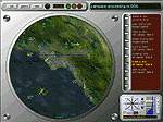 |
| Air
Traffic Controller Simulation. An air traffic controller
simulator for Windows 95/98. Allows you to take control of an
air traffic terminal facility at a major airport. Downloadable
airports. By Joe Jaworski. 9.6MB |
|
|
|
|
THERMAKE
1.0.1 : Random thermal generator for virtual soaring
everywhere you want. No code writing, no dos operation, no
file handling. Puts randomly upward-airstreams with or without
clouds in any FS5 to FS2000 scenery : 8 possible layers with
in each 200 thermic clouds plus 200 ground thermals on 64x64km
areas. Freeware. Michel Polski. 2.9MB
UPGRADE
FOR THERMAKE1.0 TO THERMAKE 1.1 (thermk10.zip required)
Random thermal generator for virtual soaring everywhere you
want. Longitudes bugs corrected and other minor improvements
added. NEW batch FS launcher : ability to make automatically
different random thermals each time you launch FS. Freeware.
Michel Polski. 135K
FIX
FOR THERMAKE1.1 (thermk11.zip required) Thermal sceneries
are now saved correctly and work properly. Freeware. Michel
Polski. 156K
|
|
| |
|