


7.69Mb (220 downloads)
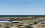
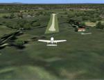
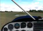
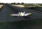
LPTJ Tojeira ULM Airfield, Portugal. Although this is a certified airfield, have no ICAO published, so I gave it the fake LPTJ.
This scenery is fully compatible with Portugal Terrain from PTSIM (http://www.ptsim.com) and is based on digital pictures taken at the place, accurate real measures by Aerodromos de Portugal (http://www.roteiro.apau.org/zmapa.html) and Google Earth.
Freeware. For Microsoft FS2004. Not tested for FSX
Posted Oct 17, 2013 04:58 by Joao A. Graca Ferreira
2.95Mb (284 downloads)
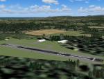
LPUN Laundos Airfield, Portugal.
This freeware scenery was created using pictures referenced from the internet, as well as real measures by Google Earth and official information at http://www.nav.pt/ais/VFRs/s.%20miguel%20de%20laundos%20ulm.pdf (it is supposed you download the file and read it). This scenery is to be used exclusively with Portugal Terrain from PTSIM (http://www.ptsim.com)
Freeware. For Microsoft FS2004. Not tested for FSX
Posted Oct 17, 2013 04:41 by Joao A. Graca Ferreira
2.93Mb (181 downloads)
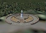
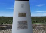
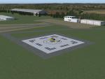
Geodesic Center of Portugal.
This scenery is only compatible with Portugal Terrain from PTSIM (http://www.ptsim.com) and is based on digital pictures taken at the place, as well as pictures from internet.
Freeware. For Microsoft FS2004. Not tested for FSX.
Posted Oct 16, 2013 07:03 by Joao A. Graca Ferreira

1.31Mb (162 downloads)
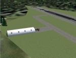
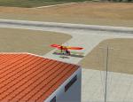
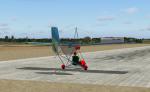
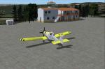
Atouguia da Baleia (Peniche) ULM Airfield V1.
This scenery is ONLY compatible with freeware Portugal Terrain from PTSIM (http://www.ptsim.com) and is based on digital pictures taken at the place, accurate real measures by Aerodromos de Portugal (http://www.pelicano.com.pt/zmapa.html). Although certified for ULM, this airfield have no ICAO so I gave it the fake LPAB
Freeware. For Microsoft FS2004. Not tested for FSX.
Posted Oct 16, 2013 07:00 by Joao A. Graca Ferreira
10.04Mb (179 downloads)
Bilrete and Garrocheira private airfields. This scenery is to be used with freeware PTTerrain from PTSIM. Digital pictures taken at the place. For FS2004. Not tested for FSX
Posted Oct 16, 2013 06:56 by Joao A. Graca Ferreira
5.62Mb (270 downloads)
LPBE Beja Civil airfield (Rwy inside Beja MCTR)
This freeware scenery was created using pictures taken at the internet, details from APAU (http://roteiro.apau.org/zp_beja.html, VFR manual (http://www.nav.pt/ais/VFRs/beja%20ulm.pdf - it is supposed you download the file) as well as real measures by Google Earth; this ULM certified airfield at south Alentejo and closer to Beja AB, despite technical information, have, in fact, two paralel rwys in good shape.
This scenery is to be used EXCLUSIVELLY with Portugal Terrain from PTSIM (http://www.ptsim.com)
For Microsoft FS2004 (ACOF). Not tested for FSX (you may try, but you'll probably get problems with geotagging as well as altitude; same fact for all my sceneries and landmarks I published so far).
Posted Oct 16, 2013 06:45 by Joao A. Graca Ferreira
3.28Mb (236 downloads)
LPCB Castelo Branco scenery 1.0
Castelo Branco Airfield. LPCB is fictional I created as it has no published ICAO.
This scenery is fully compatible with Portugal Terrain from PTSIM (http://www.ptsim.com) and is based on digital pictures taken at the place, accurate real measures by Aerodromos de Portugal (http://www.pelicano.com.pt/zmapa.html) and Google Earth.
Freeware. For Microsoft FS2004. Not tested for FSX.
Posted Oct 16, 2013 06:40 by Joao A. Graca Ferreira
5.01Mb (318 downloads)
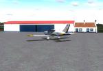
LPFA Ferreira do Alentejo private certified general and ULM aviation airfield.
This freeware scenery was created using pictures from internet as well as real measures by Google Earth and official information at http://www.nav.pt/ais/VFRs/ferreira%20do%20alentejo.pdf (it is supposed you download the file and read it carefully).
This scenery is to be used exclusively with Portugal Terrain from PTSIM (http://www.ptsim.com)
Freeware. For Microsoft FS2004. Not tested for FSX.
Posted Oct 16, 2013 06:17 by Joao A. Graca Ferreira
3.08Mb (209 downloads)
LPFC Figueira de Cavaleiros (Ferreira do Alentejo) scenery 1.0
Figueira de Cavaleiros Airfield. LPFC is a fake I create, as it has no published ICAO.
This scenery is fully compatible with Portugal Terrain from PTSIM (http://www.ptsim.com) and is based on digital pictures taken at the place, accurate real measures by Aerodromos de Portugal (http://www.pelicano.com.pt/zmapa.html).
Freeware. For Microsoft FS2004. Not tested for FSX.
Posted Oct 16, 2013 06:07 by Joao A. Graca Ferreira
2.29Mb (239 downloads)
LPFZ Ferreira do Zezere Municipal airfield (Pombeira Airfield).
This is a certified Airfield in the neighborhood of Ferreira do Zezere and closer to the Zezere river. Mostly used for fire fighting during summer season. Certified for ULM and helicopters. As there are some a great resorts on the neighborhood, this airfield is also used by some of their costomers.
This scenery is fully compatible with Portugal Terrain from PTSIM (http://www.ptsim.com) and is based on digital pictures, accurate real measures by Aerodromos de Portugal (http://www.http://roteiro.apau.org/zmapa.html) and Google Earth.
Posted Oct 16, 2013 04:24 by Joao A. Graca Ferreira