|
| FS2002/FS2004
Scenery -- Malibu, California Version 2
This scenery area includes the original 4000 foot runway and
helipad with all of the original surrounding hangars and facilities
of Aeroworks Flight Center 2 on top of a 1400 foot hill, right
by the coast of California. In addition, version 2 adds docks,
piers, and seaplane facility on the beach with a 2000ft runway
and a sea lane landing area marked with buoys for water operations
as well as several new custom designed macros and the usual
concept aircraft macros. This scenery works in conjunction with
FS2002's AFD and shows up on FS2002 GPS. Scenery and macro's
by Jason L. Terry. 1.6MB |
|
 |
| FS2004
Kai Tak Version VHHX4v1 - Total Kai Tak Package.
The package contains much more than just a Kai Tak scenery.
It represents a complete momento of this totally unique, now
almost completely destroyed airport. The scenery itself contains
full IGS/ILS data and in particular you can now shoot the famous
IGS approach to runway 13 in FS2004 exactly as it was done in
real life. The scenery should be pretty recognizable. Most of
the airport infrastructure is in place together with most of
the key features in the surrounding area. However, the scenery
does not yet have replacements for the default terminal buildings
- those will come at a later date. Dedicated to the memory of
our much missed friend John 'FSTipster' Consterdine. Created
by Roger Mole. 12.3MB |
|
 |
| FS
2004 Bangkok Scenery Package.
Features: * airport completely redesigned from scratch custom
3-D buildings created, * AFCAD2 file included, * Don Muang tollway,
* major city landmark buildings, * library objects used when
necessary, * VTP roads, parks, golf courses, rivers and lakes,
* elevated helipads located within the city, * fireworks at
Lumphini Park and Sanum Luang for most holidays. Created by
Martin Strong. 8.9MB |
|
 |
|
 |
| FS2004
or 2002 scenery - Arecibo Observatory & surrounding hills,
currently
operated by the Cornel University, is a big object in the Arecibo
area, in Puerto Rico, and can be seen from quite a distance.
It is close to the Arecibo airport, ICAO designation ABO (ARE
in FS2002). The observatory is used for radio-astronomy, and
the spheric dish is 304 metres in diameter. ("Spheric" as opposed
to "parbolic"). The "receiver-transmitter" is in a gondola suspended
over the dish by three sets of cables, which are suspended from
three towers. The Microsoft FS2004 site has testimonials claiming
the existence of the observatory, but it only exists in FS2000,
where it is quite poorly done. Author: Fern Marques. 111K |
|
 |
| FS2004
Saskatoon Airport, Saskatchewan, Canada CYXE.
This is our little airport .All the buildings are hand made
,most from digital pictures of the real airport .Some of the
buildings are made up from my own mind to add a little extra
to the scenery. 3.5MB |
|
 |
| FS2004
Grafton District Airport (YGFN), NSW, Australia. A
delightful small airport on the east coast of Australia midway
between Brisbane and Sydney. AFCAD2 and Traffic tools files
included. The small size of the airport has allowed me to concentrate
on realism. What you see is very much what is there in real
life. Photo- realistic textures for buildings and trees. John
Ross. 2.2MB |
|
 |
|
FS2004
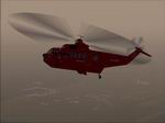
Greenland Ports and Docks V2 Description:
Greenland is a demanding place for flying: The huge island
features rapidly changing weather, short airfields, very rough
terrain and few navigational facilities. Most of these flights
simulate real Air Greenland operations: International routes
flown by a 757 and an Airbus 330. Domestic routes flown mainly
by DASH-7´s and Sikorsky S-61 choppers. Charter flights handled
by floatplanes and business jets. Also a DC-3 ferry flight.
All flights have associated weather and flightplan files,
the flightplans seek to approximate the real routes flown
by way of manual editing. 4.3MB
AFCAD
files for this package. 136K
|
|
 |
|
 |
|
  |
|