FSX
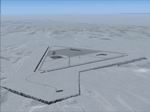
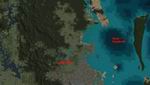
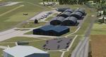
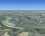
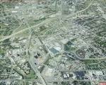
Terrain patch for CFB North Star - CYNS
(here). . Addresses ground flattening
problem evident when using FS Genesis, with alternate styles
of flatten plateaus included. Also features minor airport modifications,
although layout/3-D scenery remains unchanged. By Brian Sturton.
417K
FS2004/FSX
Rocky Mountains Scenery Package Part 4: Stevens (2V1), Colorado
(CO).
This is the fourth part of the Rockies project and it extends
the third part to the east. It contains the area around Pagosa
Springs, the San Juan Mountains and extends down to the northern
shores of Navajo Lake. All four parts provide a rectangular
area covering 14,000 sq km of beautiful soutwestern Colorado
landscape. By Gottfried Razek. 95.8MB
FSX
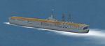
USS Ranger CV-4. This
is a static scenery model of the USS Ranger, CV-4. The Ranger
was the first US ship designed as an aircraft carrier from the
start. The model is a true FSX project; it was compiled with
Xtomdl into FSX SP-2. It has an exact shape hard deck, rotating
radar dish, rotating beacon, dual smoke effects and a ship wake
effect. It has a night texture for night carrier ops. It is
located just south of Long Beach, Ca. harbor. The necessary
files needed to relocate it to other places are included. These
files work with Bglcomp which is not included. By Paul Clawson.
329K
FSX
KISM airport, Orlando Florida.
It includes several building adjustments and parking adjustments.
I’ve tested it in free flight and online, it works very
well with both. 332K
FSX
Brisbane Parts Scenery, Australia.
This is a small addon that will just add better scenery of Samford
(a small town north of Brisbane) and North Stradbroke Island.
(an island Near Brisbane INTL).. By Grant Clahsen. 740K
FSX
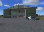
Improvements for Saratoga County Airport, New York (updated).
I have added almost every parking space I could count. A fuel
truck has been added to the airport along with a hanger. There
is no updated flight plans for the airport. Compiled in ADE.Designed
by Brandon Valvo. 474K
Update:
I have added almost every parking space I could count. A fuel
truck has been added to the airport along with a hanger. There
is no updated flight plans for the airport.Parking lot added.
Compiled in ADE.Designed by Brandon Valvo (Brando14100 on
Simviation forum). Based on the original stock airport. 136K
FSX
Alfs UK Airfields Volume 3.
Although FSX scenery is a great improvement on FS2004, there
are still many small airfields in the UK with little or no details.
I have tried to improve this in a small wayThis Volume consists
of: EGKH Lashenden EGSX North Weald EGCJ Sherburn-in-Elmett
EGBS Shobdon. Alf Denham. 2.3MB
FS2004/FSX
"City of Manila" Philippines Package.
Fly over the city of Manila as you have never done it before!
Lots of landmarks of Manila city are represented in these files.
These files are optimized for a good frame rate performance.
Author Nestor D'Angelo. 6.9MB
FSX
Alf's UK Airfields Volume 4.
Upgrades many small UK airfields whose default versions have
little or no detail. Based on Google Earth and airport guides.
This volume includes EGTB Booker and BookerPlus and EGST Elmsett.
By Alf Denham. 9.6MB
FSX
Alf's UK Airfields Volume 5.
Upgrades many small UK airfields whose default versions have
little or no detail. Based on Google Earth and airport guides.
This volume includes EGSU Duxford, EGSR Earls Colne and EGFE
Haverfordwest. By Alf Denham. 1.1MB
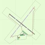
FSX
Davis University Airport (0O5).
This scenery package accurately updates taxiways, runways, and
various other aspects of University Airport in Davis, California
(0O5). For FSX ONLY! Real world dimensions were used through
Google Earth. In addition, it includes the placement of various
objects from the default FSX scenery library. Compiled using
Airport Design Editor. Phillip Coyle. 93K
FSX
Chernobyl and the exclusion zone Scenery.
Landmark scenery for FSX, tested only with SP2 and Acceleration.
Includes a custom built reactor building, but most of the rest
uses default FSX objects. The Chernobyl NPP power station is
modelled as it was from about 1997 to 2005, before construction
of the new containment building. Also includes landclass for
the surrounding area. By Mike D. Dalgleish. 602K
FSX
Taxiway Enhancement Final.
Improved the detail of the textures with enhanced colours and
texture quality. Added som new layers to the default textures
with hand designed textures. I also added a tird corrected file
this time. By Tom Knudsen. 342K
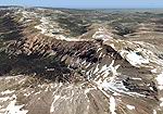
FS2004/FSX
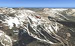
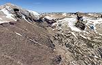
Rocky Mountains, Colorado (CO), Part 5:
Rocky Mountain National Park / Granby (KGNB) photoscenery. Fly
around Longs Peak (14,255 feet), along the Continental Divide,
Trail Ridge Road or up to the origin of the Colorado River.
Covers Estes Park and Lake Granby as well. 3500 sq km of pristine
mountain area. By Gottfried Razek. 96MB
FSX
Redding Municipal Airport (KRDD), Ca.
This scenery package updates Redding Municipal Airport in Redding,
California (KRDD). Taxiways, runways, parking, including the
northeast parking ramp, which was not in the original FSX version,
as well as other aspects, were updated. Real world demensions
were used through Google Earth. This update also includes placment
of objects from the default FSX scenery libraries. Compiled
using Airport Design Editor. By Phillip Coyle. 245K
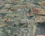
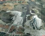
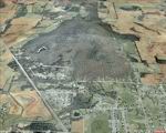
FSX
Huntsville PhotoReal Scenery Package Section A. This is
high resolution, 1Meter/Pixel, terrain scenery for Huntsville,
Alabama. This section, A, features the Tennessee River and portions
of the Redstone Arsenal. This photoscenery is for DAY USE ONLY
and will work for any season, but shows only the USGS aerial
photo data taken in 2002. The default FSX mesh works well with
this photoscenery and no additional mesh for the area needs
to be purchased. This is one section of the overall which includes
sections A, B, C, D, E, F, G, H, I, J, K and L totaling 410
square miles in 946 mb.
By Jim Jones. 72MB
FSX
Huntsville PhotoReal Scenery Package Section B. This is
high resolution, 1Meter/Pixel, terrain scenery for Huntsville,
Alabama. This section, A, features the Tennessee River and portions
of the Redstone Arsenal. This photoscenery is for DAY USE ONLY
and will work for any season, but shows only the USGS aerial
photo data taken in 2002. The default FSX mesh works well with
this photoscenery and no additional mesh for the area needs
to be purchased. This is one section of the overall which includes
sections A, B, C, D, E, F, G, H, I, J, K and L totaling 410
square miles in 946 mb.
By Jim Jones. 72MB
FSX
Huntsville PhotoReal Scenery Package Section C. This is
high resolution, 1Meter/Pixel, terrain scenery for Huntsville,
Alabama. This section, A, features the Tennessee River and portions
of the Redstone Arsenal. This photoscenery is for DAY USE ONLY
and will work for any season, but shows only the USGS aerial
photo data taken in 2002. The default FSX mesh works well with
this photoscenery and no additional mesh for the area needs
to be purchased. This is one section of the overall which includes
sections A, B, C, D, E, F, G, H, I, J, K and L totaling 410
square miles in 946 mb.
By Jim Jones. 72MB
FSX
Huntsville PhotoReal Scenery Package Section D. This is
high resolution, 1Meter/Pixel, terrain scenery for Huntsville,
Alabama. This section, A, features the Tennessee River and portions
of the Redstone Arsenal. This photoscenery is for DAY USE ONLY
and will work for any season, but shows only the USGS aerial
photo data taken in 2002. The default FSX mesh works well with
this photoscenery and no additional mesh for the area needs
to be purchased. This is one section of the overall which includes
sections A, B, C, D, E, F, G, H, I, J, K and L totaling 410
square miles in 946 mb.
By Jim Jones. 72MB
FSX
Huntsville PhotoReal Scenery Package Section E. This is
high resolution, 1Meter/Pixel, terrain scenery for Huntsville,
Alabama. This section, A, features the Tennessee River and portions
of the Redstone Arsenal. This photoscenery is for DAY USE ONLY
and will work for any season, but shows only the USGS aerial
photo data taken in 2002. The default FSX mesh works well with
this photoscenery and no additional mesh for the area needs
to be purchased. This is one section of the overall which includes
sections A, B, C, D, E, F, G, H, I, J, K and L totaling 410
square miles in 946 mb.
By Jim Jones. 72MB
FSX
Huntsville PhotoReal Scenery Package Section F. This is
high resolution, 1Meter/Pixel, terrain scenery for Huntsville,
Alabama. This section, A, features the Tennessee River and portions
of the Redstone Arsenal. This photoscenery is for DAY USE ONLY
and will work for any season, but shows only the USGS aerial
photo data taken in 2002. The default FSX mesh works well with
this photoscenery and no additional mesh for the area needs
to be purchased. This is one section of the overall which includes
sections A, B, C, D, E, F, G, H, I, J, K and L totaling 410
square miles in 946 mb.
By Jim Jones. 72MB
FSX
Huntsville PhotoReal Scenery Package Section G. This is
high resolution, 1Meter/Pixel, terrain scenery for Huntsville,
Alabama. This section, A, features the Tennessee River and portions
of the Redstone Arsenal. This photoscenery is for DAY USE ONLY
and will work for any season, but shows only the USGS aerial
photo data taken in 2002. The default FSX mesh works well with
this photoscenery and no additional mesh for the area needs
to be purchased. This is one section of the overall which includes
sections A, B, C, D, E, F, G, H, I, J, K and L totaling 410
square miles in 946 mb.
By Jim Jones. 72MB
FSX
Huntsville PhotoReal Scenery Package Section H. This is
high resolution, 1Meter/Pixel, terrain scenery for Huntsville,
Alabama. This section, A, features the Tennessee River and portions
of the Redstone Arsenal. This photoscenery is for DAY USE ONLY
and will work for any season, but shows only the USGS aerial
photo data taken in 2002. The default FSX mesh works well with
this photoscenery and no additional mesh for the area needs
to be purchased. This is one section of the overall which includes
sections A, B, C, D, E, F, G, H, I, J, K and L totaling 410
square miles in 946 mb.
By Jim Jones. 72MB
FSX
Huntsville PhotoReal Scenery Package Section I. This is
high resolution, 1Meter/Pixel, terrain scenery for Huntsville,
Alabama. This section, A, features the Tennessee River and portions
of the Redstone Arsenal. This photoscenery is for DAY USE ONLY
and will work for any season, but shows only the USGS aerial
photo data taken in 2002. The default FSX mesh works well with
this photoscenery and no additional mesh for the area needs
to be purchased. This is one section of the overall which includes
sections A, B, C, D, E, F, G, H, I, J, K and L totaling 410
square miles in 946 mb.
By Jim Jones. 72MB
FSX
Huntsville PhotoReal Scenery Package Section J. This is
high resolution, 1Meter/Pixel, terrain scenery for Huntsville,
Alabama. This section, A, features the Tennessee River and portions
of the Redstone Arsenal. This photoscenery is for DAY USE ONLY
and will work for any season, but shows only the USGS aerial
photo data taken in 2002. The default FSX mesh works well with
this photoscenery and no additional mesh for the area needs
to be purchased. This is one section of the overall which includes
sections A, B, C, D, E, F, G, H, I, J, K and L totaling 410
square miles in 946 mb.
By Jim Jones. 72MB
FSX
Huntsville PhotoReal Scenery Package Section K. This is
high resolution, 1Meter/Pixel, terrain scenery for Huntsville,
Alabama. This section, A, features the Tennessee River and portions
of the Redstone Arsenal. This photoscenery is for DAY USE ONLY
and will work for any season, but shows only the USGS aerial
photo data taken in 2002. The default FSX mesh works well with
this photoscenery and no additional mesh for the area needs
to be purchased. This is one section of the overall which includes
sections A, B, C, D, E, F, G, H, I, J, K and L totaling 410
square miles in 946 mb.
By Jim Jones. 72MB
FSX
Huntsville PhotoReal Scenery Package Section L. This is
high resolution, 1Meter/Pixel, terrain scenery for Huntsville,
Alabama. This section, A, features the Tennessee River and portions
of the Redstone Arsenal. This photoscenery is for DAY USE ONLY
and will work for any season, but shows only the USGS aerial
photo data taken in 2002. The default FSX mesh works well with
this photoscenery and no additional mesh for the area needs
to be purchased. This is one section of the overall which includes
sections A, B, C, D, E, F, G, H, I, J, K and L totaling 410
square miles in 946 mb.
By Jim Jones. 72MB
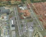
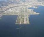
FSX
San Francisco Intl Airport (KSFO)
, update for default scenery. All runwaysand taxiways are placed
at correct geographic coordinates. Shoulders along the runways
and taxiways have been added and surfaces changed to present
an appearance that looks a little more realistic. Default scenery
for terminals and buildings are reused, parking and jetways
have been adjusted to match current assignments. All ILS holds
are placed as they are, but I added hidden runway hold lines
to work with AI traffic. Dan Downs. 1.8MB
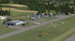
FSX
KGSP Greenville Spartanburg International Airport, South Carolina
Improvements.
This AFX File adds all jetways for normal scenery complextion
use, airline gate are correctly placed and assigned including
A6 and A7 at the back of the terminal. All AITraffic will spawn
on the right gates, and the Fedex cargo terminal is added. Taxiway
Outlines and new vehicle paths added. Just copy and paste the
file into your addon scenery/scenery folder and enjoy the scenery
by Duke DeFouw. 27K
FSX
Chico Municipal Airport (KCIC).
This is a scenery update for Chico Muni. Taxiways, runways,
parking, and other aspects were updated using real world demensions
through Google Earth. This also places a few objects from the
default FSX scenery library. Compiled using Airport Design Editor.
View Readme for installation and notes. By Phillip Coyle. 285K
FS2004/FSX
Rocky Mountains, Colorado (CO), Part 6: Mt. Evans Area / Georgetown
photoscenery.
Extends the fifth part to the south providing another 3500 sq
km of Continental Divide scenery. Contains Mount Evans where
you can see the highest paved road in the US that goes thru
three live-zones and leads right to the top of the mountain
at 14,264 feet. By Gottfried Razek. 97.2MB
FSX
VYYY Yangon Intl Airport Mingaladon V4.0 with Traffic-Pack 1
Yangon
International Airport "MINGALADON" in Burma, Myanmar,
include Traffic-Pack 1. Version 4.0 with new dock "G",
jetways, already extended runway, taxiways and new taxisigns.
First of all we corrected the airport location to the real one.
With Myanmar Air Force area, Helipads and even more parkings
for civilian airplanes. This scenery was produced based of visit
and on pictures of satellites. Traffic-Pack 2 comes with vymm2tp2.zip.
Traffic-Pack 3 comes soon too. Many Thanks go to Francisco Sánchez-Castañer,
Fernando Martinez, Mike Stone and the teams of HOUSE-RP in Burma,
FSX Planner, SceneGenX, SBuilder X, Open Ports Scanner, AFXBgDownloader,
FSUIPC and Google Earth. This scenery is only for FSX, for FS2004
please download vyyy_v2.zip (here).
By HOUSE-RP, Switzerland and Burma. 11.7MB
FSX
VYMM Mawlamyine Intl Airport V2.0 with Traffic-Pack 2
Mawlamyine International Airport in Burma, Myanmar, include
Traffic-Pack 2. Traffic-Pack 1 comes with vyyy4tp1.zip. Traffic-Pack
3 comes soon too. This scenery was produced based of suppositions,
stories and voices. It is therefore pure speculation. Whether
this airport is ever increased, the God know. If the planned
Asean-Highway leads at it past, this airport should gain importance
very quickly. Version 2.0 with new docks, jetways, already extended
runway, taxiways and new taxisigns. First of all we corrected
the airport location to the real one. With Myanmar Air Force
area, Helipads and even more parkings for civilian airplanes.
You need mai321x.zip, mai738x.zip and mai744x.zip (all here)
to use with this. Many Thanks go to Harald Nehring and Frank
Weiss, Robert Versluys, Mike Stone and the teams of HOUSE-RP
in Burma, FSX Planner, SceneGenX, SBuilder X, Open Ports Scanner,
AFXBgDownloader, FSUIPC, Google Earth and AI Flight Planner.
This scenery is pure fiction and for FSX only, for FS2004 please
download newVYMMfs9.zip and newVYMMup.zip. By HOUSE-RP, Switzerland
and Burma. 3.6MB
FSX
Aspen-Pitkin County/Sardy Field (KASE).
This scenery update is for Aspen-Pitkin County airport. Located
high in the Rocky Mountains, Aspen is known for it's challenging
high altitude runway 15 approach. It updates various aspects
of the airport, including taxiways, runways, and parking. Real
world demensions were used through Google Earth. A few objects
form the default FSX libraries were also added. View Readme
file for installation and notes. Compiled using Airport Design
Editor. By Phillip Coyle. 287K