


FSX > Terrain Mesh > Page 9

4.11Mb (1423 downloads)
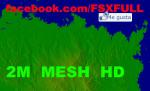
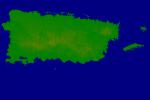
HD 2 meter mesh file for the area of Puerto Rico - See document for youtube link.
Posted Apr 1, 2014 12:36 by juan30005
11.79Mb (1615 downloads)
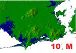
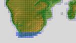
FSX Rio de Janeiro 10m Mesh. See also
www.facebook.com/FSXFULL
Posted Feb 11, 2014 01:12 by juan30005
1.13Mb (613 downloads)
This scenery addon upgrades the default FSX Terrain Mesh for the American Samoa Islands to a stunning 10 meters in resolution. All Mesh has been derived from 1/3 arc-second USGS elevation data. Scenery developed by Chris Britton of Emerald Scenery Design.
Posted Jan 3, 2014 14:41 by Emerald Scenery Design/E-Mesh
37.52Mb (1099 downloads)
This scenery addon upgrades the default FSX Terrain Mesh for the US Virgin Islands and Puerto Rico to a stunning 10 meter resolution. All Mesh has been derived from 1/3 arc-second USGS elevation data. Scenery developed by Chris Britton of Emerald Scenery Design.
Posted Jan 1, 2014 23:57 by Emerald Scenery Design/E-Mesh
65.00Mb (2275 downloads)
This scenery addon upgrades the default FSX Terrain Mesh for the islands of Hawaii to a stunning 10 meter resolution. All Mesh has been derived from 1/3 arc-second USGS elevation data. Scenery developed by Chris Britton of Emerald Scenery Design.
Posted Dec 24, 2013 23:21 by Emerald Scenery Design/E-Mesh
0.51Mb (473 downloads)
"imp" means imperfect, as other mesh I have already processed is of areas that have very little vegetation cover - over the land, or has large urban areas.
This "imp" mesh will include some slight discrepancies of altitude (in the case of forested areas - by a magnitude sometimes of +15 metres-depending on how tall the trees are, in the jungle or forest canopy) over urban areas, or areas with a lot of vegetation cover - due to the limitations of the ASTER satellites infra red scanning cameras, and the software used to process the DEM data.
Areas where there is little vegetation cover, or non urban areas, the terrain should have truer values.
But I feel this ASTER DEM data is so good - why let it all go to waste - especially flying over lovely Pacific islands?
So you FSX users out there will have to take all this into account when using this mesh.
Grateful thanks to ERSDAC, and NASA for making this data freely available to the public.
ASTER GDEM
Copyright (c) 2009 - 2011 Earth Remote Sensing Data Analysis Center (ERSDAC) All rights reserved.
ASTER GDEM is a product of METI and NASA.
Posted Aug 8, 2013 02:42 by Wayne Evans
212.41Mb (1120 downloads)
"imp" means imperfect, as other mesh I have already processed is of areas that have very little vegetation cover - over the land, or has large urban areas.
This "imp" mesh will include some slight discrepancies of altitude (in the case of forested areas - by a magnitude sometimes of +15 metres-depending on how tall the trees are, in the jungle or forest canopy) over urban areas, or areas with a lot of vegetation cover - due to the limitations of the ASTER satellites infra red scanning cameras, and the software used to process the DEM data.
Areas where there is little vegetation cover, or non urban areas, the terrain should have truer values.
But I feel this ASTER DEM data is so good - why let it all go to waste - especially flying over lovely Pacific islands?
So you FSX users out there will have to take all this into account when using this mesh.
Grateful thanks to ERSDAC, and NASA for making this data freely available to the public.
ASTER GDEM
Copyright (c) 2009 - 2011 Earth Remote Sensing Data Analysis Center (ERSDAC) All rights reserved.
ASTER GDEM is a product of METI and NASA.
Posted Apr 14, 2013 05:53 by Wayne Evans
225.28Mb (755 downloads)
"imp" means imperfect, as other mesh I have already processed is of areas that have very little vegetation cover - over the land, or has large urban areas.
This "imp" mesh will include some slight discrepancies of altitude (in the case of forested areas - by a magnitude sometimes of +15 metres-depending on how tall the trees are, in the jungle or forest canopy) over urban areas, or areas with a lot of vegetation cover - due to the limitations of the ASTER satellites infra red scanning cameras, and the software used to process the DEM data.
Areas where there is little vegetation cover, or non urban areas, the terrain should have truer values.
But I feel this ASTER DEM data is so good - why let it all go to waste - especially flying over lovely Pacific islands?
So you FSX users out there will have to take all this into account when using this mesh.
Grateful thanks to ERSDAC, and NASA for making this data freely available to the public.
ASTER GDEM
Copyright (c) 2009 - 2011 Earth Remote Sensing Data Analysis Center (ERSDAC) All rights reserved.
ASTER GDEM is a product of METI and NASA.
Posted Apr 14, 2013 05:26 by Wayne Evans
180.19Mb (690 downloads)
"imp" means imperfect, as other mesh I have already processed is of areas that have very little vegetation cover - over the land, or has large urban areas.
This "imp" mesh will include some slight discrepancies of altitude (in the case of forested areas - by a magnitude sometimes of +15 metres-depending on how tall the trees are, in the jungle or forest canopy) over urban areas, or areas with a lot of vegetation cover - due to the limitations of the ASTER satellites infra red scanning cameras, and the software used to process the DEM data.
Areas where there is little vegetation cover, or non urban areas, the terrain should have truer values.
But I feel this ASTER DEM data is so good - why let it all go to waste - especially flying over lovely Pacific islands?
So you FSX users out there will have to take all this into account when using this mesh.
Grateful thanks to ERSDAC, and NASA for making this data freely available to the public.
ASTER GDEM
Copyright (c) 2009 - 2011 Earth Remote Sensing Data Analysis Center (ERSDAC) All rights reserved.
ASTER GDEM is a product of METI and NASA.
Posted Apr 14, 2013 05:07 by Wayne Evans
101.92Mb (799 downloads)
"imp" means imperfect, as other mesh I have already processed is of areas that have very little vegetation cover - over the land, or has large urban areas.
This "imp" mesh will include some slight discrepancies of altitude (in the case of forested areas - by a magnitude sometimes of +15 metres-depending on how tall the trees are, in the jungle or forest canopy) over urban areas, or areas with a lot of vegetation cover - due to the limitations of the ASTER satellites infra red scanning cameras, and the software used to process the DEM data.
Areas where there is little vegetation cover, or non urban areas, the terrain should have truer values.
But I feel this ASTER DEM data is so good - why let it all go to waste - especially flying over lovely Pacific islands?
So you FSX users out there will have to take all this into account when using this mesh.
Grateful thanks to ERSDAC, and NASA for making this data freely available to the public.
ASTER GDEM
Copyright (c) 2009 - 2011 Earth Remote Sensing Data Analysis Center (ERSDAC) All rights reserved.
ASTER GDEM is a product of METI and NASA.
Posted Apr 14, 2013 05:04 by Wayne Evans