


2.48Mb (895 downloads)
FS2004
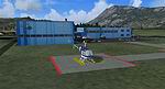
Heliport Balzers (LSXB).
A small, very accurate heliport of Rhein Helicopter AG in the
Principality of Liechtenstein with surrounding forest, static
cars, trucks and corrected roads. All textures are made with
digital photographs and are with night lightning. It's the third
heliport of the Swiss Helicopter Design Group. By Andreas Hegi.
2.5MB
Posted Jun 23, 2008 14:24 by archive
2.92Mb (725 downloads)
FS2004
Epus Airport Poland. Not
included by microsoft in FS2004. By Artur Krause. 3MB
Posted Jun 23, 2008 14:24 by archive
0.63Mb (3120 downloads)
FS2004
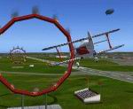
Flying Competition Scenery.
Located at LFML, Marseille, France, this scenery contains challenges
for single and multiplayer flight. Includes two pylon racing
courses, a helicopter racing course, a thermal for sailplane
races, and flaming hoops to test your piloting skills. By Ian
Radcliffe. 649K
Posted Jun 23, 2008 14:24 by archive
1.12Mb (1387 downloads)
FS2004
Kalamazoo/Battle Creek Intl Airport (KAZO) Michigan.
Scenery for Kalamazoo/Battle Creek Intl Airport in Kalamazoo,
Michigan. Created using Airport for Windows, Ground2k4, and
RWY12 ObjectPlacer. KAZO is served by Northwest Airlink, American
Eagle, Delta Connection, and United Express. It is home of the
famous AirZoo museum and Western Michigan University's Freshmen
student pilots (for one last semester). Scenery by Matt Magner.
1.1MB
Posted Jun 23, 2008 14:24 by archive
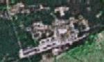
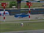
2.89Mb (2319 downloads)
FS2004
Kuching International Airport, Malaysia (KCH/WBGG)
is the main international gateway into Sarawak, Borneo, Malaysia.
This scenery is 90% handpainted because I started my construction
when the structure is almost demolished. It really test my patience
and I hope it will bring back the memories of the former Sarawakian
airport structure to everyone. By Jerry Ang. 2.9MB
Posted Jun 23, 2008 14:24 by archive
51.27Mb (1276 downloads)
FS2004
Fictional airport of Aviateham1 Coffs Harbour Australia.
Complete & detailed scenery. Designed by Carl Conway. 52.5MB
Posted Jun 23, 2008 14:24 by archive
0.22Mb (792 downloads)
FS2004
Lake Elmo Airport.St
Paul, Minnesota. 222K
Posted Jun 23, 2008 14:24 by archive
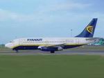
79.20Mb (5481 downloads)
FS2004
Polish AI Traffic Package.
Central Wings, LOT, EUROLOT, StarAlliance , Wizz AIR, Ryanair,
Polish Airlines AI Air Traffic Package! Contains AI Aircrafts,
and flight plans which add more traffic to the polish airports.
Flight plans set up traffic from Polish airports to the biggest
cities in Europe, USA, Canada, Russia, etc. Most of the plans
are taken from the Central Wings and lot.com.pl web pages. Fictional
plans add traffic to the airports which had no traffic - Artur
Krause. 81.1MB
Posted Jun 23, 2008 14:24 by archive

0.59Mb (982 downloads)
FS2004
Manukau Land Marks, New Zealand. Manukau
City- South Auckland - New Zealand ,is known for some interesting
structures. I have modeled these as accurate as I can. Accurately
created using photo textures. Fully compatible with Real NZ
Auckland City by Robin Corn and Mesh by Christain Stock. Not
tested with default scenery. By Ron Watson. 602K
Posted Jun 23, 2008 14:24 by archive
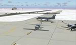
0.14Mb (1085 downloads)
FS2004
Dak Seang Airfield / Special Forces Camp
- late '60's Vietnam scenery series. . This primitive outpost
was located high in the mountains near the Cambodian border,
about 15 km north of Ben Het. It was widely regarded as the
most remote and vulnerable Special Forces camp in South Vietnam.
It was frequently attacked by the NVA and Viet Cong. The name
Dak Seang means "river of blood." The 1,400' clay runway at
Dak Seang was suitable only for helicopters, C-7 Caribous and
other short-field capable aircraft. In November 1970, Dak Seang
was turned over to the ARVN Rangers. George Knowles. 146K
Posted Jun 23, 2008 14:24 by archive