 |
| IFRPlan
2000, beta version. A tool for creating flightplans
for Microsoft Flightsimulator 95, 98 or 2000, including navaid
databases, printout of flightplans and export to flight management
systems. By Juergen Becker. 7MB |
|
| |
|
Squawker
1.0. Squawker is a program which will generate a random
transponder code each time it is run. It tests for the common
transponder codes to exclude, 1200, 7000, 7500, 7600, and
7700. It will display the generated code in a window. By Christopher
Head. 14K
|
|
 |
|
FS2000
Weight and Balance Computer 1.0 The Weight and Balance
Computer is the power-user's dream come true. Now you can
control the specific weight of your favorite FS2000 aircraft!
See and feel the difference between unloaded and a takeoff
at Max Gross Weight. Watch how the aircraft struggles to get
off the ground when you add pounds to push the weight over
Max Gross Weight! Included with this package is MFC42.dll.
By Michael Lyons. 584K
|
|
|
FstarRC.
This package provides Jeppesen FliteStar and FliteMap users
with a direct link to JDT LLC's Radar Contact 99. As an aside
it can also produce .sbp plans for Joe Jurecka's SquawkBox
and Enrico Schiratti's CDU, and .efpu plans for Chris Brett's
EFIS98. The main requirement for it to operate is that you
have version 8 of Jeppesen FliteMap or FliteStar. All the
testing has been done with version 8.04 of FliteMap and 8.10
of FliteStar. 764K
|
|
|

|
| NAV
22, A FREEWARE MS Flight Simulator 95/98/2000 scenery
viewer, printer, flight planner, flight track analyzer. By:
Ignacio Hernández-Ros, Based on NAV18 from Ted Wright. 2MB |
|
|
|
| Great
Circle and Rhumb Line Routes. A handy utility for FS2000
/ FS98 used to determine the Great Circle (shortest distance)
route and the Rhumb Line (constant bearing) route between any
two navaids or airports. The 6000+ entry database is quick and
easy to use requiring no manual keying. For Microsoft FS users
only. By Jeff Leezer. 181K |
|
 |
| Weather
Watch is a program that can connect to a server and
download weather data on any city and state within the United
States (Hawii and Alaska included). Weather includes temperature,
wind, dewpoint, humidity, visibility, barometric pressure, sunrise,
and sunset. By: Michael DeLong. 1.7MB |
|
 |
| Dispatch
Center v1.2 is a program used to create realistic flight
plans based on a format used by a major US airline. v1.2 adds
a few features and corrects the problem some users where reporting
with "MSCOMCTL.OCX" Previous version is NOT required. Eclipse
Group Ltd. 141K |
|

|
| Airliner
Navigation was created to help beginners understand
how airlines navigate. Its a basic guide of a flightplan from
Seattle to Chicago O'Hare. Its a multi-media publication, stand-alone,
best viewed at 800x600 as the publication size is 640x480. Created
by Steve Christensen. 856K |
|
|

|
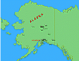
| Maps
for Alaskan Bush Pilot Sceneries from Ron Ackerley and
Ken Nelson. These maps refer to FS2000 scenery versions only
but may also fit to FS98 Bush sceneries. If feedback encourages
me to continue the job, then I'll create a version for an internet
browswer like MSIE or Netscape. There you can zoom in an out
without loosing quality in image resolution. Zoomed to largest
view you'll see then the scenery itself. Created by Josef Rotter.
35K |
|
| |


