| |
| FS2004
Replacement Road Textures.
These files will make the roads more visible from the air, and
more realistic looking. Always back up your original textures
when adding replacement textures. Daniel Kemmer. 2K |
|
 |
|
 |
| FS2004
Canada Hornets Military AI Package.
Contains everything needed to activate all Canadian CF-188 (F-18)
units. Includes AI F-18 model by Mikko Maliniemi with FDE by
Henry Tomkiewicz, realistic aircraft textures, callsign voicepacks,
AFCADs for CFB Bagotville and CFB Cold Lake, and flightplans.
Integrated by Dan Bourque. 6.7MB |
|
 |
| FS2004
Taupo Airport, New Zealand Version 1.0.
Taupo is a smallish city about halfway between Auckland and
Wellington (about 4 hours drive each way). This is another airport
in NZ that has been neglected in the FS community. I'm sure
Robin corn is going to do a definitive version sometime soon,
so I thought I would come out with a "stopgap" version until
that time. By Rob Diebold. 400K |
|
 |
| FS2004
Hamilton Airport, New Zealand Version 2.0.
Hamilton is a mid-sized city about an hour's drive south of
Auckland. The airport there is pretty busy for a little one,
and has regular air service by Air NZ and its partners, Freedom
Air, and Origin Pacific. But so far the airport has been a black
hole for scenery design. Robin corn is going to do a definitive
version sometime this year, so I thought I would come out with
a "stopgap" version until that time.By Rob Diebold. 785K |
|
 |
|
 |
| FS2004
North Haledon, Northern New Jersey, USA (Lite version) This
is Chopper Friendly scenery, folks. It wasn't designed to be
flown over at 10,000 feet - although, if you like to fly heavy
iron into the major New York/New Jersey airports, you'll notice
that it replaces the terrain elevation of Northern New Jersey
with all the hills and valleys that the default scenery left
out. No, this is interactive scenery. Built to be explored low
and slow. Want to perfect your landing skills in a huge playground
of rooftops, irregular terrain, and tight spaces? This is the
place. You won't find any unlandable surfaces or false crashes
here - just hundreds of places to touch down ranging from beginner,
through expert, to downright sick! This is the lite version,
designed for people who are having trouble with the frame rates
of the full version. I've thinned out the houses and trees,
and removed the buildings South of Oldham Pond - but managed
to keep most of the interesting places to land. In the tests
I've done, there was about a 20 percent frame rate increase
on average compared to the full version, with nearly a 45 percent
increase in the most framerate-hostile areas. Created by Mick
Posch. 11.7MB |
|
 |
| FS2004
Flying Competition Scenery Package.
Located at KNUQ, Moffett Field, California, this scenery contains
challenges for single and multiplayer flight. Includes two pylon
racing courses, a helicopter racing course, a thermal for sailplane
races, and short takeoff and landing courses to test your piloting
skills. By Ian Radcliffe. 866K |
|
 |
| FS2004
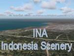
Indonesia Scenery v. 5.1.
Main road network, rail road, lake / reservoir, and river, including
all the shoreline in Java-Madura, Bali, and the whole Sumatera
island, also Indonesian Thousand archipelago. This scenery using
LWM and VTP data type. M.Andra Ganie. 1.8MB |
|
 |
| FS2004
USS Carrier Joe Foss.
The USS Carrier Joe Foss is a name many sailors know. They call
him a hero. 100% solid deck. Runway A-OK. Added MEATBALL VASI:
TCRV at "PORT AMIDSHIP". Complete CL-III ILS/NAV system. Planner
Airport ID: "FOSS". Located in San Francisco Bay. Exit out of
the bay right in front of the Golden Gate Bridge. At: N37*49.00'
W122*28.00'. Use MAP for Navigation information. Flight plan
capable using ILS, VFR, & GPS. 100% functional COMM's. ArresterCables.dat
file for FS9 included. You need our F14D for the cat and trap
zone setup. Or build a system out of it yourself. REV 1: 6/7/6:
Added trap angle runway to fix the ILS system alignment of the
ODALS STROBES, the MEATBALL lights. a Steve Hinson. 3.4MB |
|
  |
|

