


FSX > Page 1263
9.58Mb (1666 downloads)
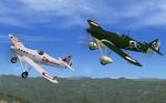
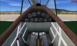
FSX/FS2004 "Dewoitine 501 and 510"
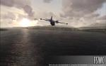
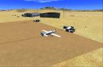
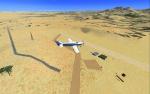
The Dewoitine D.501 and D.510 were the latest of the D.500 series of all-metal open cockpit fixed-undercarriage monoplane fighters used by the Armée de l'Air in the 1930's. The initial D.500, designed
by Emile Dewoitine , was based on specifications issued in 1930 by the air ministry, and was to be a replacement for the Nieuport 62 . The prototype first flew on June 18, 1932. D.501 and D.510 mdls included. Upgrade to FS2004/FSX by A.F.Scrub
Posted May 2, 2012 12:16 by A.F.Scrub
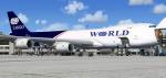
31.74Mb (3639 downloads)
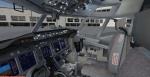
Project Opensky FSX Boeing 747-800 Cargo With V C. Painted in World Cargo Colours Model By Posky Painted By Roy Thomason. Fixed to use modified default 747 VC and FSX Posky native model updated by Chris Evans. Fitted with posky utility (views- instruments).
Posted May 2, 2012 08:32 by Roy Thomason
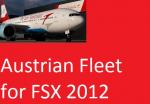
200.06Mb (8919 downloads)
Austrian Airlines Fleet 2012 package
It contains:Airbus, Boeing, Fokker and Bombardier aircraft in Austrian Airlines livery. Airplanes list: (all with VC) Project Airbus A319, A320 (old and new), A321, Project Opensky B777-200, Default Boeing 737-800 textures, default B737-800 Austrian Star Alliance, and Fokker100 and Dash Q400 by Premier Aircraft Design.
Posted May 2, 2012 07:52 by Amar
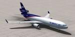
8.15Mb (5071 downloads)
MD11 cargo for fs2004 and fsx. Model by iFDG. Panel by Philippe WALLAERT. (No VC). This aircraft flew over my house on its way to Amsterdam so I decided to paint it in world cargo colours. I have put in the posky utility to help open cargo doors.
Posted May 2, 2012 05:08 by Roy Thomason
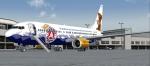
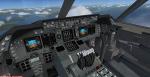
12.37Mb (1432 downloads)
Boeing 737-800 TUIfly ÜBÄRflieger Package. Tuifly Bärenmarke c/s ''ÜBÄRflieger'' D-AHFR Upgraded to FSX using Alrot's revised Boeing 737-800 VC. This model includes Working wipers (right mouse click on switch) with rain effect. Switches for LCD Screens, EICAS, PFD, MFT. Autobrake switch. Opening pilots window. Cabin Lights switch. Realistic FMC. Ground Proximity Warning System (GPWS) Panel updated by Chris Evans. VC by Alejandro Rojas Lucena (Alrot). Repainted by FSRepaintsGER/Benjamin Spranger
Posted May 1, 2012 15:20 by Benjamin Spranger
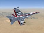
1.96Mb (758 downloads)
VRS Superbug USNTPS textures only for the payware VRS Superbug.
Posted May 1, 2012 15:14 by Chris Hammons
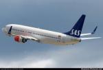
7.78Mb (1549 downloads)
SAS Braathens textures for the default Boeing 737-800.
By henrik i.l
Posted May 1, 2012 14:21 by Henrik i.l
3.32Mb (6001 downloads)
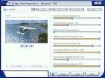
FS Water Configurator is a freeware addon utility for Microsoft Flight Simulator X designed to modify the look of the reflective water in the game. It will increase the realism of the reflections and lighting of the water and is completely controllable by the user. If you prefer glass like reflections or very subtle water reflections, FSWC is the utility for you.
Official site (below)
Posted May 1, 2012 11:17 by ricardo_tv
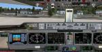
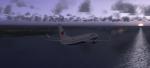
70.55Mb (17500 downloads)
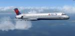
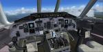
Delta Airlines MD-88 with model, panel,
textures, soundsets (custom made and realistic), radar for multiplayer/singleplayer, and more realistic dynamics. This is a simple aircraft, even though it has a safisticated panel, no FMC/ONS system is included in this aircraft, so you have to use the GPS system that is installed in the panel. This aircraft is really a beauty to fly, and I hope that you all fly it until you just cant fly it no more.
Thanks to Mitsushi Yutaka for the excellent aircraft with the vc man! you rock and I've been a fan of you since fs2002. Uses custom MD88 sounds.
Posted May 1, 2012 07:43 by uploader
0.81Mb (439 downloads)
Kokstad Airfield, South Africa (also known on FSX as the H.M.S Bastard Airfield). This airfield is located approximately eight
kilometres from the town of Kokstad. I have also enhanced the town of Kokstad and access roads to provide a more realistic interpretation of this town when flying over it.
Posted Apr 30, 2012 21:53 by Greg Olfin