


FS Navigation > Page 10
2.47Mb (104 downloads)
Tested on Windows XP and Windows 7.
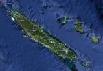
This download adds airfield markers and ICAO id's found in FSX, and overlays them on Google Earth.
This file is for New Caledonia.
There is also a seperate file with a list of basic airfield location details.
i.e: EGBB Birmingham Airport. Birmingham. N52* 27.23' W1* 44.88' alt325.
Also the tidying "My places" in Google Earth, file.
Other locator files to follow.
by Carl Vokes
Posted Jun 6, 2013 15:00 by carl vokes
2.64Mb (111 downloads)
Tested on Windows XP and Windows 7.
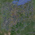
This download adds airfield markers and ICAO id's found in FSX, and overlays them on Google Earth.
This file is for Ohio. USA.
There is also a seperate file with a list of basic airfield location details.
i.e: EGBB Birmingham Airport. Birmingham. N52* 27.23' W1* 44.88' alt325.
Also the tidying "My places" in Google Earth, file.
Other locator files to follow.
by Carl Vokes
Posted Jun 5, 2013 06:13 by carl vokes
1.14Mb (268 downloads)
Tested on Windows XP and Windows 7.
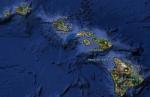
This download adds airfield markers and ICAO id's found in FSX, and overlays them on Google Earth.
This file is an update for Hawaii. USA. It places 'hi99' and 'hi32' in the correct locations. It adds a marker for 'phnl' water runway.
It replaces the original Hawaii airfield locator.
There is also a seperate file with a list of basic airfield location details.
i.e: EGBB Birmingham Airport. Birmingham. N52* 27.23' W1* 44.88' alt325.
Also the tidying "My places" in Google Earth, file.
Other locator files to follow.
by Carl Vokes
Posted Jun 3, 2013 14:02 by carl vokes
2.38Mb (108 downloads)
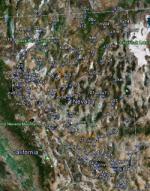
Tested on Windows XP and Windows 7.
This download adds airfield markers and ICAO id's found in FSX, and overlays them on Google Earth.
This file is an update for Nevada. USA. It moves the following airfields to their correct location: U75..kbty..nv13..2q6..nv62..01u..nv55..0l5..0l4..nv42..10u..a36..3l2..2nv2..nv47..nv96..01nv.
It replaces the original Nevada airfield locator.
There is also a seperate file with a list of basic airfield location details.
i.e: EGBB Birmingham Airport. Birmingham. N52* 27.23' W1* 44.88' alt325.
Also the tidying "My places" in Google Earth, file.
Other locator files to follow.
by Carl Vokes
Posted Jun 3, 2013 09:56 by carl vokes
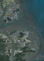
2.44Mb (115 downloads)
Tested on Windows XP and Windows 7.
This download adds airfield markers and ICAO id's found in FSX, and overlays them on Google Earth.
This file is for Macao.
There is also a seperate file with a list of basic airfield location details.
i.e: EGBB Birmingham Airport. Birmingham. N52* 27.23' W1* 44.88' alt325.
Also the tidying "My places" in Google Earth, file.
Other locator files to follow.
by Carl Vokes
Posted May 31, 2013 10:50 by carl vokes
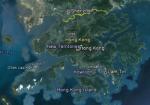
2.44Mb (283 downloads)
Tested on Windows XP and Windows 7.
This download adds airfield markers and ICAO id's found in FSX, and overlays them on Google Earth.
This file is for Hong Kong SAR.
There is also a seperate file with a list of basic airfield location details.
i.e: EGBB Birmingham Airport. Birmingham. N52* 27.23' W1* 44.88' alt325.
Also the tidying "My places" in Google Earth, file.
Other locator files to follow.
by Carl Vokes
Posted May 31, 2013 10:49 by carl vokes
2.51Mb (69 downloads)
Tested on Windows XP and Windows 7.
This download adds airfield markers and ICAO id's found in FSX, and overlays them on Google Earth.
This file is for Brunei.
There is also a seperate file with a list of basic airfield location details.
i.e: EGBB Birmingham Airport. Birmingham. N52* 27.23' W1* 44.88' alt325.
Also the tidying "My places" in Google Earth, file.
Other locator files to follow.
by Carl Vokes
Posted May 28, 2013 10:34 by carl vokes
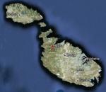
2.43Mb (130 downloads)
Tested on Windows XP and Windows 7.
This download adds airfield markers and ICAO id's found in FSX, and overlays them on Google Earth.
This file is for Malta.
There is also a seperate file with a list of basic airfield location details.
i.e: EGBB Birmingham Airport. Birmingham. N52* 27.23' W1* 44.88' alt325.
Also the tidying "My places" in Google Earth, file.
Other locator files to follow.
by Carl Vokes
Posted May 26, 2013 12:10 by carl vokes
2.44Mb (63 downloads)
Tested on Windows XP and Windows 7.
This download adds airfield markers and ICAO id's found in FSX, and overlays them on Google Earth.
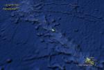
This file is for Kiribati.
There is also a seperate file with a list of basic airfield location details.
i.e: EGBB Birmingham Airport. Birmingham. N52* 27.23' W1* 44.88' alt325.
Also the tidying "My places" in Google Earth, file.
Other locator files to follow.
by Carl Vokes
Posted May 26, 2013 12:07 by carl vokes
2.42Mb (61 downloads)
Tested on Windows XP and Windows 7.
This download adds airfield markers and ICAO id's found in FSX, and overlays them on Google Earth.
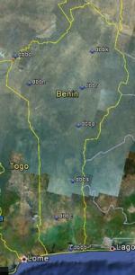
This file is for Benin.
There is also a seperate file with a list of basic airfield location details.
i.e: EGBB Birmingham Airport. Birmingham. N52* 27.23' W1* 44.88' alt325.
Also the tidying "My places" in Google Earth, file.
Other locator files to follow.
by Carl Vokes
Posted May 26, 2013 12:05 by carl vokes