


0.46Mb (2461 downloads)
Aircraft
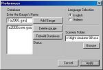
Installation Utility 4.0 for FS98 or FS2000. This Program
simply copy all the file that constitute an aircraft, scenery
or panel in the correct directories. It isn't a manager, this
means that you need this program only if you want a simple and
fast utility that with a couple of clicks can install your aircraft
directly. By Francesco Aruta. 423K
Posted Jun 23, 2008 14:20 by archive
0.40Mb (1007 downloads)
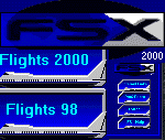
Fast
Start Extension For FlightSims 2000 And 98. Enables
You To Choose The Flight Your Sim Starts Up On. This Product
Has Been Enhanced All Round And Includes Some New Features.
Existing FSX Users Should Also Upgrade But Please Read The Upgrading
Section In The Text File. Distribution Includes A Setup Program
For Easier Installation. Released As FREEWARE By Ken Maclachlan.
422K
Posted Jun 23, 2008 14:20 by archive
0.18Mb (188 downloads)
Great
Circle and Rhumb Line Routes. A handy utility for FS2000
/ FS98 used to determine the Great Circle (shortest distance)
route and the Rhumb Line (constant bearing) route between any
two navaids or airports. The 6000+ entry database is quick and
easy to use requiring no manual keying. For Microsoft FS users
only. By Jeff Leezer. 181K
Posted Jun 23, 2008 14:20 by archive
6.72Mb (421 downloads)
IFRPlan
2000, beta version. A tool for creating flightplans
for Microsoft Flightsimulator 95, 98 or 2000, including navaid
databases, printout of flightplans and export to flight management
systems. By Juergen Becker. 7MB
Posted Jun 23, 2008 14:20 by archive
1.58Mb (373 downloads)
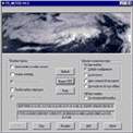
METAR
File Getter v1.0 METAR File Getter is a small, easy
to use utility for retrieving METAR weather report files from
the internet. It was designed to give FS98 users a more realistic
experience while flying. METAR File Getter will automatically
download the METAR text files from the chosen website every
hour. Freeware written by Rich Stiver. 1.6MB
Posted Jun 23, 2008 14:20 by archive
0.69Mb (673 downloads)
FS98/FS2000
FS Meteo v4.75 will set cloud layers, wind speed, gusty
wind,rain, upper wind (ALOFT),snow,thunder,wind direction, temperature,altimeter
and visibility through an Internet connection in online mode
or in offline mode. It will check where your plane will be and
set the parameters to the real weather where you fly and will
give you up to date information during flight. FSMeteo can also
request airport weather! By Marc Philibert. 708K
Posted Jun 23, 2008 14:20 by archive
1.66Mb (1330 downloads)
NAV:
A Flight Simulator scenery file viewer and flight planner.
NAV is a Microsoft Flight Simulator (versions 5, 95, 98, and
2000) compatible scenery file (BGL) viewer and flight planner.
NAV will show (and print) a map of all the navigational aids,
runways and airports in your scenery files, let you measure
distances between places, search the files for specific items,
create a flight plan showing navigational aid frequencies and
distance, fuel, and estimated time between references points,
link to Flight Simulator to show your map position updated in
real time, and control your autopilot to help you navigate.
1.7MB
Posted Jun 23, 2008 14:20 by archive
0.00Mb (1283 downloads)
Autoland
2000 is
a simple adventure utility for FS2000/FS98 that will add autoland
ability to virtually any third party aircraft, when using the
autopilot's ILS "approach" mode feature. Autoland is being distributed
as freeware. John Cillis 4K
Posted Jun 23, 2008 14:20 by archive
0.08Mb (209 downloads)
EasyNavs
2000 navaids editor for FS2K/FS9x Version 2.00 Extract
and edit ILS,VOR,NDB data from BGLs Compile navaids databases
to stand-alone BGLs New version improving program interface
and configuration Requires
VB4-32 runtime files Freeware by Hervé Sors. 82K
Posted Jun 23, 2008 14:20 by archive
0.25Mb (434 downloads)
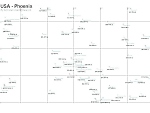
FS98
Default Scenery Map. Maps show the relative positions
of airports. Maps for part or New York, Toronto, Montreal. Dallas
and Phoneix and surrounding areas. Showing airport code and
runway length. Length of just the longest runway is shown. Great
for making and planning short hops. Word 97 and also JPEG format.
By Aziz Islam. 260K
Posted Jun 23, 2008 14:20 by archive