


CFS1 > Page 130
0.10Mb (582 downloads)
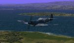
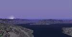
Malta
and Pantelleria scenery for CFS. Scenery files, built with
CFSTMAP, of the islands of Malta and Pantelleria, south of Sicily.
Includes also two missions, using only standard aircraft. By C Burgess.
102K
Posted Jun 10, 2008 11:32 by archive
0.70Mb (253 downloads)
CFS
Scenery Add-On Amsterdam-Schiphol Netherlands ~1938. As usual
the Amsterdam-Schiphol scenery is completly fictional. In spite of
that the Airfield is placed on the exact coordinates I've got from
FS2000: N52*18'14 E4*44'24. Ralf-J. Triebel. 720K
Posted Jun 10, 2008 11:32 by archive
0.21Mb (542 downloads)
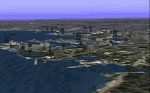
CFS
SCENERY--PORTSMOUTH ENGLAND NAVAL BASE Created by Chuck Domes
STACFS 12 utility Includes a large naval base with ships, docks and
cranes, warehouses, and factories, there is also the town of Portsmouth
and a radar station at Gosport across the harbor, there is a subbase
on the Gosport side also. Portsmouth was called "Pompey" by the English
sailors and was bombed extensively by the "Luftwaffe". By Marvin Carter.
212K
Posted Jun 10, 2008 11:32 by archive
4.29Mb (625 downloads)
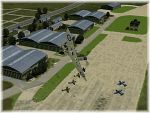
Duxford,
UK. Add-on scenery for CFS. The fifth in the ABBA series,
it is a historically accurate depiction of Duxford fighter airfield,
now run by the Imperial War Museum. Includes Ed & Reg Allen´s Duxford
Legends static aircraft. By Mike Rennie. 4.3MB
Posted Jun 10, 2008 11:32 by archive
0.10Mb (162 downloads)
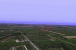
Saskatoon.
This scenery is the national airport CYXE or YXE in Saskatoon, Saskatchewan,
Canada. Its position is as follows: N52*10.15 W106*41.59 Scenery made
by:Chris Wilson. 98K
Posted Jun 10, 2008 11:32 by archive
0.02Mb (191 downloads)
Norwegian
Seasons Classlist File. Add-on for my Bergen, Oslofjord,
Stavanger cfs sceneries. covers area N57-62 E4-12 of Norway. (Requires
Bill Potvin`s CFO Weather package,Misho Katulic`s Winter Bitmaps
and Bob Wise's set of "Fall" textures). Created with Martin Wright's
MkClass. 23K
Posted Jun 10, 2008 11:32 by archive
0.05Mb (146 downloads)
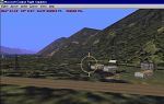
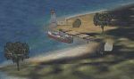
Lake
Field is a fictional WW2 airfield situated NorthEast of
Interlaken, at the far end of the lake. Included are: One dirt landing
strip, complete with landing lights for those night flights. Many
buildings, including control tower, fire station with emergency
vehicles standing by, lighthouse, HQ, factories, hangers, workshops
and barracks. Joe Spencer . 55K
Posted Jun 10, 2008 11:32 by archive
0.18Mb (445 downloads)
CFS
SCENERY--BROOKLANDS ENGLAND Created by Chuck Domes STACFS12
Utility. This is a large oil complex Northeast of Brooklands airfield.
Includes large factories,several smaller factories, oil tanks,warehouses,
vehicles, and lots of trees. By Marvin Carter. 180K
Posted Jun 10, 2008 11:32 by archive
0.33Mb (769 downloads)
CFS
Libya, Libyan scenery for CFS. Scenery files, built from USGS
DEM data using CFSClass, covering the western part of Libya west of
longitude E20. The scenery is designed to match to the west onto my
CFSTunisia (Tunisia and eastern Algeria), to the north onto my SicStrait
(which includes all of the water and islands between Libya and Sicily,
including Malta, Pantelleria, and the other small Italian islands
of Lampedusa, Lampione and Linosa), and to the east onto Mauro Giacomazzi's
Nord Africa scenery (covering eastern Libya and Egypt). Requires texture
files CFSMedTextures. By C Burgess. 342K
Posted Jun 10, 2008 11:32 by archive
0.81Mb (705 downloads)
Tunisia
scenery for CFS. Scenery files, built from USGS DEM data
using CFSClass, for eastern Algeria (east of longitude E5) and Tunisia.
It is designed to match onto my other sceneries SicStrait (which
covers the Mediterranean between Tunisia/Libya and Sicily) and CFSLibya
(covering Tripolitania and the Gulf of of Sidra, matching onto Mauro
Giacomazzi's NordAfrica scenery). Requires textures from CFSMedTextures.
By C Burgess. 827K
Posted Jun 10, 2008 11:32 by archive