FS2004 > Gliders and Ultralites > Page 9
0.06Mb (104 downloads)
FS2002/2004
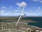
Oshkosh and Opa Locka,USA Soaring Scenery
This file add some thermals to default Microsoft Oshkosh(KOSH),Wisconsin
and Opa Locka(KOPF),Florida ,USA scenery .By Francisco Vargas.
67K
Posted Jun 23, 2008 14:18 by archive
0.09Mb (150 downloads)
FS2002/2004
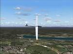
Queensland Coast, Australia Soaring Scenery
These files adds some thermals to default Microsoft whole,Queensland
Region,Australia Airport Scenery ,.over below airports: 1.Maroochydore
City - Maroochydore-Sunshine Coast Airp.(ICAO - YBMC); 2.Gympie
City - Gympir Airp.(ICAO - YGYW); 3.Maryborough City - Maryborough
Airp.(ICAO - YMYB); 4.Bundaberg City - Bundaberg Airp.(ICAO
- YBUD); 5.Monto City - Monto Airp.(ICAO - YMTO); 6.Thangool
City - Thangool Airp.(ICAO - YTNG); 7.Gladstone City - Gladstone
Airp.(ICAO - YGLA); 8.Rockhampton City - Rockhampton Airp(ICAO
- YBRK); 9.Williamson City - Williamson Airp.(ICAO - YWIS)
10.Mackay City - Mackay Airp(ICAO - YBMK); 11.Moranbah City
- Moranbah Airp(ICAO - YMRB); 12.Proserpine City - Whitsunday
Coasy Airp(ICAO - YBPN); 13.Bowen City - Bowen Airp(ICAO -
YBRK); 14.Ayr City - Ayr Airp.(ICAO - YAYR); 15.Ingham City
- Ingham Airp.(ICAO - YIGM); 16.Lavarack City - Lavarack Airp.(ICAO
- YLVK); 17.Innisfal City - Innisfal Airp.(ICAO - YIFL); 18.Mareeba
City - Mareeba Airp.(ICAO - YMBA); 19.Cooktown City - Cooktown
Airp.(ICAO - YCKN); 20.Chillagoe City - Chillagoe Airp.(ICAO
- YCGO); 21.Intermediate Point 1: Coordinates S 16* 9.93'
- E 144* 40.41" Elevation 1638.3 ft; 22.Intermediate Point
2: Coordinates S 14* 57.12' - E 144* 13.90" Elevation 67.0
ft; 23.Intermediate Point 3: Coordinates S 14* 41.19' - E
143* 34.90" Elevation 60.0 ft; 24.Coen City - Coeb Airp.(ICAO
- YCOE); 25.Lockhart River City - Lockhart River Airp.(ICAO
- YLHR); 26.Weipa City - Weipa Airp.(ICAO - YBWP); 27.Bamata
City - Inginoo Airp.(ICAO - YBAM); It is freeware. Good flights
and better landings By Francisco Vargas. 93K
Posted Jun 23, 2008 14:18 by archive
0.18Mb (350 downloads)
FS2004
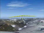
Hang Glider2 Soaring Scenery
These files adds some thermals to default Microsoft over below
Regions and also hang glider flights to: 1.Mt. Kilimanjaro,Tanzania,near
Kenya border,Africa Coordinates:S 3* 4.27' - E 37* 21.20'-
elev. 19,897ft; 2.Mt. Blanc,near France/Italy bordes,Europe
Coordinates: N 45* 49.93' - E 6* 51.76'- elev. 13,429ft; 3.Mt.Mc
Kinley,Alasca Coordinates: N 63* 4.52' - W 150* 59.14' elev.
19,508ft. By Francisco Vargas. 181K
Posted Jun 23, 2008 14:18 by archive
0.05Mb (71 downloads)
FS2002/2004
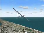
Kitty Hawk Beach Soaring Scenery
This file adds some thermals to default Microsoft scenery
for Kitty Hawk Beach Region,North Carolina,USA: -Kill Devil
Hill City,Frist Flight Airport(KFFA). By Francisco Vargas.
51K
Posted Jun 23, 2008 14:18 by archive
0.07Mb (164 downloads)
FS2002/2004
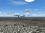
Italy Pack1 Soaring Scenery This
file add some thermals to default Microsoft scenery for below
cities of Italy Region: 1.Roma City - URBE Airfield(LIRU).
2.Ferrara City(LIPF),home of Club Volovelistico Ferrarese.
3.Torino City( LIMA and LIMF). 4.Foligno City , home of Foligno
Glider Club. By Francisco Vargas. 67K
Posted Jun 23, 2008 14:18 by archive
0.12Mb (53 downloads)
FS2002/2004
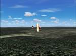
Harris Hill, Elmira, NY, Soaring Scenery. This
file adds some thermals to default Microsoft scenery for Harris
Hill (4N48) Region, New York, USA Good flights and landings
By Francisco Vargas. 120K
Posted Jun 23, 2008 14:18 by archive
0.11Mb (158 downloads)
FS2002/2004
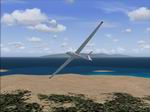
Madeira Island Soaring Scenery
This file adds some thermals to default Microsoft Scenery
for Madeira Island(LPMA) and Porto Santo Island(LPPS) Region,Portugal,
By Francisco Vargas. 111K
Posted Jun 23, 2008 14:18 by archive
0.34Mb (99 downloads)
FS2002/2004
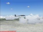
Africa 1 Soaring Scenery
This file adds some thermals to default Microsoft Africa scenery
: I.Algeria: .Houari Boumediene Airport(DAAG) - Algiers City.
.Biskra Airport(DAUB) - Biskra City. II.Benim: .Cadjehoun
Airport(DBBB) - Cotonou City. III.Botswana: .Sir Seretse KhamaAirport(FBSK)
- Gaborone City. IV.Burkina Faso: .Onagadou Airport(DFFD)
- Onagadou City. V.Burundi: .Bujumbura Airport(HBBA) - Bujumbura
City. VI.Cameroon: .Nsimalen Airport(FKYS) - Yaondé City.
VII.Angola: .4th of February Airport(FNLU) - Luanda City.
.Lubango Airport(FNUB) - Lubango City. .Intermediate Point
Thermals - S 11* 52´34.80´´- E 13* 52´46.80´´. Good Flights
and better landings By Francisco Vargas. 352K
Posted Jun 23, 2008 14:18 by archive

0.05Mb (83 downloads)
FS2002/2004
American Samoa Soaring Scenery
This file adds some thermals to default Microsoft scenery
for American Samoa Regionand cover below cities: 1.Ofu City
- Ofu Village Airport(Z08). 2.Tau City - Tau Village Airport((HI36).
3.Tau City - Fitiuta Airport(FAQ). Good flights and better
landings. By Francisco Vargas. 54K
Posted Jun 23, 2008 14:18 by archive
0.10Mb (777 downloads)
FS2002/2004
South America Pack1 Soaring Scenery This
file add some thermals to default Microsoft scenery for South
America Region: 1.Argentina: .Aeroclube Dolores - Dolores
City. .Club Argentino de Planeadores Albatros - San Andrés
de Giles City. .Club de Planeadores Zárate - Zárate City.
.Buenos Aires - Ezeiza Airport(SAEZ) 2.Uruguai - Montevideo
City(SUNU) 3.Paraguai - Assuncion City(SGAS) 4.Venezuela _
Caracas City(SVMP) 5.Bolivia - La Paz City(SLLP) 6.Peru -
Lima City(SPIM) 7.Chile - Club de Planeadores de Santiago
- Lo Castillo Airfield - Santiago City(SCEL) 8.Colombia -
Bogotá City(SKBO) 9.British Guianne - Georgetown City(SYCJ)
10.Suriname - Paramaribo City(SMZO) 11.French Guianne - Cayenne
City(SOCA) 12.Ecuador - Quito City(SEQU) By Francisco Vargas.
103K
Posted Jun 23, 2008 14:18 by archive


