0.07Mb (534 downloads)
FS2004
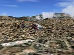
University of Utah, Ogden Regional, and McKay Dee Hospitals:
This
is a compilation of three hospitals that I made to simulate
a medevac in Northern Utah. This file consists of the University
of Utah Hospital (UofU), Ogden Regional Hospital (OGDR), and
McKay Dee Hospital (MKAY). All I did was get the coordinates
and make one helipad for Ogden Regional and McKay Dee, and three
helipads for the University of Utah. This file is very basic.
The helipads are just sitting on the ground, but at least there's
a helipad to land on. I also added some blue light to help with
night flights. I don't know how to remove buildings, so one
of the University helipads has some houses on it. All editing
was done by Andy Haws. 76K
Posted Jun 23, 2008 14:24 by archive
0.23Mb (414 downloads)
FS2004
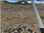
AFCAD file of the Ogden-Hinckley Airport (KOGD).
This is an updated version of the original airport with updated
taxiways and parking spots. I also added most of the helipads
where they are supposed to be. The only things I changed are
the taxiways, parking spots, and helipads. Everything else works
the same as it did before. The picture is a real picture, NOT
a screenshot. All editing was done by Andy Haws. 237K
Posted Jun 23, 2008 14:24 by archive
0.52Mb (1164 downloads)
FS2004
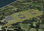
Phan Thiet Airfield, Vientam circa 1970.
Phan Thiet AF was located atop high bluffs overlooking the South
China Sea. It was home to several US Army units including the
101st Airborne. Landing at Phan Thiet could be very hazardous,
due to numerous obstructions in the flight path and strong downdrafts.
Therefore, pilots were advised to land only on runway 07 and
take off only on runway 25. George Knowles. 537K
Posted Jun 23, 2008 14:24 by archive
0.10Mb (1403 downloads)
FS2004
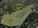
Quang Ngai Airfield, Vietnam, late 60's era.
A model of Quang Ngai Airfield, a rudimentary USMC airstrip
about 35 km south of Chu Lai Airbase. The 174th Assault Helicopter
Company flew combat support missions from this location. The
4,625' asphalt runway at Quang Ngai could also handle C-123
and C-130 transport aircraft. This scenery was designed for
FS 2002 but it should work in FS 2004. George Knowles. 103K
Posted Jun 23, 2008 14:24 by archive
0.15Mb (4844 downloads)
FS2004
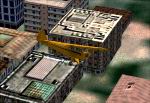
Alternative Autogen Textures.
Autogen for all world with an certain 3D effect and a larger
variety of textures. By Valentin Casares. 157K
Posted Jun 23, 2008 14:24 by archive
0.91Mb (1592 downloads)
FS2004
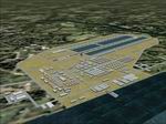
Vinh Long Airfield, Vietnam, circa 1968 Scenery.
A model of Vinh Long Airfield (circa 1968), a US Army combat
aviation base in the Mekong Delta. It was the home of the 114th
Aviation Company. This unit flew UH-1 Huey helicopters, and
was known as "The Knights of the Air." Vinh Long also had port
facilities for a fleet of US Navy swift boats. Vinh Long's 3,500'
asphalt runway was flanked on both sides by large, rectangular
water-filled basins. This scenery was designed for FS 2002 but
it should work in FS 2004. George Knowles. 929K
Posted Jun 23, 2008 14:24 by archive

3.53Mb (733 downloads)
FS2004
Manukau Shopping Mall.
Manukau Shopping Mall - South Auckland - New Zealand. By Ron
Watson. 3.6MB
Posted Jun 23, 2008 14:24 by archive
0.22Mb (1397 downloads)
FS2004
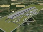
Soc Trang Airfield, Vietnam, Late 60's era.
A model of Soc Trang Airfield, a strategic combat support base
in the Mekong Delta about 2km southwest of Khanh Hung. Soc Trang
was originally a World War II Japanese fighter base. In 1962
it became the first USMC airfield in South Vietnam. The HMM-362
squadron flew UH-34 helicopters. After the marines relocated
to DaNang AB, they were replaced by the US Army's 93rd Transportation
Company and 121st Aviation Company (T-28s and A-1Es). They were
known as the "Soc Trang Tigers." A real tiger named "Tuffy"
was the base mascot. This scenery was designed for FS 2002 but
it should work in FS 2004. George Knowles. 225K
Posted Jun 23, 2008 14:24 by archive

44.88Mb (2614 downloads)
FS2004
Bear Creek Winery & Lodging Enhanced v2.0.9 "Diamond Edition",
Alaska (AK).
An all new flight simulator experience awaits you at Bear Creek.
This is a completely re-vamped "Extreme Make Over" of the previous
Bear Creek Winery & Lodging. Some additions include: scenery
changer utility, custom textures, festive events (Christmas,
Balloon Festival, etc.). Also added enhanced AI Traffic to the
whole of Bear Creek. By Michael Woolsey and David Marshall.
46MB
Posted Jun 23, 2008 14:24 by archive
0.25Mb (1540 downloads)
FS2004
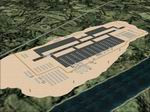
Quang Tri Airfield, Vietnam, Late 60's era.
A model of Quang Tri Airfield, a strategic USMC helicopter base.
The 1st and 3rd Division marines at Quang Tri flew CH-46 Sea
Knight and UH-1N Huey Iroquois helicopters. Quang Tri Airfield
was located just a few miles south of the the DMZ which made
it extremely vulnerable to attack. North Vietnamese and Viet
Cong forces attacked Quang Tri several times during the war.
Although it wasn't a coastal base like Cam Ranh Bay or Tuy Hoa,
the site of Quang Tri Airfield was very sandy. The sand contrasted
with the surrounding terrain and looked somewhat unnatural.
Aerial photos confirm that the base had this unusual appearance.
This scenery was designed for FS 2002 but it should work in
FS 2004. George Knowles. 252K
Posted Jun 23, 2008 14:24 by archive


