0.05Mb (159 downloads)
Randomly
Changing Weather Simulator A Flight Sim adventure that
changes weather randomly over time and/or distance. Designed
with small aircraft in mind. Modifies wind, clouds, visibility,
pressure, and temperature. Allows some user control and includes
a simple, scrolling weather report. Requires Flight Sim 2000
and Peter
Dowson's FSUIPC.DLL (version 1.8 or newer). - by James Donnelly.
50K
Posted Jun 23, 2008 14:34 by archive
2.63Mb (57 downloads)
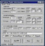
GPStoFS
provides an interface between a GPS receiver and Flight Simulator
2000 from Microsoft. You connect your GPS to your computer (usually
a laptop) through a serial cable. GPStoFS takes the position,
speed and altitude data from your GPS receiver and 'forces'
Flight Simulator 2000 to fly with the same parameters. . 2.7MB
Posted Jun 23, 2008 14:34 by archive
0.01Mb (66 downloads)
FS2000
Sean's Cockpit Vibe Version 2 for SFP2.5 An update for
the original cockpit Vibe. It fixes the 2 bugs that affected
the Go Around procedure in certain conditions. For FS2K users
who find real weather about as useful as low alcohol beer, this
module has a descent weather routine that makes your flight
interesting but not unrealistic. I hope you enjoy this as much
as I do. By Sean Mollison. 7K
Posted Jun 23, 2008 14:34 by archive

0.04Mb (218 downloads)
Flight
Planning Form JetplanThis is a planning form I developed
to assist in flight planning for the 737 and 757 in FLY. It
can be used with all flight simulation software. This form is
public domain. This file is intended for flight simulation only,
do not use for real flight planning. Have a nice day. Jim Donlin.
40K
Posted Jun 23, 2008 14:34 by archive
1.08Mb (176 downloads)
FS2000
Sean's Cockpit Vibe for SFP2.5 A simple add on module
for adventures generated using Super Flight Planner 2.5. It
goes along way to making your flight experiance a bit more realistic
by adding all sorts of Checklists, Cabin Crew Calls and Procedures.
Includes Sound Package and instructions. By Sean Mollison. 1.1MB
Posted Jun 23, 2008 14:34 by archive

0.03Mb (74 downloads)
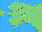
Maps
for Alaskan Bush Pilot Sceneries from Ron Ackerley and
Ken Nelson. These maps refer to FS2000 scenery versions only
but may also fit to FS98 Bush sceneries. If feedback encourages
me to continue the job, then I'll create a version for an internet
browswer like MSIE or Netscape. There you can zoom in an out
without loosing quality in image resolution. Zoomed to largest
view you'll see then the scenery itself. Created by Josef Rotter.
35K
Posted Jun 23, 2008 14:34 by archive

0.84Mb (154 downloads)
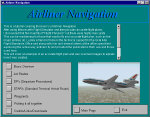
Airliner
Navigation was created to help beginners understand
how airlines navigate. Its a basic guide of a flightplan from
Seattle to Chicago O'Hare. Its a multi-media publication, stand-alone,
best viewed at 800x600 as the publication size is 640x480. Created
by Steve Christensen. 856K
Posted Jun 23, 2008 14:34 by archive

0.14Mb (125 downloads)
Dispatch
Center v1.2 is a program used to create realistic flight
plans based on a format used by a major US airline. v1.2 adds
a few features and corrects the problem some users where reporting
with "MSCOMCTL.OCX" Previous version is NOT required. Eclipse
Group Ltd. 141K
Posted Jun 23, 2008 14:34 by archive

1.63Mb (57 downloads)
Weather
Watch is a program that can connect to a server and
download weather data on any city and state within the United
States (Hawii and Alaska included). Weather includes temperature,
wind, dewpoint, humidity, visibility, barometric pressure, sunrise,
and sunset. By: Michael DeLong. 1.7MB
Posted Jun 23, 2008 14:34 by archive
0.18Mb (303 downloads)
Great
Circle and Rhumb Line Routes. A handy utility for FS2000
/ FS98 used to determine the Great Circle (shortest distance)
route and the Rhumb Line (constant bearing) route between any
two navaids or airports. The 6000+ entry database is quick and
easy to use requiring no manual keying. For Microsoft FS users
only. By Jeff Leezer. 181K
Posted Jun 23, 2008 14:34 by archive


