


98.35Mb (2813 downloads)
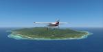
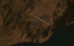
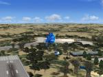
The Southern Cook Islands are a group of 9 islands and atolls in the South Pacific Ocean, north east of New Zealand. The Southern Cookies in this package are: Aitutaki, Atiu, Mangaia, Manuae, Mauke, Mitiaro, Palmerston, Rarotonga and Takutea.
Texture resolution 1m/pixel. By Tiberius Kowalski
Posted May 25, 2012 07:17 by Tiberius Kowalski
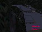
0.36Mb (1265 downloads)
Fictional Vietnam Camp headquarters.
Posted May 23, 2012 17:04 by Martin
0.00Mb (266 downloads)
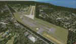
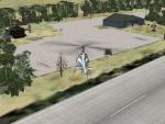
PALR Chandalar Lake fictional airport.
PALR is a medium airport near to the Chandalar Lake in Alaska.
Posted May 23, 2012 05:57 by uploader
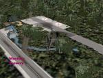
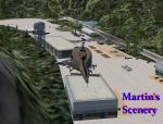
0.36Mb (1517 downloads)
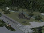
Fictional military medical camp deep in the Vietnam jungle.
Posted May 23, 2012 03:23 by Martin
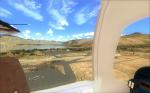
2.40Mb (1122 downloads)
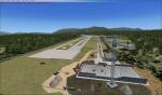
This is a stock Airport on FSX I added a lot of scenery items for you to look at. By no means is the made to look like the real airport Hope you enjoy. Zip view for more images.
Posted May 23, 2012 02:16 by uploader
0.36Mb (1428 downloads)
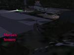
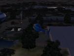
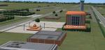
Fictional Military Vietnam Forest Camp.
Posted May 22, 2012 04:52 by Martin
0.56Mb (428 downloads)
Fictional Resort in South Africa. After installing into FSX look for airport id: SSWP. Zip preview for more pics.
Posted May 20, 2012 17:59 by Martin
0.00Mb (393 downloads)
THIS is a really relaxing place to land when you
are flying in the desert, and need a refreshment and to refill your plane!! It is situated in Namibia. Namibia in Africa. Look for airport ID: DONM. Happy Flying!!
Posted May 20, 2012 13:56 by Martin
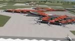
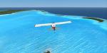
4.89Mb (9793 downloads)
Soekarno-Hatta International(ICAO: WIII) is Indonesia's largest airport. Also one of the busiest in the world based on passenger terms,this airport serves Jakarta and Banten area. Opened in 1985. A great replacer for the default Soekarno-Hatta(WIII)in FSX, which is too simple. Including detailed airport building. but the gates are static. May also work in FS2004, though not tested. Includes night lights.
Posted May 18, 2012 03:42 by ryanID
0.00Mb (440 downloads)
A Science spot on the top of Kilimanjaro mountain, in Kenya, Africa.
Look for airport id: WSMT
Posted May 17, 2012 19:05 by Martin