


0.04Mb (733 downloads)
Fictional British Columbia Scenery - Visit some of the most dangerous fictional airports available for FSX. Challenge yourself! PART 3 of 5 - EXCELSIOR'S EDGE
Posted Apr 15, 2011 12:17 by Cassidy Byars
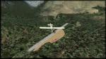
0.04Mb (596 downloads)
Fictional British Columbia Scenery - Visit some of the most dangerous fictional airports available for FSX. Challenge yourself! PART 2 of 5 - KELVIN SLOPE
Posted Apr 15, 2011 12:15 by Cassidy Byars
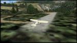
0.04Mb (705 downloads)
Fictional British Columbia Scenery - Visit some of the most dangerous fictional airports available for FSX. Challenge yourself! PART 1 of 5 - RELIANT VALLEY
Posted Apr 15, 2011 12:14 by Cassidy Byars
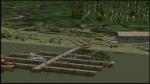
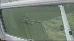
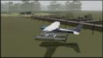
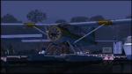
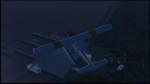
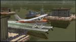
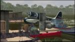
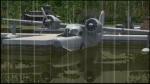
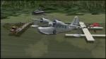
0.03Mb (1112 downloads)
Fictional Amazon River Seaplane Scenery - Travel up the Amazon in your favorite float plane or seaplane and visit small ports and native settlements along the way. PART 5 of 5 - LORICARIIDAE BAY
Posted Apr 15, 2011 12:04 by Cassidy Byars
0.02Mb (916 downloads)
Fictional Amazon River Seaplane Scenery - Travel up the Amazon in your favorite float plane or seaplane and visit small ports and native settlements along the way. PART 4 of 5 - BOTO ISLAND
Posted Apr 15, 2011 12:03 by Cassidy Byars
0.02Mb (898 downloads)
Fictional Amazon River Seaplane Scenery - Travel up the Amazon in your favorite float plane or seaplane and visit small ports and native settlements along the way. PART 3 of 5 - SERRASALMUS
Posted Apr 15, 2011 12:01 by Cassidy Byars
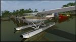
0.04Mb (1117 downloads)
Fictional Amazon River Seaplane Scenery - Travel up the Amazon in your favorite float plane or seaplane and visit small ports and native settlements along the way. PART 2 of 5 - ARUANA RIVER HOUSES
Posted Apr 15, 2011 12:00 by Cassidy Byars
0.03Mb (1131 downloads)
Fictional Amazon River Seaplane Scenery - Travel up the Amazon in your favorite float plane or seaplane and visit small ports and native settlements along the way. PART 1 of 5 - ARAPIMA
Posted Apr 15, 2011 11:56 by Cassidy Byars
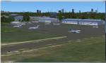
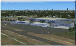
52.98Mb (1752 downloads)
FSX Scenery--Teterboro Airport (KTEB), NJ. Teterboro Airport is located across the Hudson River in New Jersey, just 12 miles from midtown Manhattan. Teterboro Airport is considered a general aviation reliever airport. As a reliever airport, it does not offer scheduled airline service, nor does it permit operations of any aircraft in excess of 100,000 pounds on any airport surface. Teterboro Airport has five Fixed Base Operators (FBOs), Atlantic Aviation, Jet Aviation, First Aviation, Meridian, and Signature Aviation. Teterboro - KTEB version 2 includes the latest google earth photo texture that depics the completed construction work of the taxiways and aprons. Photo texture includes summer, fall, winter, and spring variance textures. Night textures also included, along with snow textures in the winter months. Vegetation autogen has been re-worked. All taxiways, taxisigns are present and depicted to real-life. Custom taxilights and runway ground markings included, the ground detail is exact. All stock FSX hangars have been replaced with custom hangars. Animated people and birds are found on the airfield. Numerous SAMM generated static business jets and some light general aviation aircraft are present. Previous version had 1583 downloads. Enjoy!
Posted Apr 14, 2011 03:14 by Eric McCloud
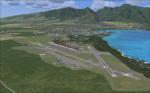
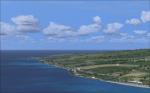
17.27Mb (4582 downloads)
FSX Scenery And Landclass For Maui, Hawaii (HI). This is a detailed landclass and scenery redesign of the entire Island of Maui. The changes that have been created will make for excellent VFR flying. Hundreds of objects have been added that reflect the real layout and scenery for this location. Maui's three airports have also been extensively modified to look like the real existing airports. By Charles Reid.
Posted Apr 10, 2011 03:47 by Charles Reid