 |
|
Home
| Search
| Forums
| Help
| Upgrade
to Premier Membership
|
|
CFS
Home
CFS
2
CFS
1
Utilities
Links
Upgrade
to Premier Membership |
 Scenery
Page 28 Scenery
Page 28 |
 |
| CFS
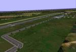
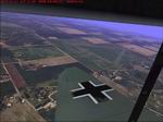
Scenery Add-On "Baden Baden" The
"Baden Baden" scenery is totally fictional but attempt to show a detailed
depiction of the german airport of Baden Baden during WWII. All information
are took through the net, from the Baden Baden scenery for FS98 created
by Thomas P. Vannauer, current aerial photos and DFS Deutsche Flugsicherung
GmbH flugplatkarte, for represent a wartime style of this airport
in West Germany. Due to problem with the CFS ground level and slopes,
the scenery is not placed in the true place of the real airfield.
Today this airport has a asphalt runway, and I don't know if this
was operated by the Luftwaffe in the WWII. But is a good fictional
complement to other sceneries of this region. I include static Junkers
Ju-52/3m, Lufthansa DC-2, HE-219 Uhu, HE-162 and FW-190, searchlights
and refuel area with moving fuel truck. By Edmundo Abad. 1.1MB |
|
 |
| CFS1
Safe Havens: Modified
textures to give a more realistic depiction of coastal ports and harbours.
Featuring sea walls, harbour defences and berthed shipping. One texture
is modified to represent a typical European seaside resort with pier.
These files will give you the most realistic coasts in combatsimland.
Arno Brooks. 656K |
|
 |
| CFS
Dale Airfield -
These files recreate all of Dale airfield's runways and buildings.
Created in CFS1's default editor, and is ONLY for CFS1. Includes taxiways,
but not dispersals. Dale Airfield Pembroke, UK. Dan Garner File size:
141 Kb |
|
 |
| CFS
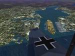
vFURBARA Airfield - Italy
- Before and during WWII this airport and his surrounding area were
utilized by the Regia Aeronautica (Italian Air Force) as weapons and
armament test center for the new aircraft that entered in service.
The FURBARA scenery is mostly fictional, because the WWII pictures
we saw didn't help in the placement of the buildings and the other
objects of this airport, but we believe that it was approximately
similar to the reality. Cliff Burgess's CFS Italy v1.5 Scenery required
(here)
. By Corrado Sandri and Edmundo Abad. 1.1MB |
|
 |
|
 |
| CFS
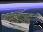
1 Langeoog Island addon scenery.
Background Langeoog one of the 7 Eastfrisian Islands with a large
"Fliegerhorst" used by the Luftwaffe during WW II. By Wolfgang Grünewald.
1.6MB |
|
 |
| CFS1
add on scenery. Dd Island airfield. Dd Island (or "Hurry" Island"
) is
located in the Pacific ocean in the Navy Ops area,halfway between
the Allied base and the Japanese base. It features an airfield,harbor
facilities and a landable aircraft carrier and escorts in the bay.This
scenery is "auto-install" and was built using Airport 2.60,Martin
Wrights' cfsClass program and the stock CFS1 scenery editor. Thanks
to Martin Wright,H_Paul and Rabid_Bart. By David "Ddave" Sumners.
829K |
|
 |
| Arid
textures for CFS. An entirely new look for CFS Part 1.
(As always - make sure you back up your default textures.)
A complete scenery change. Alters scenery to a hot, dry, tropical
landscape. Ideal for Israeli, Middle Eastern, Afgani, Pakestani theatres
of war. Includes towns, villages, resorts, plantations, deserts, coasts
and harbours. A safe and tested totally new look. Three part download.
These textures are intended to make entirely new parts of the world
accessable for CFS. They are suitable for anywhere that is hot, dry,
dusty. Can be used for the Middle East, North Africa, Afganistan,
Iraq or even Nevada or Australian Outback. You can use these textures
to change to look of your default scenery. These textures have been
made for a series of missions soon to be produced. To have all the
texture files you must download all three zipfiles. Arid Textures1
zip (this one). Arid Textures2.zip and Arid Textures3.zip. Arno Brooks.
2.6MB |
|
| |
|
| |
|
 |
| CFS
1 Wangerooge Upgrade Scenery.
Background The island of Wangerooge is the most eastern island of
the row of Eastfrisian Islands. It was heavily fortified during WW
II and hosted an airfield, which was used as an operational air base
in the early stages of the war. Scenery The new design replaces the
previous Wangerooge scenery and uses close by photo-realistic textures.
By Wolfgang Grünewald, Aurich, Germany. 1.6MB |
|
 |
| CFS1
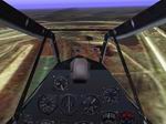
Guernsey Field,
located on Guernsey Island, UK. Features an airport with full IFR/ILS
capability, the capital of St.Peter Port,business district, manufacturing
district,harbor facilities and village. Built with Airport 2.60 and
CFS Scenery editor. By David Sumners aka Ddave. 1.2MB |
|
 |
|
 |
|
 |
| CFS
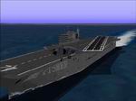
HMS John "Jacky" Fisher.
ILS equiped aircraft carrier for bad weather instrument landings.
Located offshore from St.Malo,includes destroyer escorts with helo
pads. Built with Airport 2.60 By David Sumners aka Ddave. 368K |
|
 |
|
 |
|
 |
|
 |
|
 |
| CFS
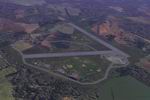
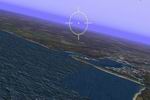
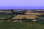
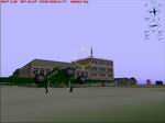
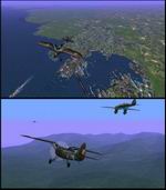
1 Emden Area. :
Scenery presenting Emden naval port, nearby airfield, including night
textures. created by Wolfgang Grünewald. 1.2MB |
|
 |
|
 |
|
 |
|
 |
| CFS1
Western Poland.
The scenery covers the area from E15 (where the CFS stock scenery
ends) to E20, and from N49 (northern Czechoslovakia) to N55 (the
Baltic Sea). Includes airfields in Poznan, Torun, Bydgoszcz, Czestochowa,
Ostrow, Katowice, Krakow, Lodz...and bridges over the Vistule river.
Elevated mesh made with CFSclass using DEM data and stock CFS textures.
2 classlists for fall/winter/summer textures or only summer. V.Moyet.
983K
Scenery
Map: A little information to help mission makers use my 'Western
Poland' scenery. The included map was generated by CFS Class by
Martin Wright during the scenery creation process. It can be used
for mission creation. Airfield coords are also provided. 364K |
|
 |
| CFS1
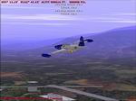
fictional Anglo-American base AAC_Ripe.
Allied Air Corp squad base with almost all brand new macros, many
of them interactive. 3 runways, 2 equipped with tri-colors VASI. J
and t-type hangars, Romney, Quonset and Nissen huts of various sizes.
Maycrete and Orlit concrete buildings. 2 "no-cheat" refuel
zones. 6 points of entry by CFO or GO TO functions. By Guy Gauvreau.
6.6MB |
|
 |
| CFS
Aleutian Islands, Alaska scenery.
These scenery files were built from USGS DEM data using Martin Wright's
CFSClass for the Aleutian Island chain from Attu Island to the Alaska
Peninsula. Five airfields of varying size are included. By Allan Lowe.
1.3MB |
|
  |
|
|
|


