


FS Navigation > Flight Simulator Navigation > Page 26
1.79Mb (208 downloads)
Tested on Windows XP and Windows 7.
This download adds airfield markers and ICAO id's found in FSX, and overlays them on Google Earth.
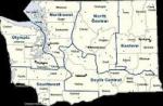
This file is for Washington state, USA.
There is also a seperate file with a list of basic airfield location details.
i.e: EGBB Birmingham Airport. Birmingham. N52* 27.23' W1* 44.88' alt325
Other locator files to follow
by Carl Vokes
Posted Feb 19, 2012 10:34 by carl vokes
1.61Mb (153 downloads)
Tested on Windows XP and Windows 7.
This download adds airfield markers and ICAO id's found in FSX, and overlays them on Google Earth.
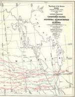
This file is for Manitoba. Canada
There is also a seperate file with a list of basic airfield location details.
i.e: EGBB Birmingham Airport. Birmingham. N52* 27.23' W1* 44.88' alt325
Other locator files to follow
by Carl Vokes
Posted Feb 13, 2012 16:47 by carl vokes
1.67Mb (147 downloads)
Tested on Windows XP and Windows 7.
This download adds airfield markers and ICAO id's found in FSX, and overlays them on Google Earth.
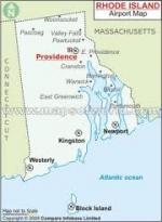
This file is for Rhode Island, USA.
There is also a separate file with a list of basic airfield location details.
i.e: EGBB Birmingham Airport. Birmingham. N52* 27.23' W1* 44.88' alt325
Other locator files to follow
by Carl Vokes
Posted Feb 9, 2012 12:28 by carl vokes
0.75Mb (288 downloads)
This download adds airfield markers and ICAO id's found in FSX, and overlays them on Google Earth.
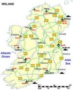
This file is for Ireland
There is also a seperate file with a list of basic airfield location details.
i.e: EGBB Birmingham Airport. Birmingham. N52* 27.23' W1* 44.88' alt325
Other locator files to follow
by Carl Vokes
Posted Feb 6, 2012 11:47 by carl vokes
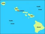
0.63Mb (292 downloads)
This download adds airfield markers and ICAO id's found in FSX, and overlays them on Google Earth.
This file is for Hawaii, USA.
There is also a separate file with a list of basic airfield location details.
i.e: EGBB Birmingham Airport. Birmingham. N52* 27.23' W1* 44.88' alt325
Other locator files to follow
by Carl Vokes
Posted Feb 5, 2012 14:37 by carl vokes
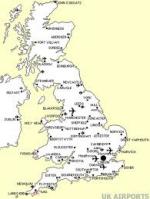
0.72Mb (539 downloads)
This download adds UK airfield markers and ICAO id's found in FSX, and overlays them on Google Earth.
This file is for The United Kingdom.
There is also a separate file with a list of basic airfield location details.
E.g: EGBB Birmingham Airport. Birmingham. N52* 27.23' W1* 44.88' alt325
Other locator files to follow
by Carl Vokes
Posted Feb 4, 2012 16:57 by carl vokes
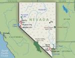
1.12Mb (203 downloads)
This download adds Nevada airfield markers and ICAO id's found in FSX, and overlays them on Google Earth.
This file is for Nevada USA.
There is also a separate file with a list of basic airfield location details.
i.e: EGBB Birmingham Airport. Birmingham. N52* 27.23' W1* 44.88' alt325
Other locator files to follow
by Carl Vokes
Posted Feb 4, 2012 16:51 by carl vokes
1.20Mb (470 downloads)
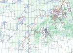
The Tomvale Aviation Calculator does standard math calculations, as well as calculates crosswind component, initial heading, wind and ground speed problems, and aviation conversions. Essential for flight planning. It includes a database with all aerodromes and heliports in Canada and the US, with a utility to determine heading and distance between them.
Posted Sep 25, 2011 10:35 by C. Valentini
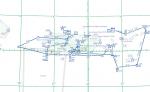
1.21Mb (318 downloads)
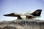
This package includes 9 individual FS2004 flight plans for current IFR, VFR and Slow Speed Routes in the U.S.Territories of Guam and Puetro Rico. These are great routes for B-52, F-111, B-1B, B-2 A6, A4, Vulcan and any fighter or bomber enthusiasts. Of course you can fly the route with any aircraft of your choice. Also included in this package is Karol Chlebowski's TFR gauge. This gauge will greatly enhance your ability to fly these challenging routes and are a great companion of the flight plans. Another option is to download Version 2.0 of my FS9 mini panel which has all this functionality and more.
Posted Sep 19, 2011 23:59 by Bill McClellan
1.36Mb (400 downloads)
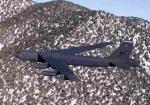
This package includes 52 individual FS2004 flight plans for current IFR, VFR and Slow Speed Routes in Alaska. These are great routes for B-52, F-111, B-1B, B-2 A6, A4, Vulcan and any fighter or bomber enthusiasts. Of course you can fly the route with any aircraft of your choice. Also included in this package is Karol Chlebowski's TFR gauge. This gauge will greatly enhance your ability to fly these challenging routes and are a great companion of the flight plans. Another option is to download Version 2.0 of my FS9 mini panel which has all this functionality and more.
Posted Sep 19, 2011 23:56 by Bill McClellan