1.75Mb (1184 downloads)
FS2004
- Canberra Airport , ACT - Australia. This is a basic representation
of Canberra Airport & Telstra Tower that I made for a friend
that lives in Canberra. Also includes an updated but basic AFCAD2
file. Ian Thatcher. 1.8MB
Posted Jun 23, 2008 14:25 by archive

1.41Mb (9211 downloads)
FS2004
Scenery Enhancements Innsbruck, Austria
New roads, railroads, streams, river, land- and waterclass for
the LOWI area, Austrian Alps. Based on satellite imagery. A
small, "Sunday afternoon" product to illustrate the visual improvements
possible with Ground2K4. Looks best with one of the SRTM add-on
meshes. Includes my Ground2K4 source code so that others can
change or add to this scenery. By Holger Sandmann. 1.4MB
Posted Jun 23, 2008 14:25 by archive

1.79Mb (1605 downloads)
FS2004
CYKZ (Buttonville) Toronto Ontario scenery.
Has some extra goodies like fire trucks With lights and fence
around the airport with the roads and light posts for the real
Feeling into runway 15. Have fun! Look for updates as they come
out, I am always working(v1.0) Made by Daniel Jarczyn. 1.8MB
Posted Jun 23, 2008 14:25 by archive

0.78Mb (8321 downloads)
FS2004
Statue of Liberty
Detailed model of the Statue of Liberty. Includes day and night
textures and 3 LODs for framerate-friendliness. Tested with
Aerosoft Manhattan. By Daniel Buechter. 797K
Posted Jun 23, 2008 14:25 by archive

2.24Mb (1136 downloads)
FS2004
Selfridge Air National Guard Base, Mt. Clemens, Michigan
- one of the largest and busiest Guard bases in the country
and serves every branch of the military. Totally redone scenery
has new macros, the new runway, and was made to be more frame
rate friendly. Includes new Selfridge ANGB scenery, 9 AFCAD2
files, flight plans, and charts. A must have for any one that
lives in the Detroit area. Requires NOVA GOLD Textures 1 (novagt1.zip)(here),
TTools V2+, and AFCAD2+ (here).
Matt Magner. 2.3MB
Posted Jun 23, 2008 14:25 by archive

219.76Mb (4763 downloads)
FS2004/2002
Netherlands 2000 Scenery V2.9.scenery.This
is a total new V2.9 release of The Netherlands 2000. Included
are now AFCAD files, completely rebuilded airports and a new
basic surface. A model with landable water is also included,
and the new featurepanel will help you to install many different
add-on's. By The Netherlands 2000 Design team. 225MB
Posted Jun 23, 2008 14:25 by archive

2.22Mb (1542 downloads)
FS2004/2002
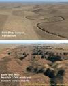
Landclass and Scenery enhancements of Namibia, southwestern
Africa
Replacement landclass file for the entire country of Namibia
(S15-30 E11-25) and parts of western Botswana. Based on the
new Global Land Cover 2000 Project data, this landclass file
is still quite basic but better (I hope) than the FS original.
In addition, I used Ground2K4 to more accurately represent natural
and man-made features in five areas throughout the country,
including Windhoek, Swakopmund/Walvis Bay, and the Fish River
Canyon. Meant to be used with my Namibia LOD9 add-on mesh series.
Landclass source files are included. Holger Sandmann. 2.3MB
Posted Jun 23, 2008 14:25 by archive

0.21Mb (8140 downloads)
FS2004
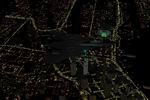
Nighttime Brighter Highways and Roads These
are default textures to make the Highways and Roads in FS2004
look considerably more lit up with traffic at nighttime. They
make for better screenshots and make it much easier to navigate
using roads as VFR lanmdmarks at night. Please see the enclosed
screenshot for a much better look. Submitted by Jimmy Richards..
220K
Posted Jun 23, 2008 14:25 by archive
0.01Mb (383 downloads)
FS2004/2002
Shenzhen Airlines v3.0 (Summer 2004).
You need to obtain and know how to use TTools by Lee Swordy
(here) .
You install these plans at your own risk. Doug McEwen. 9K
Posted Jun 23, 2008 14:25 by archive
0.00Mb (438 downloads)
FS2004/2002
Orient Thai v3.0 (Summer 2004).
You need to obtain and know how to use TTools by Lee Swordy
(here) .
You install these plans at your own risk. Doug McEwen. 3K
Posted Jun 23, 2008 14:25 by archive


