


0.30Mb (1276 downloads)
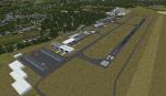
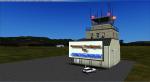
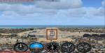
This is a small fix for the FSX EDKB Bonn-Hangelar airfield scenery. It fixes a texture problem at the building of the ADAC HEMS acadamy.
Posted Sep 10, 2014 11:22 by Patrick Freitag
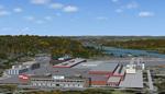
28.15Mb (3550 downloads)
FSX scenery of the small German airfield Bonn-Hangelar. For further information see the Readme file !
Posted Sep 9, 2014 07:31 by Patrick Freitag
4.17Mb (718 downloads)
(LICX) Condofuri Marina (RC) airport in the Calabria area of Italy.
Posted Sep 7, 2014 07:42 by Voyager
4.15Mb (1446 downloads)
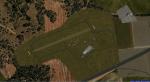
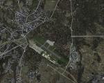
Rieti Airfield (LIQN), Italy. is an aerodrome located 1.34 nautical miles (2.48 km; 1.54 mi) northwest of Rieti, a city in the Lazio region in Italy. It is also known as G. Ciuffelli Airport. By Voyager
Posted Sep 7, 2014 05:33 by Voyager

19.96Mb (772 downloads)
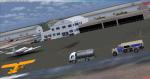
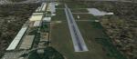
This scenery addon will update KFCI in Richmond, VA to it's current appearance in 2014. The ramps and taxiways have been added as the airport has grown since FSX came out. Also, the main terminal is added along with all hangars; these have all been custom made. All other objects are default FSX objects. This scenery works best with photoscenery but will also work with default FSX.
Posted Sep 6, 2014 17:55 by Wes Van Gelder
60.52Mb (1303 downloads)
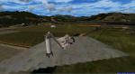
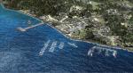
Package scenarios for heliports in the Aeolian Islands (Sicily - Messina).
This includes heliports all 7 islands, preview only
picture (LIEJ) Eli Stromboli.
Scenery optimizer for UTX.Italian - Pacchetto scenari per gli eliporti delle Isole Eolie (Sicilia - Messina).
Sono compresi gli eliporti di tutte e 7 le isole, in anteprima solo le
foto di (LIEJ) Eli Stromboli.
Scenario ottimizzato per UTX.
-
Posted Sep 5, 2014 10:09 by Voyager
0.43Mb (976 downloads)
This is a fix for my scenery lmml.zip.
The ILS for RWY 14/32 caused conflicts with the stock-ILS because they used the same frequences. This caused wrong ILS-approaches. I changed it to 109.75 MHZ for RWY 14 and 110.55 MHZ for RWY 32.
Required files:
required file
Posted Sep 4, 2014 14:46 by Klaus-Peter Kniffka
17.43Mb (2325 downloads)
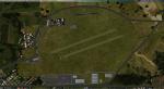
Vergiate Airport (LILG) in northern Italy, near Milan.
FS9 version converted for FSX (Italian - Vergiate Aeroporto (LILG) Italia
Versione FS9 convertita per FSX)
Posted Sep 3, 2014 12:41 by Voyager
77.23Mb (2428 downloads)
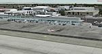
Detailed scenery of Long Beach Airport, Long Beach, California, USA. This is version 5 incorporating the latest design techniques and upgraded to the latest development stage. This version includes the modern new terminal and the new parking garage. This is a brand new stand alone version for FSX/P3Dv2. **Includes all fixes**
Posted Sep 2, 2014 13:45 by Shehryar Ansari
1.57Mb (595 downloads)
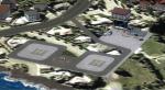
FSX Sikorsky Aircraft Company, Stratford, CT
Airport, helipads, aprons, and buildings of
the main Sikorsky Aircraft complex off the
Merritt Parkway in southern CT. Includes the
whirl stands and drop tower at the north side
of the property. RWY12 download required for
cars and street lamps. Source data primarily
Google Earth along with some ground level
photos. By David Allan.
Posted Sep 2, 2014 12:55 by uploader