12.90Mb (344 downloads)
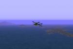
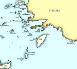
This CFS scenery shows the Elevated Mesh Terrain of Italian Dodecaneso with them main islands with real and ficcional airfields.
This scenery is a complement of Greece Scenery for CFS, created by the Mushy Peas Group on 2000.
The three italian airfields of Rodi, (Maritsa, Gadurra and Cattavia), and Scarpanto airfield, are historically accurate, but the airfields of the rest of the islands are totally fictional. Shows the current airfields in ficcional WWII style.
Special thanks to Corrado Sandri, GREAT CFS MISSIONS CREATOR, by the lot of provided information (since 2003) for the development of this virtual CFS scenery.
Posted Jan 12, 2011 09:41 by Edmundo Abad

1.74Mb (230 downloads)
Bad Zwischenahn was opened in 1937 as a civil airport (grass runway) and seaport (using the Bad Zwischenahner See). It was taken over by the Luftwaffe in 1939. Reconstruction and extension up to 1940. Three asphalt runways were constructed, and hangars erected.
The Erprobungskommando 16 (EK16), the Me 163B "Komet" test unit, were stationed here from late summer 1943 to October 1944. And early 1945-April 1945 was Home of II./JG400, also equipped with "Komets".
The design is based on the information of Arne Bartels on 'Chronik des Flugplatzes Zwischenahn' as the main source, and Bernhard Weiss with his Fliegerhorste site, and other page about Bad Zwischenahn of Manfred Tegge (Relikte in Niedersachsen und Bremen).
Special thanks to Stephan Sholtz by the provided information for the development of this virtual CFS scenery.
The "Bad Zwischenahn" scenery is fictional, but shows the airport like it (may) have looked like in WWII days. The buldings's position are taken from wartime aerial photos and other photos of current golf-club located on the former airbase. I built the scenery in "Luftwaffe Style", in accordance with Combat Flight Simulator.
The airbase Bad Zwischenahn was located in Lower Saxony, North of West Germany, near Oldemburg.
Posted Jan 10, 2011 12:07 by Edmundo Abad
1.73Mb (228 downloads)
CFS Scenery Add-On "Rechlin Lõrz and Rechlin North"
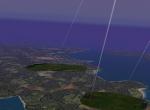
The "Rechlin" scenery is totally fictional, but is an effort to represent the airport like it (may) have looked like in WWII days. Shows the current airfields layer took from the real maps and a supposed buildings distribution just as a German Airfield during WWII.
This scenery places Runway, AFD menu entry, NDB beacon frequency, buildings, fields, trees, ground vehicles, static planes, active gastruck, searchlights and more to the airfield of Rechlin - Germany.
Posted Jan 7, 2010 19:35 by Edmundo Abad

0.29Mb (865 downloads)
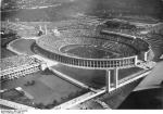
This little design places a 3d object on accurate cordinates of West-Berlin for represent Olympic Stadium of 1936 Olympic Games at wartime (1939-45).
Posted Apr 20, 2009 23:27 by Edmundo Abad

0.81Mb (565 downloads)
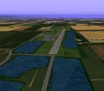
The new design replaces my previous "Regensburg_Straubing" scenery and give an accurate aerial view taken from Google Earth.
The "Regensburg_Straubing" scenery is totally fictional but attempt to show a detailed depiction of the two little german airports of Regensburg and Straubing during WWII.
Posted Apr 19, 2009 23:37 by Edmundo Abad

0.74Mb (427 downloads)
Strausberg aerodrome was opened in 1927 - as a glider airfield. Was turned into a military airbase in 1935, location of an airman navigationsschule and a Jagdgeschwader of german Luftwaffe during World War Two. After the end of War, the airfield was in the hands of the Soviet Air Force until 1952, after which the East German Armed Forces (NVA) used it.
Posted Apr 19, 2009 22:23 by Edmundo Abad

1.68Mb (682 downloads)
Brussels - Zaventem WWII Scenery for COMBAT FLIGHT SIMULATOR I. Airport original by Edmundo Abad with with additional files for Brussels downtown:
Posted Apr 19, 2009 12:44 by Edmundo Abad
1.80Mb (1045 downloads)
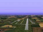
The new design replaces my previous "Linz - Austria" scenery and uses accurate elevation to CFS world, I took some current time objects and replace them with others wartime (1939-45) objects.This scenery places a concrete and a grass Runways, AFD menu entry, NDB beacon frequency, buildings, fields, trees and ground vehicles to the Linz airport, and Eferding, Hofkirchen and Wels airfields.
Also I have added a section of Danube river, downtown buildings and the railroad net around Linz.
Posted Feb 26, 2009 21:13 by Edmundo Abad

1.04Mb (690 downloads)
This new design replaces my previous Brandis - Germany" CFS1 scenery and uses accurate elevation to CFS world.
Between July 1944 - April 1945, Brandis was home of I./JG400 unit . After August 1944 also EK16 unit. Both equipped with the ME-163 Komet.
Posted Jan 27, 2009 21:45 by Edmundo Abad

1.23Mb (567 downloads)
The airfield of Dessau is the former Junkers company airport. This airport was officially opened in 1926. The new airport got a beton runway from the beginning. Until 1945 this airfield became the Junkers company airport, but it was also used by Lufthansa for commercial flights and by amateur pilots during these years.
Most buildings were destroyed already during WWII or at least during the initial years following WWII. Only a few items are left today.
This scenery places Runway, AFD menu entry, NDB beacon frequency, buildings, fields, trees, ground vehicles, static planes, searchlights and more to the wartime Dessau airfield.
I have added a section of Elba and Mulde rivers and downtown buildings in Dessau area.
Posted Jan 25, 2009 16:04 by Edmundo Abad


