


FS2004 > Gliders and Ultralites > Page 15
0.06Mb (55 downloads)
FS2002/2004
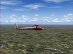
Lasham, United Kingdom Soaring Scenery
This file add some thermals to default Microsoft Lasham,United
Kingdom Airport(ICAO - EGHL) Scenery ,home of Imperial College´s
Gliding Club. By Francisco Vargas. 63K
Posted Jun 23, 2008 14:18 by archive
0.23Mb (1079 downloads)
FS2004
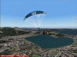
Hang Glider/Paraglider Soaring Scenery
These files adds some thermals to default Microsoft Scenery
,over below Regions: 1.Guatemala City Coordinates: N 14* 28.65´
- W 90* 42.00´ - Elevation - 1200 ft 2.Rio de Janeiro City
- Pepino´s Beach Coordinates: S 22* 59.10´ - W 43* 13.05´
- Elevation - 11,902ft Goods flights and better landings By
Francisco Vargas. 240K
Posted Jun 23, 2008 14:18 by archive
0.26Mb (308 downloads)
FS2002/2004
Chile Pack 1 Soaring Scenery This
file add some thermals to default Microsoft scenery for Chile
Region: 1.Santiago de Chile City - Lo Castillo Airp.(ICAO-SCLC);
2.Valparaiso City - Quintero Airp.(ICAO-SCER); 3.Arica City
- Chacalluta Airp.(ACAO-SCAR); 4.Iquique City - Diego Aracena
Airp.(ICAO-SCDA); 5.Antofagasta City - La Chimba Airp.(ICAO-SCMB);
6.Copiapo City - Chamonate Airp.(ICAO-SCHA); 7.Las Tacas City
near Coquimbo/La Serena Cities- Las Tacas Airp.(ICAO-SCQT);
8.Linares City near Talca - Linares Airp.(ICAO-SCLN); 9.Concepcion
City - Carriel Sur Airp.(ICAO-SCIE); 10.Osorno City - Pampa
Alegre Airp.(ICAO-SCOS); 11.Puerto Montt City - El Mirador
Airp.(ICAO-SCPV); 12.Moquegua City - Moquegua Airp(ICAO-SPEQ).
Good Flights and better landings By Francisco Vargas. 268K
Posted Jun 23, 2008 14:18 by archive
0.17Mb (179 downloads)
FS2002/2004
USA Pack 2 Soaring Scenery This
file add some thermals to default Microsoft scenery for several
cities of California and Nevada States,USA: 1.San Francisco(KSFO).
2.Los Angeles(KLAX). 3.Las Vegas(KLAS). 4.Crystal,CA(L01)
- Great Western Soaring Club. 5.San Diego(CA84) - Associated
Glider Club of Southern California. 6.Hemet-Ryan(KHMT) - Cypress
Soaring. 7.Skylark Field(CA89) - Lake Elsinore Soaring Club.
8.Truckee(KTRK) - Soar Truckee. 9.Hollister(3O7) - Hollister
Gliding Club. 10.California City(L71) - Caracoles Soaring.
11.Chico Mun(KCIC) - Chico Soaring 12.Avenal(CA69) - Central
California Soaring Club. By Francisco Vargas. 147K
Posted Jun 23, 2008 14:18 by archive
2.25Mb (208 downloads)
FS2004
Glider Tow-Navigation Operation Video This
file presents a navifation flight video from Matamata to Tauranga,North
Island,New Zealand: It simulates a Piper J-3 towing a Rolladen-Schneider
LS-7 Glider and can be useful for glider training because
it shows a navigation flight: 1.Take-off -Piper J-3 towing
LS-7 from Matamata Airfield(ICAO - NZMA) - elevation - 182
ft;. 2.Climb - During flight glider pilot must keep vision
of tow plane wings flattened to horizon and ascencion is rectangular
format paralel to airfield directions(RWY 10/28),so both aircrafts
stays inside security cone if happens a pane; 3.Release -
2000 feet above ground is pattern level to leave tow plane(J-3
pilot balance two wings - that´s the signal)- 2325ft in this
case; 4.After release flightsimmers change J-3 for glider
LS-7)L/D 1:43) or another and so glider flight begins; 5.Thermals
clibbing - keep glider above stall speed and make port curves(in
this case); 6.After get altitude(9715ft) keep heading 058-060
to go Tauranga direction; 7.Some aerobatics; 8.As glider finishes
aerobatics at low altitude pilot much reduce speed to minimal
sink to reach Tauranga(ICAO-NZTG) 9.Dive; 10.Flatten dive;
11. Precision Landing. It will be useful to receive any feed-back
avaliation. By Francisco Vargas. 2.3MB
Posted Jun 23, 2008 14:18 by archive
0.05Mb (64 downloads)
FS2002/2004
Sun Coast Spain Soaring Scenery These
files adds thermals to default Microsoft Marbella,Spain, scenery
Region : 1.Benalmadena City - Coordinates: N36* 36´3.49" -
W 4* 34´16.16" - elevation: 929 ft; 2.Mijas City - Coordinates:
N36* 36´8.42" - W 4* 38´20.25" - Elevation: 2113 ft; 3.Marbella
City - Coordinates:N36* 31´21.50" - W 4* 53´37.52" - Elevation:
389 ft; 4. Marbella Gliderport(LEMB) - ficcional. - RWY -
07/25 - 3000x450 ft - Asphalt and apron. - Coordinates:N36*
31´21.50" - W 4* 53´37.52". - Elevation: 389 ft. - Radio AIDS:
TWR - 122.1 Ground - 127.4 ATIS - 128.0 - Facilities: 2 Hangars;
5.Torremolinos City - Coordinates:N36* 37´50.77" - W 4* 30´35.43"
- Elevation: 350 ft ; Good Flights and better landings It
is freeware. By Francisco Vargas. 47K
Posted Jun 23, 2008 14:18 by archive
0.08Mb (116 downloads)
FS2002/2004
Nevada ,USA Soaring Scenery This
file add some thermals to default Microsoft Jean,Airport(ICAO
- OL7) and Air Sailing Gliderport(ICAO - NV23) Sceneries ,Nevada,USA
home of Las Vegas Valley Soaring Association and Nevada Soaring
Association . It is freeware. By Francisco Vargas. 85K
Posted Jun 23, 2008 14:18 by archive
0.07Mb (149 downloads)
FS2002/2004
Wasserkuppe upgrade Soaring Scenery This
file is an upgrade and add some thermals to default Microsoft
Wasserkuppe Region, Germany changing lenticular clouds to
cumullus. By Francisco Vargas. 68K
Posted Jun 23, 2008 14:18 by archive
0.06Mb (85 downloads)
FS2002/2004
Wick, Scotland, UK Soaring Scenery
This file add some thermals to default Microsoft scenery for
Wick City(ICAO Code - EGPC), North of Scotland Region,United
Kingdom. By Francisco Vargas. 60K
Posted Jun 23, 2008 14:18 by archive
0.29Mb (734 downloads)
FS2004
Hang Glider Upgrade/Paraglider Soaring Scenery These
files adds some thermals to default Microsoft Scenery ,over
below Regions and corrects Rio de Janeiro Coordinates: 1.Guatemala
City Coordinates: N 14* 28.65´ - W 90* 42.00´ - Elevation
- 1200 ft 2.Rio de Janeiro City - Pepino´s Beach Coordinates/Elevation/HDG:
S 22* 59.45´ - W 43* 14.34´ - Elevation - 1378 ft HDG - 180
degrees Goods flights and better landings By Francisco Vargas.
298K
Posted Jun 23, 2008 14:18 by archive