
3.99Mb (7477 downloads)
FS2004
Southwest Airlines AI Traffic v2.0. These flight plans may
not be the original flight plans from Southwest Airlines. Below
i included the aircraft that comes with this package. "Boeing
737-200" "Boeing 737-300" "Boeing 737-500" "Boeing 737-700 new
colors with Winglets" "Boeing 737-700 old colors with Winglets".
Compiled by David Hays. 4.1MB
Posted Jun 23, 2008 14:24 by archive
2.85Mb (1337 downloads)
FS2004
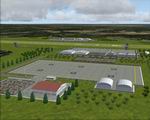
TTCV "Camden Base" airport of "Couva" located in Trinidad Caribbean
Islands
Camden Base is a medium airport and a heliport used mainly for
small aircrafts and helicopters and also for emergencies should
there be a problem at Piarco. the Heliport operated by National
Helicopters Services Ltd. Note that this scenery is not exact
as the actual thing because informations about it are very limited,the
airstrip is real it's reworked about an old FS 2002 scenery
of Couva by Treverson Adams,all others things of this scenery
are fictitious because I haven't found any photos of this airport.
I don't know The ICAO code of this airport,I have just tell
it "TTCV" to do an AFCAD because this airport not exist in FS9
default scenery. By: Delblond Christian. 2.9MB
Posted Jun 23, 2008 14:24 by archive

6.14Mb (4352 downloads)
FS2004
Qantas AI Traffic. Flight
plans might not the original of these Airlines. David Hays.
6.3MB
Posted Jun 23, 2008 14:24 by archive
4.14Mb (2795 downloads)
FS2004
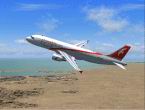
Air Arabia A320 AI Traffic.
. Flight plans might not the original of these Airlines. Package
includes only the Airbus A380 in 3 differnet liveries David
Hays. 4.2MB
Posted Jun 23, 2008 14:24 by archive

5.81Mb (2501 downloads)
FS2004,
Huatulco Int. Airport, Oaxaca, Mexico, MMBT.
This scenery depicts another unique airport of the world,
Huatulco, Mexico. It is a smaller airport that has recently
seen a large scale expansion in 2004, and is presently still
under construction. This scenery depicts it in it's finished
state. The Mexican government is developing this area as another
super resort, and it is located almost at the southern tip
of Mexico on the Pacific Ocean. The airport is a beautiful
series of large thatched roof huts joined around a central
court, and is for the most part open air. The airport presently
has no direct flights, and is serviced through Mexico City,
and feeders from Acapulco, which is a short hop up the coast.
A complete afcad is included. By: Bill Melichar. 5.9MB
Posted Jun 23, 2008 14:24 by archive
26.48Mb (9881 downloads)
FS2004
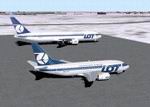
Inter Continental Airlines AI Traffic Pack Full Package Part
2.
Might work on FS2002. Flight plans are NOT the original of
these Airlines. This AI Package will add more traffic to more
airports that didn't have any traffic. Package includes "Airbus
A320 United" "ATR42-300 EuroLOT" "ATR72-500 LOT Polish Airlines"
"B1900 Air Link" "B1900 Continental Airlines" "B1900 US Airways"
"Boeing 727-200 Continental" "Boeing 727-100 Federal Express"
"Boeing 727-100 UPS" "Boeing 737-200 Continental" "Boeing
737-300 LOT" "Boeing 737-400 LOT" "Boeing 737-500 LOT" "Boeing
737-700 Airtran" "Boeing 737-700 NG Southwest Airlines" "Boeing
737-700 Alaska" "Boeing 737-700 Continental" "Boeing 737-700
Southwest OC" "Boeing 737-700 Southwest NC" "Boeing 737-800
NG South African Airways" "Boeing 737-800 NG ATA" "Boeing
747-400 United Airlines" "Boeing 747-400 Virgin Atlantic"
"Boeing 747-400 Northwest Airlines" "Boeing 757-300 Continental"
"Boeing 767-300 Air Canada" "Boeing 767-300 American" "Boeing
767-300GE LOT" "Boeing 767-400 Continental" "Boeing 767-400
Delta" "EMB-120 Delta" "EMB-120 ComAir" "EMB-120 United Express"
"EMB-170 LOT Polish Airlines" "EMB-170 LOT Star Alliance"
"LOT Embraer 145 W". Assembled by David Hays. 27MB
Posted Jun 23, 2008 14:24 by archive
5.88Mb (3468 downloads)
FS2004
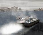
Columbia River AI Floatplanes and Vessels Package.
An optional add-on for my cr_gorge.zip, these files add custom
AI floatplane and ship traffic on the Columbia River between
Washougal and The Dalles, as well as GA flightplans for some
of the smaller airfields in the coverage area. Included are
the HU-16 Albatross (Greg Pepper/Warren Landis), two variants
of the Monocoupe 135 (Tom Miller), a S300C helicopter on floats
(Jordan Moore), as well as Hovercraft and Jetfoil vessels
by Mitsuya "Hama" Hamaguchi using repaints by M. Allen Richards
and Dobro. All models have custom flight models and dynamic
water effects. The included AI models can be utilized in other
locations for which custom AFCAD files are available. For
more details on AI floatplanes and ships see my ai_ships,
ai_shipx, and ai_floats.zip packages. Holger Sandmann. 6MB
Filename: gorge_ai.zip
Posted Jun 23, 2008 14:24 by archive
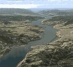
18.73Mb (4478 downloads)
FS2004
Columbia River Gorge and Cascade Volcanoes, USA.
This package completely replaces approx. 5,000 sq mi of the
default landscape of the Columbia River Gorge and adjacent
areas of Washington and Oregon. Three volcanic peaks - Mount
St. Helens, Mount Adams, and Mount Hood - as well as old lava
beds, deep river valleys, many small lakes, and the majestic
Columbia River offer great opportunities for scenic and challenging
flights. Accurate placement of rivers, lakes, streams, roads,
railroads, hydro dams, and power lines, as well as land use
textures (land class), water colors (water class) and a high-res
terrain mesh. Also added are the massive volcanic blast area
of Mount St. Helens and the ski areas at Mt. Hood. Made primarily
with Christian Fumey's "Ground2K4", using 1:24,000 DRG digital
topographic maps and Landsat 7 satellite imagery. Fully compatible
with existing add-on meshes of the western US. Custom AI traffic
will be available as a separate file. Holger Sandmann. Filename:
19.7MB cr_gorge.zip
See
update here
Required files:
required file
Posted Jun 23, 2008 14:24 by archive

3.03Mb (2054 downloads)
FS2004
Tengah AFB, Singapore scenery v.1,
- WSAT Tengah Airforce Base is a small military airbase located
on the western side of the tiny island of Singapore. It is the
main base for the Republic of Singapore Air Force's (RSAF) F16
Falcons, E2 Hawkeyes, and the A4 Skyhawks. This is a fictional
depiction of an actual airbase in Singapore. WSAT is unuseable
and dormant in the default FS2K2 scenery. So this scenery, created
using FSSC, makes WSAT functional and active with ILS enabled.
The whole scenery is framerate friendly and looks great at night
with pulsating approach lights. There's also an additional makeshift
runway made out of a public road, (ie. Lim Chu Kang Road) for
touch and gos like in real-life, and with night lighting too!
PLUS- AFCAD files provided for WSAP, WSAT, WMKB, WMKD and WMSA.
Up and coming: other sceneries of airbases in southeast asia.
Sharizal "Wirana" Zahrin. 3.1MB
Posted Jun 23, 2008 14:24 by archive

2.77Mb (2174 downloads)
FS2004
Butterworth AFB, Malaysia scenery v.1,
- WMKB Butterworth Airforce Base is a military airbase located
on the western coast of Peninsula Malaysia. It is the main base
for the Royal Malaysian Air Force's (TUDM) F18 Hornets and F5
Tigers. This is a fictional depiction of an actual airbase in
Malaysia. WMKB is unuseable and dormant in the default FS2K2
scenery. So this scenery, created using FSSC, makes WMKB functional
and active with ILS enabled. The whole scenery is framerate
friendly and looks great at night with pulsating approach lights.
PLUS- AFCAD files provided for WSAP, WSAT, WMKB, WMKD and WMSA.
Up and coming: other sceneries of airbases in southeast asia.
Sharizal "Wirana" Zahrin. 2.8MB
Posted Jun 23, 2008 14:24 by archive


