


FSX > Page 1675
14.73Mb (15180 downloads)
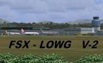
New reworked Addition (works well with Aerosoft's "Austria Professional X" Scenery). You may use it without but it will look not that complete! This Scenery uses alot custom made objects for your eyes and is best used in multiplayer sessions! Credits in the Installation Guide.
If you still use version 1.0 of my scenery = Please delete it before you overwrite it! Thank you Simon, Guy and Jim for the help!
Posted Mar 14, 2010 14:58 by Karl Meindl
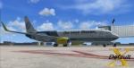
![FSX Boeing 737-800 Tuifly (Sharan [after Release]) Textures](https://static.simviation.com/DAHFB2.jpg-thumb.jpg)
3.71Mb (1502 downloads)
Textures only for the default 737-800 in the colours of Tuifly (Sharan [after Release]-Edition), a German airline. By Marius Krämer.
Posted Mar 14, 2010 12:09 by Marius Krämer
3.71Mb (1158 downloads)
Textures only for the default 737-800 in the colours of Tuifly (Sharan-Edition), a German airline. By Marius Krämer.
Posted Mar 14, 2010 11:57 by Marius Krämer
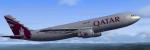
4.24Mb (2929 downloads)
Qatar Airways (New Color) repaint, only for FSX Thomas Ruth's A300-600R, textures by Christophe Bonneville.
Required files:
required file
Posted Mar 14, 2010 10:16 by Christophe Bonneville
3.93Mb (3769 downloads)
KLM (Old Color) repaint, only for FSX Thomas Ruth's A300-600R, textures by Christophe Bonneville.
Required files:
required file
Posted Mar 14, 2010 10:13 by Christophe Bonneville

4.22Mb (3868 downloads)
Kuwait Airways repaint, only for FSX Thomas Ruth's A300-600R, textures by Christophe Bonneville.
Required files:
required file
Posted Mar 14, 2010 10:11 by Christophe Bonneville
4.16Mb (2653 downloads)
Korean Air repaint, only for FSX Thomas Ruth's A300-600R, textures by Christophe Bonneville.
Required files:
required file
Posted Mar 14, 2010 10:09 by Christophe Bonneville
4.26Mb (2056 downloads)
Qatar Airways Cargo repaint, only for FSX Thomas Ruth's A300-600F (above), textures by Christophe Bonneville.
Required files:
required file
Posted Mar 14, 2010 10:06 by Christophe Bonneville
4.35Mb (2987 downloads)
Emirates Sky Cargo repaint, only for FSX Thomas Ruth's A300-600F (above), textures by Christophe Bonneville.
Required files:
required file
Posted Mar 14, 2010 10:03 by Christophe Bonneville
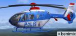
1.33Mb (1481 downloads)
EC-135 Polnisch POLIS Textures only. A Repaint of Heiko Richter's beautiful EC-135
Posted Mar 14, 2010 08:36 by benimix