


FSX > Page 1914
21.72Mb (32126 downloads)
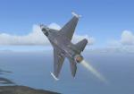
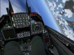
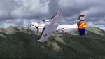
This is a re-packaged version of Kirk Olsson's F-16 Viper/Tunderbird/Falcon which was updated for FSX by Bob Chicilo. This package has 2 separate F-16s. Mr. Chicilo has also fixed the window problem in the F-16. Now you can see out of the VC windows! BY: Kirk Olsson Updated BY: Bob Chicilo Re-packaged BY: Soaring Falcon
Posted Dec 14, 2008 13:44 by Soaring Falcon
33.23Mb (55435 downloads)
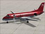
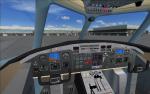
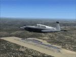
FSX Saab 340 The FSX SP2 ONLY model of the FSND Saab 340. 100% FSX compliant. Hi-resolution textures, fully functional VC, realistic flight-dynamics and operations. A completely modeled interior allowing for in-flight roaming about the cabin with a 'passneger seat' camera definition. Full animation includes the self-storing stairway, and prop-blade pitch. Model, texturing and flight-dynamics by Brett Henderson . Pilots, sounds and texture detailing by Alejandro Rojas Lucena . And as always.. thanks to the Simv / FFDS crew.
Posted Dec 14, 2008 12:16 by Alejandro Rojas (alrot)
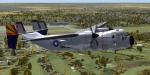
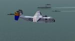
1.51Mb (1132 downloads)
C-2 Greyhound Textures only for the Flight Deck 5 C-2
Posted Dec 13, 2008 23:13 by mike FSXF"Rhino"
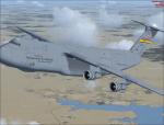
7.02Mb (2935 downloads)
Alphasim C-5m Independent Air Mobility Textures
Posted Dec 13, 2008 23:12 by Thunder

1.51Mb (659 downloads)
This is a repaint of the Flight Deck 5 C-2 greyhound for VRC-40
Posted Dec 13, 2008 17:22 by mike FSXF"Rhino"
0.26Mb (987 downloads)
This scenery package updates Auburn Muniicipal airport in Northern California. Taxiways, runways, aprons, and other aspects of the airport were updated using real satellite images from Google Earth were used for accuracy. Many default scenery objects were placed from the FSX scenery libraries. View Readme file for installation and notes. Compiled using Airport Design Editor.
Posted Dec 13, 2008 15:23 by Phillip Coyle
0.01Mb (1531 downloads)
Updated Version. Better Runway, Assault Strip entrance on both ends, Fire Dept, Parking and Helipads, and Hangers.
Posted Dec 13, 2008 10:27 by Mr. AirForce

13.05Mb (3375 downloads)
This is the Air China Cargo Texture Pack for the FSX Default Boeing 747. This texture package includes two liveries and splash screens each; One in an old livery, and one in a new livery. Normally, this was supposed to be in the Air China Texture Pack, but on this file, it is only on cargo textures. By Victor Vu.
Posted Dec 13, 2008 00:13 by Victor Vu
0.82Mb (4444 downloads)
This is another United Airlines repaint for the FSX AI Default MD-83. If you have the original United Airlines texture for the MD-83, keep the original if you want to use them for your collection of United Airlines repaints from me. Although the old colors were debuted in the 1980s and the MD-80 family entered service in October 1980, the MD-83 never went into UAL service. Splash screen included. This repaint requires the MD-83 Flyable pack by Braden Peters. By Victor Vu.
Required files:
required file
Posted Dec 12, 2008 16:51 by Victor Vu
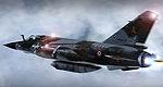
63.01Mb (36008 downloads)
FSX Mirage F1 Package for FSX SP2 or Acceleration. Modifications include two textures: 33NL Reco Savoie
4096x4096; 33NC Reco Operation DAGUET. Original by Kirk Olsson. By Joel Aramendy.
Posted Dec 12, 2008 14:20 by Joel Aramendy