


FSX > Terrain Mesh > Page 22
113.48Mb (1625 downloads)
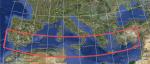
This version of the NASA SRTM DEM data, processed by the people at CGIAR-CSI, Kings College, London - is a considerable improvement on previous versions.
It is considered to be the highest quality SRTM 90m dataset available.
So I thought it would be a good idea to process it, so you FSX users out there could use it.
Citation:
Thanks to NASA, and CGIAR-CSI Kings College, London, UK.
Void-filled seamless SRTM data V1 (Now v4.1), 2004, International Centre for Tropical Agriculture (CIAT), available from the CGIAR-CSI SRTM 90m Database: http://srtm.csi.cgiar.org and http://www.ambiotek.com/topoview
Posted May 10, 2012 06:51 by Wayne Evans
162.10Mb (1920 downloads)
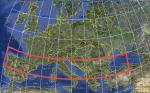
This version of the NASA SRTM DEM data, processed by the people at CGIAR-CSI, Kings College, London - is a considerable improvement on previous versions.
It is considered to be the highest quality SRTM 90m dataset available.
So I thought it would be a good idea to process it, so you FSX users out there could use it.
Citation:
Thanks to NASA, and CGIAR-CSI Kings College, London, UK.
Void-filled seamless SRTM data V1 (Now v4.1), 2004, International Centre for Tropical Agriculture (CIAT), available from the CGIAR-CSI SRTM 90m Database: http://srtm.csi.cgiar.org and http://www.ambiotek.com/topoview
Posted May 10, 2012 03:36 by Wayne Evans

184.59Mb (2120 downloads)
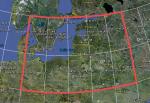
This version of the NASA SRTM DEM data, processed by the people at CGIAR-CSI, Kings College, London - is a considerable improvement on previous versions.
It is considered to be the highest quality SRTM 90m dataset available.
So I thought it would be a good idea to process it, so you FSX users out there could use it.
Citation:
Thanks to NASA, and CGIAR-CSI Kings College, London, UK.
Void-filled seamless SRTM data V1 (Now v4.1), 2004, International Centre for Tropical Agriculture (CIAT), available from the CGIAR-CSI SRTM 90m Database: http://srtm.csi.cgiar.org and http://www.ambiotek.com/topoview
Posted May 10, 2012 03:02 by Wayne Evans
157.34Mb (1785 downloads)
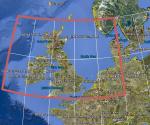
This version of the NASA SRTM DEM data, processed by the people at CGIAR-CSI, Kings College, London - is a considerable improvement on previous versions.
It is considered to be the highest quality SRTM 90m dataset available.
So I thought it would be a good idea to process it, so you FSX users out there could use it.
Citation:
Thanks to NASA, and CGIAR-CSI Kings College, London, UK.
Void-filled seamless SRTM data V1 (Now v4.1), 2004, International Centre for Tropical Agriculture (CIAT), available from the CGIAR-CSI SRTM 90m Database: http://srtm.csi.cgiar.org and http://www.ambiotek.com/topoview
Posted May 9, 2012 04:48 by Wayne Evans
71.45Mb (2734 downloads)
This version of the NASA SRTM DEM data, processed by the people at CGIAR-CSI, Kings College, London - is a considerable improvement on previous versions.
It is considered to be the highest quality SRTM 90m dataset available.
So I thought it would be a good idea to process it, so you FSX users out there could use it.
Citation:
Thanks to NASA, and CGIAR-CSI Kings College, London, UK.
Void-filled seamless SRTM data V1 (Now v4.1), 2004, International Centre for Tropical Agriculture (CIAT), available from the CGIAR-CSI SRTM 90m Database: http://srtm.csi.cgiar.org and http://www.ambiotek.com/topoview
Posted May 9, 2012 03:46 by Wayne Evans
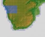
151.77Mb (465 downloads)
There are four parts to download for this area of Africa.
ASTER GDEM Version 2 is a 30 metre definition DEM, its better than the version 1 data that ERSDAC, of Japan and NASA originally released, but it does have its limitations.
GDEM has been obtained from a satellite that uses stereoscopic infrared scanning cameras, this brings with it problems in the resultant data.....where it sees the tops of trees, buildings etc, as the ground terrain.
If you look at the jpg image with the terrain type errors shown as a graph, you will see that the only 'safe' terrain to use this data with - in FSX - is scrubland, or desert terrain.
Its hopeless in defining the terrain in places like Europe - with all the artificial structures, (buildings) and different types of woodland, so any mesh I create from this data won't include areas like that....it will be more desert type terrain, and scrubland.
I won't be doing Greenland because something about the ice around Greenland, (or any other land mass with ice) it creates false data.
It does give enough fine data to reveal railway lines, and some roads though.
This mesh has been made for FSX only.
Grateful thanks to ERSDAC, and NASA for making this data freely available to the public.
ASTER GDEM
Copyright (c) 2009 - 2011 Earth Remote Sensing Data Analysis Center (ERSDAC) All rights reserved.
ASTER GDEM is a product of METI and NASA.
Posted May 5, 2012 06:51 by Wayne Evans
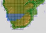
199.19Mb (444 downloads)
There are four parts to download for this area of Africa.
ASTER GDEM Version 2 is a 30 metre definition DEM, its better than the version 1 data that ERSDAC, of Japan and NASA originally released, but it does have its limitations.
GDEM has been obtained from a satellite that uses stereoscopic infrared scanning cameras, this brings with it problems in the resultant data.....where it sees the tops of trees, buildings etc, as the ground terrain.
If you look at the jpg image with the terrain type errors shown as a graph, you will see that the only 'safe' terrain to use this data with - in FSX - is scrubland, or desert terrain.
Its hopeless in defining the terrain in places like Europe - with all the artificial structures, (buildings) and different types of woodland, so any mesh I create from this data won't include areas like that....it will be more desert type terrain, and scrubland.
I won't be doing Greenland because something about the ice around Greenland, (or any other land mass with ice) it creates false data.
It does give enough fine data to reveal railway lines, and some roads though.
This mesh has been made for FSX only.
Grateful thanks to ERSDAC, and NASA for making this data freely available to the public.
ASTER GDEM
Copyright (c) 2009 - 2011 Earth Remote Sensing Data Analysis Center (ERSDAC) All rights reserved.
ASTER GDEM is a product of METI and NASA.
Posted May 5, 2012 06:27 by Wayne Evans
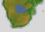
158.51Mb (388 downloads)
There are four parts to download for this area of Africa.
ASTER GDEM Version 2 is a 30 metre definition DEM, its better than the version 1 data that ERSDAC, of Japan and NASA originally released, but it does have its limitations.
GDEM has been obtained from a satellite that uses stereoscopic infrared scanning cameras, this brings with it problems in the resultant data.....where it sees the tops of trees, buildings etc, as the ground terrain.
If you look at the jpg image with the terrain type errors shown as a graph, you will see that the only 'safe' terrain to use this data with - in FSX - is scrubland, or desert terrain.
Its hopeless in defining the terrain in places like Europe - with all the artificial structures, (buildings) and different types of woodland, so any mesh I create from this data won't include areas like that....it will be more desert type terrain, and scrubland.
I won't be doing Greenland because something about the ice around Greenland, (or any other land mass with ice) it creates false data.
It does give enough fine data to reveal railway lines, and some roads though.
This mesh has been made for FSX only.
Grateful thanks to ERSDAC, and NASA for making this data freely available to the public.
ASTER GDEM
Copyright (c) 2009 - 2011 Earth Remote Sensing Data Analysis Center (ERSDAC) All rights reserved.
ASTER GDEM is a product of METI and NASA.
Posted May 5, 2012 05:55 by Wayne Evans
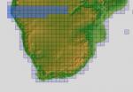
153.52Mb (415 downloads)
There are four parts to download for this area of Africa.
ASTER GDEM Version 2 is a 30 metre definition DEM, its better than the version 1 data that ERSDAC, of Japan and NASA originally released, but it does have its limitations.
GDEM has been obtained from a satellite that uses stereoscopic infrared scanning cameras, this brings with it problems in the resultant data.....where it sees the tops of trees, buildings etc, as the ground terrain.
If you look at the jpg image with the terrain type errors shown as a graph, you will see that the only 'safe' terrain to use this data with - in FSX - is scrubland, or desert terrain.
Its hopeless in defining the terrain in places like Europe - with all the artificial structures, (buildings) and different types of woodland, so any mesh I create from this data won't include areas like that....it will be more desert type terrain, and scrubland.
I won't be doing Greenland because something about the ice around Greenland, (or any other land mass with ice) it creates false data.
It does give enough fine data to reveal railway lines, and some roads though.
This mesh has been made for FSX only.
Grateful thanks to ERSDAC, and NASA for making this data freely available to the public.
ASTER GDEM
Copyright (c) 2009 - 2011 Earth Remote Sensing Data Analysis Center (ERSDAC) All rights reserved.
ASTER GDEM is a product of METI and NASA.
Posted May 5, 2012 05:22 by Wayne Evans
197.59Mb (458 downloads)
There are Eighteen (18) parts of this mesh to download as separate files.
ASTER GDEM Version 2 is a 30 metre definition DEM, its better than the version 1 data that ERSDAC, of Japan and NASA originally released, but it does have its limitations.
GDEM has been obtained from a satellite that uses stereoscopic infrared scanning cameras, this brings with it problems in the resultant data.....where it sees the tops of trees, buildings etc, as the ground terrain.
If you look at the jpg image with the terrain type errors shown as a graph, you will see that the only 'safe' terrain to use this data with - in FSX - is scrubland, or desert terrain.
Its hopeless in defining the terrain in places like Europe - with all the artificial structures, (buildings) and different types of woodland, so any mesh I create from this data won't include areas like that....it will be more desert type terrain, and scrubland.
I won't be doing Greenland because something about the ice around Greenland, (or any other land mass with ice) it creates false data.
It does give enough fine data to reveal railway lines, and some roads though.
This mesh has been made for FSX only.
Grateful thanks to ERSDAC, and NASA for making this data freely available to the public.
ASTER GDEM
Copyright (c) 2009 - 2011 Earth Remote Sensing Data Analysis Center (ERSDAC) All rights reserved.
ASTER GDEM is a product of METI and NASA.
Posted Apr 22, 2012 05:47 by Wayne Evans