


FSX > Page 1163

47.02Mb (330 downloads)
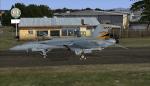
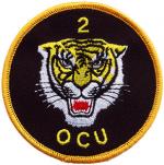
RAAF 2OCU Squadron textures for the payware VRS Superbug. There are all 20 aircraft in this 2 part Pack. please import through the ACM
Posted Jan 17, 2013 01:42 by Barry Wynd (AKA Kartikeya)
41.57Mb (220 downloads)
RAAF 2OCU Squadron textures for the payware VRS Superbug. There are all 20 aircraft in this 2 part Pack. please import through the ACM
Posted Jan 17, 2013 01:33 by Barry Wynd (AKA Kartikeya)

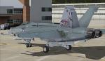
49.53Mb (307 downloads)
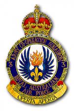
RAAF 3 Squadron textures for the payware VRS Superbug. There are all 16 aircraft in this Pack. please import through the ACM
Posted Jan 17, 2013 01:22 by Barry Wynd (AKA Kartikeya)
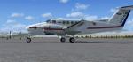
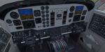
41.46Mb (12922 downloads)
ISDT Beechcraft Kingair 200 package with VC for FSX and P3D.
The website isdt is no longer available and the files are now widely distributed. I had previously downloaded this file from isdt. Original docs included.
I have found textures only for this aircraft in simviation but the link to the
required file is dead. So here it is folks!
I can find no way to contact Max .M or (ISDT team) or the website www.isdt-israel.com
but all credit goes to them for the aircraft model and textures and credit for the
added VC by Joao "Muas" Martins.
Posted Jan 17, 2013 01:19 by Chris Evans
.jpg-thumb.jpg)
4.19Mb (1258 downloads)
Aires (Colombia) textures for the default FSX Boeing 737-800
Posted Jan 16, 2013 23:02 by Gabriel Marín
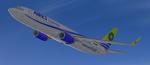
60.24Mb (14098 downloads)
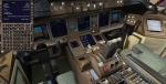
Boeing 777-300ER British Airways G-STBA with new Virtual Cockpit with FMC for FSX
British Airways Speedbird Boeing 777-336 ER Registration "G-STBA". Includes revised VC and FMC (via Views-Instrument panel). Model features are Opening doors & Cargo doors, detailed textures, accurate paint, dynamic shine & effects, dynamic flexing wings that respond to turbulence, fully independent suspension, trim animation, gear steering, accurate flight dynamics, spoiler animation, reflective cockpit windows, crash effects, animated tilting bogies, full night lighting, ground service vehicles when cargo
door open, (FSX - Go to Views - Instrument Panel -Posky Utility), detailed virtual cockpit, jetway (Ctrl J) and more. Model by Project Opensky and professionally textured by Carlos Eduardo Salas. Updated VC by Isaac Tan. Mods for FSX by Chris Evans. See FMC docs.
Posted Jan 16, 2013 15:51 by Chris Evans
7.86Mb (10010 downloads)
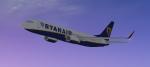
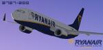
Ryanair textures for the FSX default Boeing 737-800.
Posted Jan 15, 2013 23:43 by Gabriel Marín
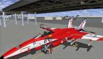
64.30Mb (332 downloads)
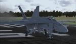
RAAF 1 Squadron textures for the payware VRS Superbug. There are all 12 aircraft in this Pack A44-201 to A44-212 please import through the ACM
Posted Jan 15, 2013 22:52 by Barry Wynd (AKA Kartikeya)
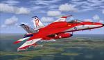
20.10Mb (526 downloads)
Fictional repaints for the payware VRS Superbug of the RAAF Roulettes Display Team. Import Via ACM
Posted Jan 15, 2013 21:43 by Barry Wynd (AKA Kartikeya)

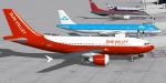
27.59Mb (2986 downloads)
FSX Sun Valley Airlines textures only 5-pack: (Base files required) : Thomas Ruth Airbus
A310-300 Sun Valley passenger (with VC), Thomas Ruth Airbus A310-300F Sun
Valley cargo (with VC), iSDT ATR42-300 Sun Valley Express commuter (no VC),
SGA-Cantu Douglas DC-9-10 Sun Valley Express commuter (no VC), and
Sun Valley Airlines employee flying club default FSX Cessna 172SP
Skyhawk (VC analog gauges). Screenshots enclosed. Easy installation.
Repaints by Tom Tiedman.
Posted Jan 15, 2013 13:19 by Tom Tiedman