


FSX > Page 1273
.jpg-thumb.jpg)
8.72Mb (533 downloads)
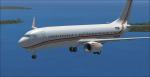
Textures for the default 737-800 in a private livery of N792XM. It has red, orange, and gold stripes. The livery and the tail number are fictional. By Tyler Lawrence.
Posted May 18, 2012 22:05 by Tyler Lawrence
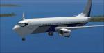
.jpg-thumb.jpg)
8.62Mb (626 downloads)
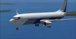
Textures for the default 737-800 in a private livery of N405RG. It has a blue and grey belly. The livery and the tail number are fictional. By Tyler Lawrence.
Posted May 18, 2012 22:03 by Tyler Lawrence
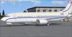
.jpg-thumb.jpg)
8.71Mb (477 downloads)
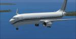
Textures for the default 737-800 in a private livery of N314DF. It has black and grey stripes. The livery and the tail number are fictional. By Tyler Lawrence.
Posted May 18, 2012 21:58 by Tyler Lawrence

8.62Mb (495 downloads)
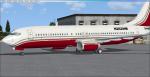
Textures for the default 737-800 in a private livery of N262HM. It has a red belly with gold and grey stripes. The livery and the tail number are fictional. By Tyler Lawrence.
Posted May 18, 2012 21:51 by Tyler Lawrence
8.78Mb (288 downloads)
Textures for the default 737-800 in a private livery of G-RGHD. It has blue stripes. The livery and the tail number are fictional. By Tyler Lawrence.
Posted May 18, 2012 21:46 by Tyler Lawrence

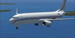
43.57Mb (993 downloads)
These are five repaints for the default 737-800 in private liveries. One is G-RGHD that has blue stripes. One is N262HM that has a red belly with gold and grey stripes. One is N314DF that has black and gray stripes. One is N405RG that has a blue and grey belly. And the last one is N792XM that has red, orange and gold stripes. All the tail numbers and liveries are fictional. These are also available as separate downloads. There are instructions on how to install in the readme file. By Tyler Lawrence.
Posted May 18, 2012 21:44 by Tyler Lawrence
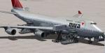
25.78Mb (2877 downloads)
Northwest Boeing 747-400 v4 for fsx
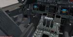
FSX native model features recolored default 747 VC, Ground services. Posky utilities to enable ground service traffic and stairs. (Find it under Views-Instrument panel - Posky Utilities). Textures by unknown. Upgraded to FSX model by Chris Evans.
Posted May 18, 2012 15:02 by Chris Evans
4.89Mb (9807 downloads)
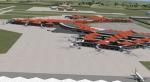
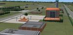
Soekarno-Hatta International(ICAO: WIII) is Indonesia's largest airport. Also one of the busiest in the world based on passenger terms,this airport serves Jakarta and Banten area. Opened in 1985. A great replacer for the default Soekarno-Hatta(WIII)in FSX, which is too simple. Including detailed airport building. but the gates are static. May also work in FS2004, though not tested. Includes night lights.
Posted May 18, 2012 03:42 by ryanID
90.85Mb (289 downloads)
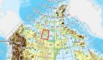
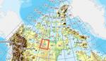
As Raimondo Taburet hasn't processed the CDED files above 60 degrees latitude for Canada, well here are the ones I have processed.
There isn't any data available from geobase in some of the blocks above 60 degrees latitude, these are blocks: 15, 17, 18, 28, 108, 109, 118, 119.
See jpg for coverage.
Thanks go to Geobase (Copyright) Canada for the availability & public use of this data.
Posted May 18, 2012 03:33 by Wayne Evans
156.15Mb (302 downloads)
As Raimondo Taburet hasn't processed the CDED files above 60 degrees latitude for Canada, well here are the ones I have processed.
There isn't any data available from geobase in some of the blocks above 60 degrees latitude, these are blocks: 15, 17, 18, 28, 108, 109, 118, 119.
See jpg for coverage.
Thanks go to Geobase (Copyright) Canada for the availability & public use of this data.
Posted May 18, 2012 03:27 by Wayne Evans