
0.63Mb (1899 downloads)
FS2004
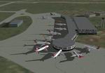
Brasilia Brazil Airport (SBBR) scenery,
now fully operational, with taxiways signs of the new runway
(11R/29L). Also includes better terrain mesh. By Luiz Beneduzi.
641K
Posted Jun 23, 2008 14:24 by archive
0.31Mb (1836 downloads)
Fs2004
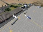
New Afcad of Brasilia Int SBBR.
Adds more gates and parking - Cristiano Magnani. 318K
Posted Jun 23, 2008 14:24 by archive
2.14Mb (1304 downloads)
FS2004
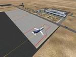
Chacalluta International Airport,(SCAR) Arica, Chile Version
3.0
This scenery includes updated Taxiways, Taxyways signs, Taxiways
Lights, detailed new terminal buildings, new gates and ramp
with night textures,hangars, and surrounding buildings. Created
whit Airport v3.0, Scenery Gen X and Easy Object Designer. By
Daniel Rojas. 2.2MB
Posted Jun 23, 2008 14:24 by archive
1.21Mb (1020 downloads)
FS2004
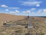
Desierto de Atacama Airport,(SCAT) Copiapo, Chile
Version 3.0 This scenery includes updated Taxiways, Taxyways
signs, Taxiways Lights, detailed terminal buildings, ramp with
night textures and surrounding buildings. Created whit Airport
v3.0, Scenery Gen X and Easy Object Designer. By Daniel Rojas.
1.2MB
Posted Jun 23, 2008 14:24 by archive
1.82Mb (1297 downloads)
FS2004
Diego Aracena Intl Airport (SCDA) Iquique, Chile
Version 5.0 This scenery includes updated Taxiways, and Taxysigns.
detailed terminal buildings and ramp with night textures, gates,
hangars, military base Los Condores Fuerza Aerea de Chile, whit
new F-16 Ramp. Production materials by Andres Valenzuela and
Gabriel Concha. Created with Airport v3.0, Scenery Gen X and
Easy Object Designer. By Daniel Rojas. 1.8MB
Posted Jun 23, 2008 14:24 by archive
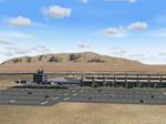
1.78Mb (1528 downloads)
FS2004
Cerro Moreno Intl Airport (SCFA) Antofagasta, Chile.
Version 4.0 This scenery includes airport buildings, corrected
taxiways,taxylights and taxysigns, general aviation hangars,
animated control tower, detailed terminal building with realistic
day and night textures, gates, Chilean Air force Air Combat
Group Nº 7 and Nº 8 Ramp. By Daniel Rojas, productions materials
by Gabriel Concha and Andres Valenzuela O. 1.8MB
Posted Jun 23, 2008 14:24 by archive

0.50Mb (1066 downloads)
FS2004
Manchester, UK AFCAD Update.
Adds extra gates to Manchester. By Adrian Roberts. 514K
Posted Jun 23, 2008 14:24 by archive

98.08Mb (4762 downloads)
FS2004
'"DREAMLAND" - Area-51, Bald Mount. Radar site, Basecamp (Updated).
Area-51
(dreamland) Bald Mountain Radar site (N.E. of Area-51) Basecamp
(Another facility N. of area-51) Nevada. Added AFCADD Files.
All Parking marked "J" at KLAS and KGLK IS Janet Aircraft and
terminals. This is an on-going project which will include the
INTIRE Tonopah test range when finished. Includes Scenery Design
API's. Update: Added: Hanger numbers Janet terminal, Security
Bldg, and Fire Station #2 Signs Corrected some mistakes Credits:
Mike Wallace Al Simms Rafael Garcia Sanchez Andrej Urosevic
Lars Hoyer David Rawlins AI_AARDVARK Bob Familton for his beta
testing and excellent insight. This scenery was created using
FSSC and EOD and AFCAD. Gerry Parks. 100MB
Posted Jun 23, 2008 14:24 by archive
14.68Mb (1002 downloads)
FS2004
Australian Outback Cargo Pilot Sceneries & Hops..
In this add-on that I have created there is 12 different legs
of hopping around airports in the Australian outback using a
wide variety of default FS2004 aircraft from the new to the
old. Each airport has been fictionally modified. In the word
document called "Flight Plans" has information on each leg of
the job as an outback cargo pilot including the cargo being
carried, the aircraft and a briefing / description.
15MB
Posted Jun 23, 2008 14:24 by archive
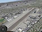
17.96Mb (2435 downloads)
FS2004
Santa Monica, California, High Resolution Airport Area Ground
Scenery.
This scenery contains high resolution ground scenery for the
airport area of Santa Monica (SMO). Intended as part of the
California sceneries above. It has a resolution approx. 1.2m/pixel
(4.7m/pixel is standard). Coverage is the traffic pattern area
around SMO. For more information about my California Freeware
Scenery Project please visit http://n330dg.batcave.net. Gottfried
Razek. 18.4MB
Posted Jun 23, 2008 14:24 by archive


