


FSX > Page 1233

10.52Mb (814 downloads)
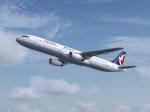
Textures for the default Boeing 737-800 FSX. ITS D-AXLD repaint by JimFly.
Posted Aug 13, 2012 07:06 by Jim Fly
2.09Mb (2356 downloads)
Here is the new Kunming airport (ZPPP) now called Changshui!! This file also include the old Wujiaba airport in China.
Posted Aug 13, 2012 06:37 by musicflyer
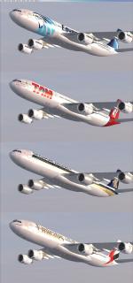
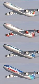
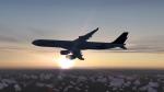
169.93Mb (54966 downloads)
Tom Ruth A340-500 , -600 Airbus A340 mega package V2 (updated version of Tom Ruth A340 multi airline Package I previously uploaded, many paint livery updates done by the artists.) including multiple airlines, with added FMC, altitude callouts, autoland, range tested at 7,400 nm with 12% fuel on board.
-500 9 Liveries: Arik, TAM, Etihad, Thai International, Emirates, Singapore, Lufthansa, kingfisher, Egypt Air."
-600 27 Liveries: Airbus Houses, EVA, Qatar OC/NC, Turkish, Cathay Pacific, Emirates, Iberia, Lufthansa, Swiss Air, TAP, Thai Internationnal, Virgin "G-VRED", China Eastern, China Eastern Skyteam, South African, South African "Star", KLM, Hainan, Arrow Cargo VA, Blue Skywings, Qantas "Spirit", Singapore, Air India, Etihad, Etihad F1, Egypt Air."
See File for credits and Readmes. Features: Garrett Smith "Bendix King/Honeywell General Aviation FMC", Stefan Liebe, Doug Dawson, Jimmy Foongs Altitude Callout gaugeset, "3rett" FMA AutoLand. Original models and VC's by Thomas Ruth.
Posted Aug 12, 2012 23:05 by T.Marson
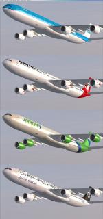
192.84Mb (27244 downloads)
Tom Ruth A340-200, -300, Airbus A340 mega package V2 (updated version of Tom Ruth A340 multi airline Package I previously uploaded, many paint livery updates done by the artists, and I added the -200 modal as well.) including multiple airlines, with added FMC, altitude callouts, autoland, range tested at 7,400 nm with 12% fuel on board.
"-200 13 Liveries: Aerolineas Argentinas, Sabena, SriLankan Air, New Zealand, Etihad F1, Malaysia Air "Oneworld", Philippines, Swiss International, Afriqiyah Air, Air France, Air France (Asie), Royal jordanian, Cathay Pacific."
"-300 35 Liveries: Gulf Air, Lufthansa, Lufthansa "Star", Air China, Etihad, Swiss International, South African, Cathay Pacific, Air France, Air France "Old Livery", China Eastern, Turkish, Turkish "Star", Sabena, Airbus House, Jamaica, Finnair NC, Finnair NC "Oneworld", Philippine, Iberia, Air Mauritius, SAS, Global Jet, Air Tahiti, TAP, Air Asia X, Qantas, Emirates, Luftwaffe, Virgin, China Air, Olympic Air, Sri Lankan."
See File for credits and Readmes. Features: Garrett Smith "Bendix King/Honeywell General Aviation FMC", Stefan Liebe, Doug Dawson, Jimmy Foongs Altitude Callout gaugeset, "3rett" FMA AutoLand. Original models and VC's by Thomas Ruth.
Posted Aug 12, 2012 22:08 by T.Marson
6.76Mb (8861 downloads)
China Eastern Skyteam Livery B-6053 for Tom Airbus A340-600. Original aircraft by Thomas Ruth. China Eastern repaint by Lingyuan He from China. This package contains Texture files only, original aircraft package is available: TomA346.ZIP. For more information see Readme.txt. IMPORTANT: The Tom A340-600 is for FSX only , and you have to at least have FSX Acceleration or install FSX SP1 or SP2, or the aircraft won't be displayed properly!
Posted Aug 12, 2012 06:48 by Lingyuan He
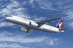
37.44Mb (2198 downloads)
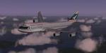
Air Macau Airbus A320 Series for Flight Simulator X. Aircraft models and texture of B-MAO "Rio Yaluzangbu"(A319),B-MAX "Development"(A320) and B-MAP "Rio Das Perola"(A321) are included, along with panel, sound and virtual cockpit from the default A321. Original aircraft by Project Airbus, textures by Lingyuan He from China.
Posted Aug 12, 2012 06:35 by Lingyuan He
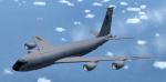
6.83Mb (5598 downloads)
Boeing KC 135 R U.S AIR FORCE Stratotanker. Original model by Mike Stone. Repaint, adaptation to FSX, 2D panel for wide and standard screen (no VC) by Philippe Wallaert. Fully functionnal gauges including GPWS callout. Credits: Mike Stone for the original model. See instructions for installation and configuration in the readme.txt file. Nice flights!
Posted Aug 12, 2012 03:59 by Philippe Wallaert
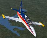
2.07Mb (2305 downloads)
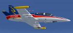
FSX Textures only for Albatros Aero L-39ZA Attack variant of L39, ZU-FMN, significantly upgraded L-39ZO with GSh-23L 23mm twin-barrelled cannon attached under the pilot's compartment, by Harri Thaha & Hadi Tahir (original aircraft needed: ht_l39za-011.zip)
Required files:
required file
Posted Aug 10, 2012 19:26 by Enrique Medal
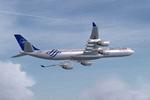
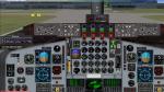
32.70Mb (7090 downloads)
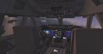
SkySpirit 2011 - Cathay Pacific Boeing 747-8i Skyspirit FSX native Boeing 747-800 Freighter model upgraded using the vastly improved Boeing 747 VC from Alejandro Rojas Lucena/FSND (See panel docs for details). VC includes FMC, EICAS, MFD with control panel, GPWS, working wipers, cabin lights, fire suppression, avionics switch, fuel crossfeed, landing lights switches, taxi light switch, engine generators, APU generator, battery switch, starter switches, de-ice switch, general lights switches. Beautiful Skyspirit 747-800 Freighter model with complex features and ground service vehicles (press shift e 2, shift e 3, etc. ). Textures by Project Opensky member. Also includes Boeing 747 VC textures upgrade by Jason A. Lee. This give a much clearer 747 interior look. Assembled and edited for FSX by Chris Evans. Zip preview for larger pictures. See panel docs and images for VC details and controls!
Posted Aug 10, 2012 17:11 by chris evans
7.14Mb (904 downloads)
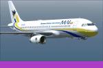
For FSX with DX9 only! XY-AGG, XY-AGI, XY-AGL and XY-AGM. With new Myanmar (Burma) flag, that is used in the country since October 2010. You need the base-pack mai322x.zip
Required files:
required file
Posted Aug 10, 2012 15:20 by HOUSE-RP, Robby Pauletto