FSX > Page 1891

0.80Mb (10005 downloads)
This is an update for FSX acceleration of the
YF-23A by Daniel Buchter. I have updated the
flight dynamics and changed the panel
background and some of the gauges. There is
a virtual cockpit but I am unable to add
gauges to it. You need the original aircraft
for this update to work.
Bob Chicilo.
Required files:
required file
Posted Dec 22, 2008 17:04 by Bob Chicilo
3.62Mb (9227 downloads)
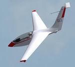
Patch for LAK Genesis 2 for FSX
This is a fix to correct the yawstring on gen2fsx.zip.
Minor adjustments to the handling as suggested by a Genesis owner are also included .
David Rowberry
Posted Dec 22, 2008 16:59 by David Rowberry
1.08Mb (2904 downloads)
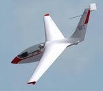
Patch for LAK Genesis 2 for FS2004
This is a fix to correct the yawstring and rudder on gen2fs9.zip.
Minor adjustments to the handling as suggested by a Genesis owner are also included .
David Rowberry
Posted Dec 22, 2008 16:57 by David Rowberry
7.38Mb (16023 downloads)
Original POSKY Boeing 757 adapted to work in FSX. Uses default 737-800 panel and sound. No VC.
Posted Dec 22, 2008 13:49 by Erik Ingram
0.22Mb (1964 downloads)
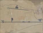
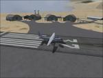
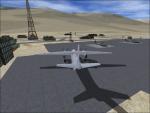
FSX OPSD Skardu Airport (Pakistan - K2, Broad Peak, Nanga Parbat)
This airport is better as the FSX standard airport. If yhou have an additional scenery for the K2
or/and Broad Peak or/and Nanga Parbat, it is more realistic to start from an real airport. OPSD is one from the Pakistan side.
Made with ADE 1.37
Posted Dec 22, 2008 07:14 by Bernhard W.
0.22Mb (1522 downloads)
FSX VI57 Thoise Airport, Kashmir - K2, Broad Peak, Nanga Parbat.
This airport is better as the FSX standard airport. If yhou have an additional scenery for the K2
or/and Broad Peak or/and Nanga Parbat, it is more realistic to start from an real airport. VI57 is one from the India/Kashmir side.
Made with ADE 1.37
Posted Dec 22, 2008 07:11 by Bernhard W.
7.88Mb (5609 downloads)
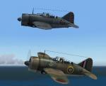
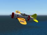
FS2004/FSX Brewster Buffalo F2a3 shipboard fighter
In 1939, the F2A became the first monoplane fighter aircraft used by the US Navy. Later versions had a more powerful Wright R-1820-40 Cyclone engine of 1,200 hp (895 kw), a better propeller, and integral flotation gear, but still lacked pilot armor and self-sealing fuel tanks. Both the F2A-2 and the F2A-3 variants of the Brewster were liked by early Navy and Marine pilots, including Pappy Boyington, who praised the good turning and manoeuvring abilities of the aircraft.
Original model by Thicko. Three versions included. Upgraded for FS2004/FSX by A.F.Scrub
Posted Dec 22, 2008 06:23 by A.F.Scrub
1.04Mb (2506 downloads)
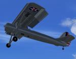
The YO-51 was a prewar USAAC attempt to create a STOL aircraft. This is a native FSX-Acceleration project. It has the usual animations plus drooping ailerons, animated cowl flaps and leading edge slats. The reflective textures are in .dds format. The VC has working gauges and animated flight controls. There is a minimal 2D panel. By Paul Clawson
Posted Dec 21, 2008 18:57 by Paul Clawson
![Elblag Airport [EPEL], Poland](https://static.simviation.com/epel.gif-thumb.jpg)
15.44Mb (1886 downloads)
Elblag (EPEL), Poland, scenery for the MS FSX. Done with FSX SDK, Sbuilder, ADE and Whisplacer. Contains phototexture with seasonal and night variations. By Lukasz Kubacki (SimHangar)
Posted Dec 21, 2008 18:09 by Lukasz Kubacki
![Lososina Dolna Airport, Poland [EPNL]](https://static.simviation.com/snap.gif-thumb.jpg)
10.45Mb (1663 downloads)
Lososina Dolna - home of the Podhalanski Flying Club in the South Eastern Poland. Contains 1m/pix phototexture with seasonal and night variations and custom buildings. TS-11 "Iskra" model by Michal Krawczyk. Scenery compiled with FSX SDK, SbuilderX, Whisplacer and ADE 1.37. Blue Skies! By Lukasz Kubacki (SimHangar)
Posted Dec 21, 2008 17:40 by Lukasz Kubacki


