


FSX > Terrain Mesh > Page 11
131.52Mb (2269 downloads)
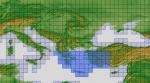
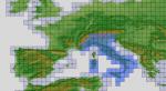
"imp" means imperfect, as other mesh I have already processed is of areas that have very little vegetation cover - over the land, or has large urban areas.
This "imp" mesh will include some slight discrepancies of altitude (in the case of forested areas - by a magnitude sometimes of +15 metres-depending on how tall the trees are, in the jungle or forest canopy) over urban areas, or areas with a lot of vegetation cover - due to the limitations of the ASTER satellites infra red scanning cameras, and the software used to process the DEM data.
Areas where there is little vegetation cover, or non urban areas, the terrain should have truer values.
But I feel this ASTER DEM data is so good - why let it all go to waste - especially flying over lovely Pacific islands?
So you FSX users out there will have to take all this into account when using this mesh.
Grateful thanks to ERSDAC, and NASA for making this data freely available to the public.
ASTER GDEM
Copyright (c) 2009 - 2011 Earth Remote Sensing Data Analysis Center (ERSDAC) All rights reserved.
ASTER GDEM is a product of METI and NASA.
Posted Oct 10, 2012 06:18 by Wayne Evans
247.48Mb (2051 downloads)
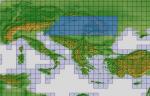
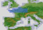
"imp" means imperfect, as other mesh I have already processed is of areas that have very little vegetation cover - over the land, or has large urban areas.
This "imp" mesh will include some slight discrepancies of altitude (in the case of forested areas - by a magnitude sometimes of +15 metres-depending on how tall the trees are, in the jungle or forest canopy) over urban areas, or areas with a lot of vegetation cover - due to the limitations of the ASTER satellites infra red scanning cameras, and the software used to process the DEM data.
Areas where there is little vegetation cover, or non urban areas, the terrain should have truer values.
But I feel this ASTER DEM data is so good - why let it all go to waste - especially flying over lovely Pacific islands?
So you FSX users out there will have to take all this into account when using this mesh.
Grateful thanks to ERSDAC, and NASA for making this data freely available to the public.
ASTER GDEM
Copyright (c) 2009 - 2011 Earth Remote Sensing Data Analysis Center (ERSDAC) All rights reserved.
ASTER GDEM is a product of METI and NASA.
Posted Oct 10, 2012 06:16 by Wayne Evans
198.65Mb (3851 downloads)
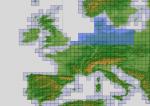
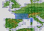
"imp" means imperfect, as other mesh I have already processed is of areas that have very little vegetation cover - over the land, or has large urban areas.
This "imp" mesh will include some slight discrepancies of altitude (in the case of forested areas - by a magnitude sometimes of +15 metres-depending on how tall the trees are, in the jungle or forest canopy) over urban areas, or areas with a lot of vegetation cover - due to the limitations of the ASTER satellites infra red scanning cameras, and the software used to process the DEM data.
Areas where there is little vegetation cover, or non urban areas, the terrain should have truer values.
But I feel this ASTER DEM data is so good - why let it all go to waste - especially flying over lovely Pacific islands?
So you FSX users out there will have to take all this into account when using this mesh.
Grateful thanks to ERSDAC, and NASA for making this data freely available to the public.
ASTER GDEM
Copyright (c) 2009 - 2011 Earth Remote Sensing Data Analysis Center (ERSDAC) All rights reserved.
ASTER GDEM is a product of METI and NASA.
Posted Sep 29, 2012 07:17 by Wayne Evans

143.52Mb (4146 downloads)
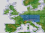
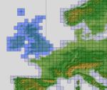
"imp" means imperfect, as other mesh I have already processed is of areas that have very little vegetation cover - over the land, or has large urban areas.
This "imp" mesh will include some slight discrepancies of altitude (in the case of forested areas - by a magnitude sometimes of +15 metres-depending on how tall the trees are, in the jungle or forest canopy) over urban areas, or areas with a lot of vegetation cover - due to the limitations of the ASTER satellites infra red scanning cameras, and the software used to process the DEM data.
Areas where there is little vegetation cover, or non urban areas, the terrain should have truer values.
But I feel this ASTER DEM data is so good - why let it all go to waste - especially flying over lovely Pacific islands?
So you FSX users out there will have to take all this into account when using this mesh.
Grateful thanks to ERSDAC, and NASA for making this data freely available to the public.
ASTER GDEM
Copyright (c) 2009 - 2011 Earth Remote Sensing Data Analysis Center (ERSDAC) All rights reserved.
ASTER GDEM is a product of METI and NASA.
Posted Sep 29, 2012 06:23 by Wayne Evans
214.89Mb (4342 downloads)
"imp" means imperfect, as other mesh I have already processed is of areas that have very little vegetation cover - over the land, or has large urban areas.
This "imp" mesh will include some slight discrepancies of altitude (in the case of forested areas - by a magnitude sometimes of +15 metres-depending on how tall the trees are, in the jungle or forest canopy) over urban areas, or areas with a lot of vegetation cover - due to the limitations of the ASTER satellites infra red scanning cameras, and the software used to process the DEM data.
Areas where there is little vegetation cover, or non urban areas, the terrain should have truer values.
But I feel this ASTER DEM data is so good - why let it all go to waste - especially flying over lovely Pacific islands?
So you FSX users out there will have to take all this into account when using this mesh.
Grateful thanks to ERSDAC, and NASA for making this data freely available to the public.
ASTER GDEM
Copyright (c) 2009 - 2011 Earth Remote Sensing Data Analysis Center (ERSDAC) All rights reserved.
ASTER GDEM is a product of METI and NASA.
Posted Sep 29, 2012 04:36 by Wayne Evans
180.71Mb (4177 downloads)
"imp" means imperfect, as other mesh I have already processed is of areas that have very little vegetation cover - over the land, or has large urban areas.
This "imp" mesh will include some slight discrepancies of altitude (in the case of forested areas - by a magnitude sometimes of +15 metres-depending on how tall the trees are, in the jungle or forest canopy) over urban areas, or areas with a lot of vegetation cover - due to the limitations of the ASTER satellites infra red scanning cameras, and the software used to process the DEM data.
Areas where there is little vegetation cover, or non urban areas, the terrain should have truer values.
But I feel this ASTER DEM data is so good - why let it all go to waste - especially flying over lovely Pacific islands?
So you FSX users out there will have to take all this into account when using this mesh.
Grateful thanks to ERSDAC, and NASA for making this data freely available to the public.
ASTER GDEM
Copyright (c) 2009 - 2011 Earth Remote Sensing Data Analysis Center (ERSDAC) All rights reserved.
ASTER GDEM is a product of METI and NASA.
Posted Sep 20, 2012 11:04 by Wayne Evans
149.05Mb (3430 downloads)
"imp" means imperfect, as other mesh I have already processed is of areas that have very little vegetation cover - over the land, or has large urban areas.
This "imp" mesh will include some slight discrepancies of altitude (in the case of forested areas - by a magnitude sometimes of +15 metres-depending on how tall the trees are, in the jungle or forest canopy) over urban areas, or areas with a lot of vegetation cover - due to the limitations of the ASTER satellites infra red scanning cameras, and the software used to process the DEM data.
Areas where there is little vegetation cover, or non urban areas, the terrain should have truer values.
But I feel this ASTER DEM data is so good - why let it all go to waste - especially flying over lovely Pacific islands?
So you FSX users out there will have to take all this into account when using this mesh.
Grateful thanks to ERSDAC, and NASA for making this data freely available to the public.
ASTER GDEM
Copyright (c) 2009 - 2011 Earth Remote Sensing Data Analysis Center (ERSDAC) All rights reserved.
ASTER GDEM is a product of METI and NASA.
Posted Sep 17, 2012 04:11 by Wayne Evans
156.32Mb (3510 downloads)
"imp" means imperfect, as other mesh I have already processed is of areas that have very little vegetation cover - over the land, or has large urban areas.
This "imp" mesh will include some slight discrepancies of altitude (in the case of forested areas - by a magnitude sometimes of +15 metres-depending on how tall the trees are, in the jungle or forest canopy) over urban areas, or areas with a lot of vegetation cover - due to the limitations of the ASTER satellites infra red scanning cameras, and the software used to process the DEM data.
Areas where there is little vegetation cover, or non urban areas, the terrain should have truer values.
But I feel this ASTER DEM data is so good - why let it all go to waste - especially flying over lovely Pacific islands?
So you FSX users out there will have to take all this into account when using this mesh.
Grateful thanks to ERSDAC, and NASA for making this data freely available to the public.
ASTER GDEM
Copyright (c) 2009 - 2011 Earth Remote Sensing Data Analysis Center (ERSDAC) All rights reserved.
ASTER GDEM is a product of METI and NASA.
Posted Sep 17, 2012 03:39 by Wayne Evans
210.86Mb (4282 downloads)
"imp" means imperfect, as other mesh I have already processed is of areas that have very little vegetation cover - over the land, or has large urban areas.
This "imp" mesh will include some slight discrepancies of altitude (in the case of forested areas - by a magnitude sometimes of +15 metres-depending on how tall the trees are, in the jungle or forest canopy) over urban areas, or areas with a lot of vegetation cover - due to the limitations of the ASTER satellites infra red scanning cameras, and the software used to process the DEM data.
Areas where there is little vegetation cover, or non urban areas, the terrain should have truer values.
But I feel this ASTER DEM data is so good - why let it all go to waste - especially flying over lovely Pacific islands?
So you FSX users out there will have to take all this into account when using this mesh.
Grateful thanks to ERSDAC, and NASA for making this data freely available to the public.
ASTER GDEM
Copyright (c) 2009 - 2011 Earth Remote Sensing Data Analysis Center (ERSDAC) All rights reserved.
ASTER GDEM is a product of METI and NASA.
Posted Sep 12, 2012 05:32 by Wayne Evans
124.56Mb (2248 downloads)
"imp" means imperfect, as other mesh I have already processed is of areas that have very little vegetation cover - over the land, or has large urban areas.
This "imp" mesh will include some slight discrepancies of altitude (in the case of forested areas - by a magnitude sometimes of +15 metres-depending on how tall the trees are, in the jungle or forest canopy) over urban areas, or areas with a lot of vegetation cover - due to the limitations of the ASTER satellites infra red scanning cameras, and the software used to process the DEM data.
Areas where there is little vegetation cover, or non urban areas, the terrain should have truer values.
But I feel this ASTER DEM data is so good - why let it all go to waste - especially flying over lovely Pacific islands?
So you FSX users out there will have to take all this into account when using this mesh.
Grateful thanks to ERSDAC, and NASA for making this data freely available to the public.
ASTER GDEM
Copyright (c) 2009 - 2011 Earth Remote Sensing Data Analysis Center (ERSDAC) All rights reserved.
ASTER GDEM is a product of METI and NASA.
Posted Sep 8, 2012 04:22 by Wayne Evans