


FSX > Terrain Mesh > Page 13
165.60Mb (879 downloads)
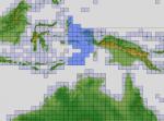
"imp" means imperfect, as other mesh I have already processed is of areas that have very little vegetation cover - over the land, or has large urban areas.
This "imp" mesh will include some slight discrepancies of altitude (in the case of forested areas - by a magnitude sometimes of +15 metres-depending on how tall the trees are, in the jungle or forest canopy) over urban areas, or areas with a lot of vegetation cover - due to the limitations of the ASTER satellites infra red scanning cameras, and the software used to process the DEM data.
Areas where there is little vegetation cover, or non urban areas, the terrain should have truer values.
But I feel this ASTER DEM data is so good - why let it all go to waste - especially flying over lovely Pacific islands?
So you FSX users out there will have to take all this into account when using this mesh.
Grateful thanks to ERSDAC, and NASA for making this data freely available to the public.
ASTER GDEM
Copyright (c) 2009 - 2011 Earth Remote Sensing Data Analysis Center (ERSDAC) All rights reserved.
ASTER GDEM is a product of METI and NASA.
Posted Aug 24, 2012 10:55 by Wayne Evans
147.91Mb (777 downloads)
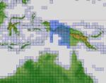
"imp" means imperfect, as other mesh I have already processed is of areas that have very little vegetation cover - over the land, or has large urban areas.
This "imp" mesh will include some slight discrepancies of altitude (in the case of forested areas - by a magnitude sometimes of +15 metres-depending on how tall the trees are, in the jungle or forest canopy) over urban areas, or areas with a lot of vegetation cover - due to the limitations of the ASTER satellites infra red scanning cameras, and the software used to process the DEM data.
Areas where there is little vegetation cover, or non urban areas, the terrain should have truer values.
But I feel this ASTER DEM data is so good - why let it all go to waste - especially flying over lovely Pacific islands?
So you FSX users out there will have to take all this into account when using this mesh.
Grateful thanks to ERSDAC, and NASA for making this data freely available to the public.
ASTER GDEM
Copyright (c) 2009 - 2011 Earth Remote Sensing Data Analysis Center (ERSDAC) All rights reserved.
ASTER GDEM is a product of METI and NASA.
Posted Aug 24, 2012 10:25 by Wayne Evans
85.28Mb (646 downloads)
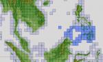
"imp" means imperfect, as other mesh I have already processed is of areas that have very little vegetation cover - over the land, or has large urban areas.
This "imp" mesh will include some slight discrepancies of altitude (in the case of forested areas - by a magnitude sometimes of +15 metres-depending on how tall the trees are, in the jungle or forest canopy) over urban areas, or areas with a lot of vegetation cover - due to the limitations of the ASTER satellites infra red scanning cameras, and the software used to process the DEM data.
Areas where there is little vegetation cover, or non urban areas, the terrain should have truer values.
But I feel this ASTER DEM data is so good - why let it all go to waste - especially flying over lovely Pacific islands?
So you FSX users out there will have to take all this into account when using this mesh.
Grateful thanks to ERSDAC, and NASA for making this data freely available to the public.
ASTER GDEM
Copyright (c) 2009 - 2011 Earth Remote Sensing Data Analysis Center (ERSDAC) All rights reserved.
ASTER GDEM is a product of METI and NASA.
Posted Aug 24, 2012 09:22 by Wayne Evans
44.27Mb (626 downloads)
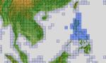
"imp" means imperfect, as other mesh I have already processed is of areas that have very little vegetation cover - over the land, or has large urban areas.
This "imp" mesh will include some slight discrepancies of altitude (in the case of forested areas - by a magnitude sometimes of +15 metres-depending on how tall the trees are, in the jungle or forest canopy) over urban areas, or areas with a lot of vegetation cover - due to the limitations of the ASTER satellites infra red scanning cameras, and the software used to process the DEM data.
Areas where there is little vegetation cover, or non urban areas, the terrain should have truer values.
But I feel this ASTER DEM data is so good - why let it all go to waste - especially flying over lovely Pacific islands?
So you FSX users out there will have to take all this into account when using this mesh.
Grateful thanks to ERSDAC, and NASA for making this data freely available to the public.
ASTER GDEM
Copyright (c) 2009 - 2011 Earth Remote Sensing Data Analysis Center (ERSDAC) All rights reserved.
ASTER GDEM is a product of METI and NASA.
Posted Aug 24, 2012 08:26 by Wayne Evans
52.78Mb (627 downloads)
"imp" means imperfect, as other mesh I have already processed is of areas that have very little vegetation cover - over the land, or has large urban areas.
This "imp" mesh will include some slight discrepancies of altitude (in the case of forested areas - by a magnitude sometimes of +15 metres-depending on how tall the trees are, in the jungle or forest canopy) over urban areas, or areas with a lot of vegetation cover - due to the limitations of the ASTER satellites infra red scanning cameras, and the software used to process the DEM data.
Areas where there is little vegetation cover, or non urban areas, the terrain should have truer values.
But I feel this ASTER DEM data is so good - why let it all go to waste - especially flying over lovely Pacific islands?
So you FSX users out there will have to take all this into account when using this mesh.
Grateful thanks to ERSDAC, and NASA for making this data freely available to the public.
ASTER GDEM
Copyright (c) 2009 - 2011 Earth Remote Sensing Data Analysis Center (ERSDAC) All rights reserved.
ASTER GDEM is a product of METI and NASA.
Posted Aug 24, 2012 08:06 by Wayne Evans
142.43Mb (761 downloads)
"imp" means imperfect, as other mesh I have already processed is of areas that have very little vegetation cover - over the land, or has large urban areas.
This "imp" mesh will include some slight discrepancies of altitude (in the case of forested areas - by a magnitude sometimes of +15 metres-depending on how tall the trees are, in the jungle or forest canopy) over urban areas, or areas with a lot of vegetation cover - due to the limitations of the ASTER satellites infra red scanning cameras, and the software used to process the DEM data.
Areas where there is little vegetation cover, or non urban areas, the terrain should have truer values.
But I feel this ASTER DEM data is so good - why let it all go to waste - especially flying over lovely Pacific islands?
So you FSX users out there will have to take all this into account when using this mesh.
Grateful thanks to ERSDAC, and NASA for making this data freely available to the public.
ASTER GDEM
Copyright (c) 2009 - 2011 Earth Remote Sensing Data Analysis Center (ERSDAC) All rights reserved.
ASTER GDEM is a product of METI and NASA.
Posted Aug 24, 2012 06:27 by Wayne Evans
63.26Mb (650 downloads)
"imp" means imperfect, as other mesh I have already processed is of areas that have very little vegetation cover - over the land, or has large urban areas.
This "imp" mesh will include some slight discrepancies of altitude (in the case of forested areas - by a magnitude sometimes of +15 metres-depending on how tall the trees are, in the jungle or forest canopy) over urban areas, or areas with a lot of vegetation cover - due to the limitations of the ASTER satellites infra red scanning cameras, and the software used to process the DEM data.
Areas where there is little vegetation cover, or non urban areas, the terrain should have truer values.
But I feel this ASTER DEM data is so good - why let it all go to waste - especially flying over lovely Pacific islands?
So you FSX users out there will have to take all this into account when using this mesh.
Grateful thanks to ERSDAC, and NASA for making this data freely available to the public.
ASTER GDEM
Copyright (c) 2009 - 2011 Earth Remote Sensing Data Analysis Center (ERSDAC) All rights reserved.
ASTER GDEM is a product of METI and NASA.
Posted Aug 9, 2012 02:37 by Wayne Evans
72.18Mb (821 downloads)
"imp" means imperfect, as other mesh I have already processed is of areas that have very little vegetation cover - over the land, or has large urban areas.
This "imp" mesh will include some slight discrepancies of altitude (in the case of forested areas - by a magnitude sometimes of +15 metres-depending on how tall the trees are, in the jungle or forest canopy) over urban areas, or areas with a lot of vegetation cover - due to the limitations of the ASTER satellites infra red scanning cameras, and the software used to process the DEM data.
Areas where there is little vegetation cover, or non urban areas, the terrain should have truer values.
But I feel this ASTER DEM data is so good - why let it all go to waste - especially flying over lovely Pacific islands?
So you FSX users out there will have to take all this into account when using this mesh.
Grateful thanks to ERSDAC, and NASA for making this data freely available to the public.
ASTER GDEM
Copyright (c) 2009 - 2011 Earth Remote Sensing Data Analysis Center (ERSDAC) All rights reserved.
ASTER GDEM is a product of METI and NASA.
Posted Aug 9, 2012 02:16 by Wayne Evans
12.87Mb (659 downloads)
"imp" means imperfect, as other mesh I have already processed is of areas that have very little vegetation cover - over the land, or has large urban areas.
This "imp" mesh will include some slight discrepancies of altitude (in the case of forested areas - by a magnitude sometimes of +15 metres-depending on how tall the trees are, in the jungle or forest canopy) over urban areas, or areas with a lot of vegetation cover - due to the limitations of the ASTER satellites infra red scanning cameras, and the software used to process the DEM data.
Areas where there is little vegetation cover, or non urban areas, the terrain should have truer values.
But I feel this ASTER DEM data is so good - why let it all go to waste - especially flying over lovely Pacific islands?
So you FSX users out there will have to take all this into account when using this mesh.
Grateful thanks to ERSDAC, and NASA for making this data freely available to the public.
ASTER GDEM
Copyright (c) 2009 - 2011 Earth Remote Sensing Data Analysis Center (ERSDAC) All rights reserved.
ASTER GDEM is a product of METI and NASA.
Posted Aug 8, 2012 09:47 by Wayne Evans
81.36Mb (835 downloads)
"imp" means imperfect, as other mesh I have already processed is of areas that have very little vegetation cover - over the land, or has large urban areas.
This "imp" mesh will include some slight discrepancies of altitude (in the case of forested areas - by a magnitude sometimes of +15 metres-depending on how tall the trees are, in the jungle or forest canopy) over urban areas, or areas with a lot of vegetation cover - due to the limitations of the ASTER satellites infra red scanning cameras, and the software used to process the DEM data.
Areas where there is little vegetation cover, or non urban areas, the terrain should have truer values.
But I feel this ASTER DEM data is so good - why let it all go to waste - especially flying over lovely Pacific islands?
So you FSX users out there will have to take all this into account when using this mesh.
Grateful thanks to ERSDAC, and NASA for making this data freely available to the public.
ASTER GDEM
Copyright (c) 2009 - 2011 Earth Remote Sensing Data Analysis Center (ERSDAC) All rights reserved.
ASTER GDEM is a product of METI and NASA.
Posted Jul 28, 2012 01:31 by Wayne Evans