


FSX > Terrain Mesh > Page 10
372.51Mb (2590 downloads)
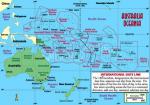
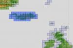
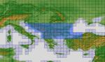
Part 5 of 5. Oceana - Asia SRTM terrain mesh package. FSX only. Covers Australia, New Zealand (including Auckland Islands & Macquarie Island), PNG/Irian Jaya, Indonesia, Malaysia, Philippines, Taiwan, Japan, Korea, Micronesia, Solomon Islands, New Caledonia, Vanuatu, Fiji Islands and all other Pacific Islands (except The Hawaiian Islands). This Mesh is PROCESSED FROM SRTM DATA VERSIONS 3 and 4.1 and Complied using Global Mapper & FSX SDK. PLEASE NOTE: The Oceania/Pacific Regions are covered in Parts 1, 2, 3 & 4. Part 5 covers the Asian Mainland. Thomas Trewin & Tracey Thatcher
Posted Mar 23, 2013 12:34 by Tracey Thatcher

148.26Mb (1892 downloads)
Part 3 of 5. Oceana - Asia SRTM terrain mesh package. FSX only.
Covers Australia, New Zealand (including Auckland Islands & Macquarie Island), PNG/Irian Jaya, Indonesia, Malaysia, Philippines, Taiwan, Japan, Korea, Micronesia, Solomon Islands, New Caledonia, Vanuatu, Fiji Islands and all other Pacific Islands (except The Hawaiian Islands).
This Mesh is PROCESSED FROM SRTM DATA VERSIONS 3 and 4.1 and Complied using Global Mapper & FSX SDK.
PLEASE NOTE: The Oceania/Pacific Regions are covered in Parts 1, 2, 3 & 4. Part 5 covers the Asian Mainland. Thomas Trewin & Tracey Thatcher
Posted Mar 23, 2013 09:58 by Tracey Thatcher

136.86Mb (1880 downloads)
Part 4 of 5. Oceana - Asia SRTM terrain mesh package. FSX only.
Covers Australia, New Zealand (including Auckland Islands & Macquarie Island), PNG/Irian Jaya, Indonesia, Malaysia, Philippines, Taiwan, Japan, Korea, Micronesia, Solomon Islands, New Caledonia, Vanuatu, Fiji Islands and all other Pacific Islands (except The Hawaiian Islands).
This Mesh is PROCESSED FROM SRTM DATA VERSIONS 3 and 4.1 and Complied using Global Mapper & FSX SDK.
PLEASE NOTE: The Oceania/Pacific Regions are covered in Parts 1, 2, 3 & 4. Part 5 covers the Asian Mainland. Thomas Trewin & Tracey Thatcher
Posted Mar 23, 2013 09:56 by Tracey Thatcher

131.62Mb (1985 downloads)
Part 2 of 5. Oceana - Asia SRTM terrain mesh package. FSX only.
Covers Australia, New Zealand (including Auckland Islands & Macquarie Island), PNG/Irian Jaya, Indonesia, Malaysia, Philippines, Taiwan, Japan, Korea, Micronesia, Solomon Islands, New Caledonia, Vanuatu, Fiji Islands and all other Pacific Islands (except The Hawaiian Islands).
This Mesh is PROCESSED FROM SRTM DATA VERSIONS 3 and 4.1 and Complied using Global Mapper & FSX SDK.
PLEASE NOTE: The Oceania/Pacific Regions are covered in Parts 1, 2, 3 & 4. Part 5 covers the Asian Mainland. Thomas Trewin & Tracey Thatcher
Posted Mar 23, 2013 08:05 by Tracey Thatcher

96.97Mb (2698 downloads)
Part 1 of 5. Oceana - Asia SRTM terrain mesh package. FSX only.
Covers Australia, New Zealand (including Auckland Islands & Macquarie Island), PNG/Irian Jaya, Indonesia, Malaysia, Philippines, Taiwan, Japan, Korea, Micronesia, Solomon Islands, New Caledonia, Vanuatu, Fiji Islands and all other Pacific Islands (except The Hawaiian Islands).
This Mesh is PROCESSED FROM SRTM DATA VERSIONS 3 and 4.1 and Complied using Global Mapper & FSX SDK.
PLEASE NOTE: The Oceania/Pacific Regions are covered in Parts 1, 2, 3 & 4. Part 5 covers the Asian Mainland. Thomas Trewin & Tracey Thatcher
Posted Mar 23, 2013 07:48 by Tracey Thatcher
13.43Mb (1851 downloads)
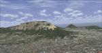
FSX Scenery--Table Mountain. This is a freeware mesh for Table Mountain, Cape Town, South Africa. This mesh will improve your VFR flying experience. By Domonique Dantu.
Posted Feb 13, 2013 04:40 by uploader
5.07Mb (2004 downloads)
"imp" means imperfect, as other mesh I have already processed is of areas that have very little vegetation cover - over the land, or has large urban areas.
This "imp" mesh will include some slight discrepancies of altitude (in the case of forested areas - by a magnitude sometimes of +15 metres-depending on how tall the trees are, in the jungle or forest canopy) over urban areas, or areas with a lot of vegetation cover - due to the limitations of the ASTER satellites infra red scanning cameras, and the software used to process the DEM data.
Areas where there is little vegetation cover, or non urban areas, the terrain should have truer values.
But I feel this ASTER DEM data is so good - why let it all go to waste - especially flying over lovely Pacific islands?
So you FSX users out there will have to take all this into account when using this mesh.
Grateful thanks to ERSDAC, and NASA for making this data freely available to the public.
ASTER GDEM
Copyright (c) 2009 - 2011 Earth Remote Sensing Data Analysis Center (ERSDAC) All rights reserved.
ASTER GDEM is a product of METI and NASA.
Posted Dec 31, 2012 09:57 by Wayne Evans
155.31Mb (885 downloads)
"imp" means imperfect, as other mesh I have already processed is of areas that have very little vegetation cover - over the land, or has large urban areas.
This "imp" mesh will include some slight discrepancies of altitude (in the case of forested areas - by a magnitude sometimes of +15 metres-depending on how tall the trees are, in the jungle or forest canopy) over urban areas, or areas with a lot of vegetation cover - due to the limitations of the ASTER satellites infra red scanning cameras, and the software used to process the DEM data.
Areas where there is little vegetation cover, or non urban areas, the terrain should have truer values.
But I feel this ASTER DEM data is so good - why let it all go to waste - especially flying over lovely Pacific islands?
So you FSX users out there will have to take all this into account when using this mesh.
Grateful thanks to ERSDAC, and NASA for making this data freely available to the public.
ASTER GDEM
Copyright (c) 2009 - 2011 Earth Remote Sensing Data Analysis Center (ERSDAC) All rights reserved.
ASTER GDEM is a product of METI and NASA.
Posted Oct 29, 2012 04:44 by Wayne Evans
87.09Mb (1135 downloads)
"imp" means imperfect, as other mesh I have already processed is of areas that have very little vegetation cover - over the land, or has large urban areas.
This "imp" mesh will include some slight discrepancies of altitude (in the case of forested areas - by a magnitude sometimes of +15 metres-depending on how tall the trees are, in the jungle or forest canopy) over urban areas, or areas with a lot of vegetation cover - due to the limitations of the ASTER satellites infra red scanning cameras, and the software used to process the DEM data.
Areas where there is little vegetation cover, or non urban areas, the terrain should have truer values.
But I feel this ASTER DEM data is so good - why let it all go to waste - especially flying over lovely Pacific islands?
So you FSX users out there will have to take all this into account when using this mesh.
Grateful thanks to ERSDAC, and NASA for making this data freely available to the public.
ASTER GDEM
Copyright (c) 2009 - 2011 Earth Remote Sensing Data Analysis Center (ERSDAC) All rights reserved.
ASTER GDEM is a product of METI and NASA.
Posted Oct 25, 2012 03:51 by Wayne Evans
254.73Mb (2825 downloads)
"imp" means imperfect, as other mesh I have already processed is of areas that have very little vegetation cover - over the land, or has large urban areas.
This "imp" mesh will include some slight discrepancies of altitude (in the case of forested areas - by a magnitude sometimes of +15 metres-depending on how tall the trees are, in the jungle or forest canopy) over urban areas, or areas with a lot of vegetation cover - due to the limitations of the ASTER satellites infra red scanning cameras, and the software used to process the DEM data.
Areas where there is little vegetation cover, or non urban areas, the terrain should have truer values.
But I feel this ASTER DEM data is so good - why let it all go to waste - especially flying over lovely Pacific islands?
So you FSX users out there will have to take all this into account when using this mesh.
Grateful thanks to ERSDAC, and NASA for making this data freely available to the public.
ASTER GDEM
Copyright (c) 2009 - 2011 Earth Remote Sensing Data Analysis Center (ERSDAC) All rights reserved.
ASTER GDEM is a product of METI and NASA.
Posted Oct 10, 2012 06:29 by Wayne Evans