


0.11Mb (477 downloads)
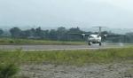
Gelephu Airport (IATA: GLU, ICAO: VQGP) is located in Samtenling Gewog, about three kilometres from Gelephu town in Sarpang District, Bhutan. The airport has been constructed on an area spanning over 500 acres.
Bhutan.
Posted Mar 4, 2014 09:42 by Alberto Thomas
0.07Mb (682 downloads)
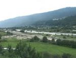
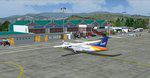
Bathpalathang Airport (IATA: BUT, ICAO: VQBT) is a domestic Bhutanese airport in Jakar (Bjakar), Bumthang District.[1] It began operations on 17 December 2011 with flights to Paro.
Bhutan.
FS2004
Scenery
Posted Mar 4, 2014 09:25 by Alberto Thomas

17.31Mb (493 downloads)
Durham Tees Valley Airport for FSX. The Airport has been scaled up to the correct proportions, the runway's start location has been switched to the correct end. The airport now looks and acts like the real thing. AI traffic is fully supported and performs as real airport traffic would in the actual airport.
Posted Mar 1, 2014 15:02 by Mark Piccolo - Soarfly Concepts
9.73Mb (4417 downloads)
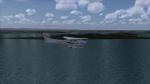
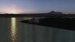
I've created unique textures that produce very realistic looking water for Flight Simulator 2004! It features nice sunrise and sunset effects, realistic water ripples, and nice night water with moon reflections. You won't believe it's fs9! (remember to back up your original files)
Posted Feb 1, 2014 05:11 by Melvin Roden
12.71Mb (1708 downloads)
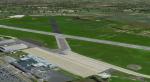
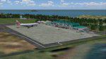
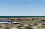
Grenada Island International Airport: " Maurice Bishop Intl (TGPY)" for FS 2004.
"Maurice Bishop" is the new name of Grenada airport, the old was "Point Salines"
"TGPY_Maurice Bishop Intl" is the Scenery of the International Airport of Grenada Carribean Island.
This scenery is only for FS 2004.
Created By: Christian Delblond.
Posted Dec 11, 2013 04:45 by DELBLOND Christian

27.38Mb (682 downloads)
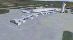
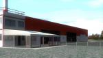
Jersey Airport is located on the small island of Jersey in the English channel. It has a single runway that is just shy of 2000 meters in length. This is a concept version of the airfield, consisting of a redesigned terminal and unique qualities.
Posted Dec 8, 2013 20:29 by Mark Piccolo - Soarfly Concepts

28.77Mb (1299 downloads)
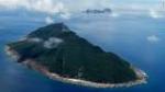
Diaoyu Island fiction airport on the island of Diaoyu between Japan and China.
Posted Nov 3, 2013 05:35 by Cuizijian
10.79Mb (398 downloads)
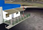
Benavente Airfield V1
This certificate aerodrome for ULM's has no pubished ICAO assigned, so for ease of flight simulation, I
gave it the fake LPBV and is to be used with freeware PTTerrain of PTSIM (http://www.ptsim.com); digital photos taken at the place that have been applied to buildings and other equipment.
Freeware for FS9. Not tested in FSX
Posted Oct 23, 2013 18:50 by Joao A. Graca Ferreira
6.16Mb (520 downloads)
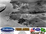
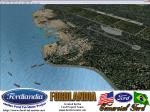
Fordlandia is a now-abandoned, prefabricated industrial town established in the Amazon Rainforest in 1928 by American industrialist Henry Ford to secure a source of cultivated rubber for the automobile manufacturing operations of the Ford Motor Company in the United States.
Scenery is a historical FS2004 rendition of the town and factory facilities circa 1930's. Has a runway and airport plus a sea runway and some additional fictional extras to enrich the scenery. Created for your flight sim enjoyment by the Ford Project Team. This FREE scenery and many more can be found at: http://www.ford-tri-motor.net/scenery.htm Plus buckets of historical liveries available for several vintage aircraft at the Ford Project Site.
Posted Oct 18, 2013 00:07 by Garry J. Smith and Edward C. Moore
7.69Mb (226 downloads)
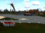
LPTJ Tojeira ULM Airfield, Portugal. Although this is a certified airfield, have no ICAO published, so I gave it the fake LPTJ.
This scenery is fully compatible with Portugal Terrain from PTSIM (http://www.ptsim.com) and is based on digital pictures taken at the place, accurate real measures by Aerodromos de Portugal (http://www.roteiro.apau.org/zmapa.html) and Google Earth.
Freeware. For Microsoft FS2004. Not tested for FSX
Posted Oct 17, 2013 04:58 by Joao A. Graca Ferreira