0.03Mb (409 downloads)
This is the old Durban Airport in South Africa. I have designed it to look something like the real thing. I hope you enjoy it! + my other sceneries.
Posted Jul 17, 2011 06:47 by Michael Adkin

1.37Mb (1977 downloads)
FSX Scenery Senai International Airport ADE (WMKJ)
Some upgrade from default WMKJ airport including terminal with jetways, cargo terminal, hotels, hospital, parking lots and waterfall also ILS approch
Using Airport Design Editor 9x
reference airport design from google earth
(Senai International Airport Johor Bahru)
by Mohd Shukri
Posted Jul 17, 2011 06:43 by Mohd Shukri


0.01Mb (477 downloads)
New Plymouth, New Zealand, has been selected for the Virtual Coast Guards pacific division, the runway has been made longer and a base has been set-up
Posted Jul 13, 2011 01:19 by Virtual Coast Guard

6.50Mb (1031 downloads)
Eastern Iowa Airport update for FSX. Installed Jetways, vehicles and lights. Corrected the gate assignments for Delta, Alligiant, United. Cargo ramps for FedEx and UPS.
Thanks to Rob Touchtone and the RWY12 Program.
Posted Jul 12, 2011 15:19 by zach gloss

4.02Mb (1222 downloads)
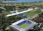
White Hart Lane is the home of Tottenham Hotspurs FC, a UK soccer club based in London. The stadium has night textures. You will see it in North East London. It's a bonus from my payware "English stadiums for FSX" (by Reydarts).
Posted Jul 11, 2011 13:41 by Reydid

9.87Mb (8121 downloads)
FSX native scenery of duesseldorf international airport, needs FSX servicePack 1 or 2 to run! Complete rework of the default FSX airport with all new Custom buildings, textures and new animated
jetways. To be released as Open Source under Creative Commons License. Developers source files available separately (search Duesseldorf)
By Thomas Ruth.
Posted Jul 8, 2011 16:32 by Thomas Ruth

2.00Mb (972 downloads)
Home of West Ham United FC. You will find it in East London near London city airport. It have night texture. It's a bonus included in my payware addon "English stadiums for FSX". By Reydarts
Posted Jul 8, 2011 12:02 by Reydid


3.64Mb (1203 downloads)
TalonSim is very excited to bring to you City of Birmingham 1.0. Finally Birmingham, Alabama has character as many features about this historic city have been detailed into Microsoft Flight simulator. This scenery package depicts key architectural structures of The Magic City skyline.
Posted Jul 7, 2011 13:16 by Dexter Pierre Gray and TalonSim


13.91Mb (4986 downloads)
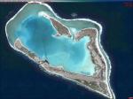
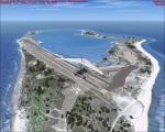
This is Wake Island photoscenery, photo real water, and updated airport. This is a great spot for medium haul cargo runs and makes a challenging flight. The runway can just allow a 747-8 to take off at 100% N1 or land. Now with 100% more fun.
Posted Jul 5, 2011 10:31 by Scenery Dude

35.47Mb (1151 downloads)
Small regional airport located in San Juan de los Morros city, the door of entry to the Central Llanos of Venezuela.
With photo-terrain scenery from satellite imagery in Google Earth.
Not compatible with versions prior to FSX.
This scenery includes terminal building and hangars with realistic textures from images obtained from Internet and photos taken by the author on the site. Also includes a friendly Auto-Install.
Posted Jul 4, 2011 21:43 by David Maldonado


