


FSX > Page 1250
26.51Mb (5274 downloads)
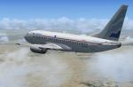
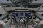
EuroAtlantic Boeing 737-300 Package. EuroAtlantic Airways had 5 Boeing's B737-33A entered in 2000 and stored in 2004. This uses the Project Opensky 737-7 model coupled with Alrot's upgraded 737-800 VC with FMC, working wipers, altitude callouts and more.
Textures, merge & packaged by ricardo_tv
Posted Jul 1, 2012 17:46 by ricardo_tv
2.15Mb (2110 downloads)
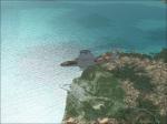
SVGI - Guiria/Almirante Cristobal Colon Airport, Venezuela, for FSX
Posted Jul 1, 2012 14:02 by Francisco Ramirez Lecuna

0.19Mb (605 downloads)
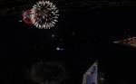
Fireworks placed throughout Canada - replacing the original 2011 file with two new locations added - Newmarket, ON & Langley, BC - plus many great provincial cities in the Canadian Confederation. Dedicated to past & present Canadian soldiers. PLEASE READ THE README 1st FILE BEFORE INSTALLING!
Posted Jul 1, 2012 03:55 by Josef A Kunzlar of FSXTIpline

0.24Mb (584 downloads)
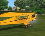
Update for Spike's J3 cup with Engine Fire. ... adds more engine fire effect to the default FSX Cub.
Required files:
required file
Posted Jul 1, 2012 00:10 by Spike
1.50Mb (2396 downloads)
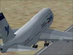
Iran Air 747-400 textures for the default FSX B747.
By Amin Heyrani Nobari
Posted Jun 30, 2012 23:12 by Amin Heyarni nobari
3.61Mb (2580 downloads)
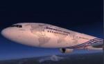
Meljet Boeing 777-200 United Airlines. FSX update of the FS2004 Meljet 777-200 with internal views and PDF doc. Uses 737-800 sound and 2d panel with no vc.
Posted Jun 30, 2012 20:49 by Meljet
53.75Mb (8048 downloads)
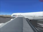
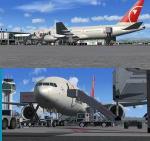
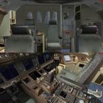
FSX Northwest Airlines/NWA Boeing 777-200LR, registration N776NW.
Model by Project Open Sky.
Includes VC edited by Danny Garnier. Wonderful Boeing 777-200ER P&W
VC model by Project Opensky. Includes ground services (Views -
Instrument Panel - Posky Utilities). Textures Cameron White. Happy
Flying! Updated for FSX by Chris Evans
Posted Jun 30, 2012 15:27 by Chris Evans
78.31Mb (5167 downloads)
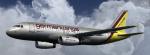
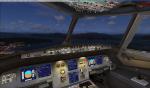
This is an New version of the A319-112 German Wings with Virtual Cockpit for FSX.
Model by Project Airbus. Textures by : ©Fsx Designs, Wouter Hollanders
Posted Jun 30, 2012 05:48 by Wouter Hollanders
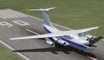
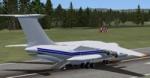
0.10Mb (1917 downloads)
Views ( defined by camera definitions in the aircraft.cfg file ) for
the "FSX IL-76 Cargo" ( Ilyushin ) package. Original model by Sergey Varnavskiy.
Textures and updates by Mark Rooks of RSDG. NO VC !
13 outside views of the aircraft and a total of 3 virtual cockpit views ( front, left
right, no panels).
See Read me.txt file for very easy installation procedures.
Also included is a text file that contains the new camera definitions.
Enjoy !
Required files:
required file
Posted Jun 29, 2012 22:52 by Marc Renaud
1.23Mb (3463 downloads)
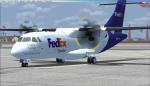
This is a repaint for the ISDT ATR 42-300 in the FedEx livery. Textures saved in 32 bit format with no mip maps. Credits can be found in the readme. Enjoy!
Required files:
required file
Posted Jun 29, 2012 16:39 by Sean