FSX > Page 1262


11.73Mb (4251 downloads)
Photoreal scenery covering Nanshan, Futian, Luohu and Yantian districts (Dameisha and Xiaomeisha) Guangdong, CHINA.
Blend mask and water mask clever placed to blend the photoreal scenery seamlessly into the default FSX scenery
Hand placed thousands of objects, to represent this megacity in its full glory
Hand placed super tankers and yachts traffic, to represent the real harbour environment
Animals and birds realistically placed around mountains to give our helicopter pilots more challenge
Framerate friendly design, using most of FSX's default building and object library
Posted May 5, 2012 13:55 by Jacques Lees

2.69Mb (2725 downloads)
This is the default FSX Boeing 737-800 gauge recolored to give a black background instead of blue on the instrument screens. Backup your original gauge and simply place this gauge inside the panel folder of your 737 using the default B737_800.CAB.
Posted May 5, 2012 09:37 by kraleks


16.03Mb (19068 downloads)
Boeing 737-800 in Ryanair EI-DLT livery.
Skyspirit/Project Opensky native FSX Boeing 737-800 winglet model.
Ryanair headquarters is located at Dublin Airport with its primary operational bases at
Dublin and London Stansted Airports.
Ryanair operates over 290 Boeing 737-800 aircraft.
Upgraded to FSX using Alrot's revised Boeing 737-800 VC. This model includes Working
wipers (right mouse click on switch) with rain effect. Switches for LCD Screens, EICAS,
PFD, MFT. Autobrake switch. Opening pilots window. Cabin Lights switch. Realistic FMC.
Ground Proximity Warning System (GPWS), More Realistic night textures.
FSX native model winglet by Skyspirit/Project Opensky. VC by Alejandro Rojas Lucena
(Alrot).
Textures by Xudeva Irribarra.
Adapted for FSX by Chris Evans.
Posted May 5, 2012 07:36 by Chris Evans
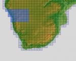
151.77Mb (464 downloads)
There are four parts to download for this area of Africa.
ASTER GDEM Version 2 is a 30 metre definition DEM, its better than the version 1 data that ERSDAC, of Japan and NASA originally released, but it does have its limitations.
GDEM has been obtained from a satellite that uses stereoscopic infrared scanning cameras, this brings with it problems in the resultant data.....where it sees the tops of trees, buildings etc, as the ground terrain.
If you look at the jpg image with the terrain type errors shown as a graph, you will see that the only 'safe' terrain to use this data with - in FSX - is scrubland, or desert terrain.
Its hopeless in defining the terrain in places like Europe - with all the artificial structures, (buildings) and different types of woodland, so any mesh I create from this data won't include areas like that....it will be more desert type terrain, and scrubland.
I won't be doing Greenland because something about the ice around Greenland, (or any other land mass with ice) it creates false data.
It does give enough fine data to reveal railway lines, and some roads though.
This mesh has been made for FSX only.
Grateful thanks to ERSDAC, and NASA for making this data freely available to the public.
ASTER GDEM
Copyright (c) 2009 - 2011 Earth Remote Sensing Data Analysis Center (ERSDAC) All rights reserved.
ASTER GDEM is a product of METI and NASA.
Posted May 5, 2012 06:51 by Wayne Evans
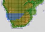
199.19Mb (442 downloads)
There are four parts to download for this area of Africa.
ASTER GDEM Version 2 is a 30 metre definition DEM, its better than the version 1 data that ERSDAC, of Japan and NASA originally released, but it does have its limitations.
GDEM has been obtained from a satellite that uses stereoscopic infrared scanning cameras, this brings with it problems in the resultant data.....where it sees the tops of trees, buildings etc, as the ground terrain.
If you look at the jpg image with the terrain type errors shown as a graph, you will see that the only 'safe' terrain to use this data with - in FSX - is scrubland, or desert terrain.
Its hopeless in defining the terrain in places like Europe - with all the artificial structures, (buildings) and different types of woodland, so any mesh I create from this data won't include areas like that....it will be more desert type terrain, and scrubland.
I won't be doing Greenland because something about the ice around Greenland, (or any other land mass with ice) it creates false data.
It does give enough fine data to reveal railway lines, and some roads though.
This mesh has been made for FSX only.
Grateful thanks to ERSDAC, and NASA for making this data freely available to the public.
ASTER GDEM
Copyright (c) 2009 - 2011 Earth Remote Sensing Data Analysis Center (ERSDAC) All rights reserved.
ASTER GDEM is a product of METI and NASA.
Posted May 5, 2012 06:27 by Wayne Evans
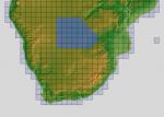
158.51Mb (387 downloads)
There are four parts to download for this area of Africa.
ASTER GDEM Version 2 is a 30 metre definition DEM, its better than the version 1 data that ERSDAC, of Japan and NASA originally released, but it does have its limitations.
GDEM has been obtained from a satellite that uses stereoscopic infrared scanning cameras, this brings with it problems in the resultant data.....where it sees the tops of trees, buildings etc, as the ground terrain.
If you look at the jpg image with the terrain type errors shown as a graph, you will see that the only 'safe' terrain to use this data with - in FSX - is scrubland, or desert terrain.
Its hopeless in defining the terrain in places like Europe - with all the artificial structures, (buildings) and different types of woodland, so any mesh I create from this data won't include areas like that....it will be more desert type terrain, and scrubland.
I won't be doing Greenland because something about the ice around Greenland, (or any other land mass with ice) it creates false data.
It does give enough fine data to reveal railway lines, and some roads though.
This mesh has been made for FSX only.
Grateful thanks to ERSDAC, and NASA for making this data freely available to the public.
ASTER GDEM
Copyright (c) 2009 - 2011 Earth Remote Sensing Data Analysis Center (ERSDAC) All rights reserved.
ASTER GDEM is a product of METI and NASA.
Posted May 5, 2012 05:55 by Wayne Evans
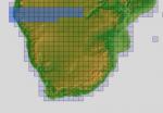
153.52Mb (414 downloads)
There are four parts to download for this area of Africa.
ASTER GDEM Version 2 is a 30 metre definition DEM, its better than the version 1 data that ERSDAC, of Japan and NASA originally released, but it does have its limitations.
GDEM has been obtained from a satellite that uses stereoscopic infrared scanning cameras, this brings with it problems in the resultant data.....where it sees the tops of trees, buildings etc, as the ground terrain.
If you look at the jpg image with the terrain type errors shown as a graph, you will see that the only 'safe' terrain to use this data with - in FSX - is scrubland, or desert terrain.
Its hopeless in defining the terrain in places like Europe - with all the artificial structures, (buildings) and different types of woodland, so any mesh I create from this data won't include areas like that....it will be more desert type terrain, and scrubland.
I won't be doing Greenland because something about the ice around Greenland, (or any other land mass with ice) it creates false data.
It does give enough fine data to reveal railway lines, and some roads though.
This mesh has been made for FSX only.
Grateful thanks to ERSDAC, and NASA for making this data freely available to the public.
ASTER GDEM
Copyright (c) 2009 - 2011 Earth Remote Sensing Data Analysis Center (ERSDAC) All rights reserved.
ASTER GDEM is a product of METI and NASA.
Posted May 5, 2012 05:22 by Wayne Evans


17.79Mb (7589 downloads)
Boeing 737-800 in American Airlines "Flagship Liberty" livery for FSX.
POSKY FSX 737-800W model included.
Skyspirit/Project Opensky native FSX Boeing 737-800 winglet model.
Upgraded to FSX using Alrot's revised Boeing 737-800 VC. This model includes Working wipers (right mouse click on switch) with rain effect. Switches for LCD Screens, EICAS, PFD, MFT. Autobrake switch. Opening pilots window. Cabin Lights switch. Realistic FMC. Ground Proximity Warning System (GPWS), More Realistic night textures.
FSX native model winglet by Skyspirit/Project Opensky. VC by Alejandro Rojas Lucena (Alrot).
Textures by Xudeva Irribarra.
Modified for FSX by Chris Evans.
Posted May 4, 2012 12:38 by Chris Evans


17.87Mb (3855 downloads)
United/Continental Star Alliance Boeing 737-800 for FSX.
Skyspirit/Project Opensky native FSX Boeing 737-800 winglet model.
Upgraded to FSX using Alrot's revised Boeing 737-800 VC. This vc model includes Working wipers (right mouse click on switch) with rain effect. Switches for LCD Screens, EICAS, PFD, MFT. Autobrake switch. Opening pilots window. Cabin Lights switch. Realistic FMC. Ground Proximity Warning System (GPWS), More Realistic night textures.
FSX native model winglet by Skyspirit/Project Opensky. VC by Alejandro Rojas Lucena (Alrot).
Textures by Unknown.
Modified for FSX by Chris Evans.
Posted May 4, 2012 07:22 by Chris Evans

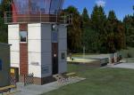
26.72Mb (1182 downloads)
EDQX-Hetzleser Berg for FSX.
North of Nuernberg-Airport EDDN, on a hilltop, you will find this loveley Airfield surounded by woods.
The Airfield is hostet by Soaring Clubs, however there are all kinds of aircraft, up to 2000KG MTOW.
It is easy to find when you track the VOR Erlangen 114.90 MHz. Its position is just 1 NM away from the
center of the VOR.
Posted May 4, 2012 06:11 by uploader


