


FSX > Page 1600
0.56Mb (1158 downloads)
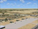
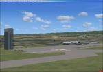
Taji.zip. Scenery in and aroun Al Taji. Emergency scenery. By Steve Dean using scenery shortcut.
Posted Aug 21, 2010 23:55 by Steven Dean
4.28Mb (847 downloads)
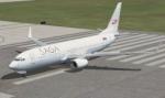
Repaint of default Boeing 737-8 in Saga Airlines Colors.
Posted Aug 21, 2010 14:16 by Pierre du Lac

2.62Mb (876 downloads)
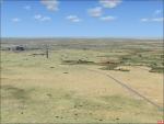
Some add on scenery for the plain Wheeler AAF. Adds some military objects and buildings. Made with scenery shortcut. By Steve Dean.
Posted Aug 21, 2010 13:37 by Steven Dean
8.55Mb (2833 downloads)
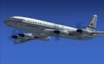
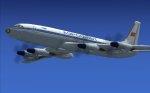
Original Samdim Design Tupolev Tu-114 Aeroflot/JAL 60-ties
and Aeroflot 70-ties livery textures in DDS format for FSX.
Customized model files are associated with the textures providing various passenger cabin configurations.
Adapted by Branislav Jansik
Required files:
required file
Posted Aug 21, 2010 12:45 by Branislav Jansik
0.78Mb (1109 downloads)
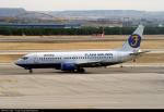
Flash Airlines was a charter airline in Egypt. They owned 2 737-300's. This is a fictional flash airlines 737-800. This is what it may look like if they own one. Uses the default FSX 737-800. Pictures from JetPhotos.net
Posted Aug 21, 2010 10:13 by Diego
9.22Mb (5896 downloads)
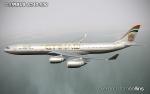
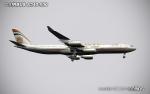
FS2004/FSX Etihad Airways Airbus A340-500, registration A6-EHC. Includes textures only for both the Commercial Level Simulations (CLS) and Overland payware A340-500 models. Repaint by Tom Collins.
Posted Aug 21, 2010 09:21 by OBIE BARRY
8.90Mb (4588 downloads)
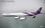
FS2004/FSX Thai Airways Airbus A340-500. Textures only for both the Commercial Level Simulations (CLS) and Overland A340-500 models. Repaint by Tom Collins.
Posted Aug 21, 2010 09:12 by OBIE BARRY
3.81Mb (2171 downloads)
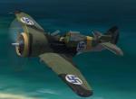
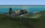
FS2004/FSX P36 Mohawk:
The Curtiss P-36 Hawk, also known as the Curtiss Hawk Model 75, was an American designed and built fighter aircraft of the 1930s and 40s. A contemporary of the much superior Hawker Hurricane and Messerschmitt Bf 109, it was one of the first of a new generation of combat aircraft—a sleek monoplane design making extensive use of metal in its construction and powered by a powerful radial engine. Obsolete at the onset of World War II and best known as the predecessor of the Curtiss P-40. This is a Finnish version powered by the Cyclone engine.
GMAX model by A.F.Scrub
Posted Aug 21, 2010 04:40 by A.F.Scrub
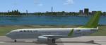
3.64Mb (1762 downloads)
Repaint of the default Boeing 737-800 in Air Baltic colors. Air Baltic is the national airline of Latvia.
Posted Aug 20, 2010 18:15 by Iune Arena
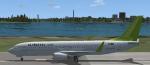
3.62Mb (535 downloads)
Repaint of the Default Boeing 737-800 in Air Baltic Colors. Air Baltic is the national airline of the country of Latvia.
Posted Aug 20, 2010 18:11 by Iune Arena