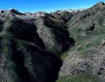
259.16Mb (8251 downloads)
FSX 30cm generic project textures forests - part3/3.
Tropical forests.
All forest around the world are updated from 1m to 30cm.
Only summer textures are in this pack.
(Other parts are Conifer forests and Seasonal forests)
Aime Leclercq.
Posted Oct 31, 2009 14:41 by Aime Leclercq

252.26Mb (2515 downloads)
FSX 30cm generic project textures forests - part1/3.
All forest around the world are updated from 1m to 30cm.
Only summer textures are in this pack.
(Other parts are Seasonal forests and Tropical forests)
.
Posted Oct 31, 2009 13:00 by Aime Leclercq

245.93Mb (2315 downloads)
FSX 30cm generic project textures forests - part2/3.
Seasonal forests.
All forest around the world are updated from 1m to 30cm.
Only summer textures are in this pack.
(Other parts are Conifer forests and Tropical forests)
Aime Leclercq.
Posted Oct 31, 2009 12:54 by Aime Leclercq

226.23Mb (2634 downloads)
FSX 30cm generic project textures Rocks mountains - part 3/4.
All rocks mountain around the world are updated from 1m to 30cm.
Only summer textures are in this pack.
Aime Leclercq.
Posted Oct 31, 2009 05:28 by Aime Leclercq

178.34Mb (2350 downloads)
FSX 30cm generic project textures Rocks mountains - part 4/4.
All rocks mountain around the world are updated from 1m to 30cm.
Only summer textures are in this pack.
Aime Leclercq.
Posted Oct 31, 2009 05:01 by Aime Leclercq

261.72Mb (2887 downloads)
FSX 30cm generic project textures Rocks mountains - part 1/4.
All rocks mountain around the world are updated from 1m to 30cm.
Only summer textures are in this pack.
Aime Leclercq.
Posted Oct 30, 2009 23:30 by Aime Leclercq

222.03Mb (2374 downloads)
FSX 30cm generic project textures Rocks mountains - part 2/4.
All rocks mountain around the world are updated from 1m to 30cm.
Only summer textures are in this pack.
Aime Leclercq
Posted Oct 30, 2009 23:13 by Aime Leclercq


3.67Mb (2325 downloads)
This Scenery for KNHK, Patuxent River Naval Air Station (Trapnell Field)
Patuxent River, Maryland, USAThanks to Guy Diotte for his scenery ojects (t-6,ea-6b,t-34). Made by Tom Neubauerrn / Naval Air Forces
Posted Oct 30, 2009 17:00 by Tom Neubauer


35.71Mb (1605 downloads)
Ants Aussie Airports Boonah, Australia.
Highly detailed photoreal scenery of
the small GA field Boonah located 70km
SSW of Brisbane, QLD, Australia
Features 9 sq km of photoreal ground
textures which blend best with the
payware FTX textures. Also includes
realistic custom 3D objects.
By Anthony Lynch.
Posted Oct 25, 2009 06:31 by Uploader


6.55Mb (3215 downloads)
The autogen textures product features the following: - new autogen forest textures - new autogen water mirror textures for FSX - autogen water textures - new beach,streets and river - all textures have 3 differents altitude - sharpness - raster - all textures are adjusted air photos The Airport Rostock – Laage ( ETNL ) product features the following: - New static display of F-4F Phantom and AIRBUS A350 - New opjects and new forest - static display of Eurofighter, Eurocopter Tiger - accurate simulation of Fliegerhorst German Bundeswehr: “ Jagdgeschwader 73 Steinhof ” - 200 authentic objects - with shelter for the Eurofighters, forest, streets, hangars for civils and military air traffic - new airport terminal and many more
Posted Oct 24, 2009 07:37 by Andreas Meyer


