9.74Mb (698 downloads)
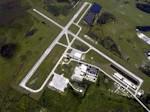
FSX Lake Wales, Fl (X07) USA.
The Lake Wales Municipal Airport is located approximately 2 miles southwest of the downtown business district of Lake Wales, Florida within an area having the highest elevation in the state at 127 feet above mean sea level.
Posted Sep 15, 2016 01:04 by uploader


417.86Mb (4852 downloads)
City of Paris, France - Light version.
For years I've planned this scenery. I started to work on summer of 2013. I did not imagine at those time it would take me so long time to build it. I wanted to create a very specific autogen based on news "extrusions" to render more accurately the density of buildings in Paris. This is the purpose of this scenery. Everything else is only the standard improvment. By Marc Guitteny
Posted Sep 9, 2016 07:15 by uploader

7.85Mb (764 downloads)
Iqaluit CYFB 2010 FSX scenery, Nunavut, Canada.
Founded in 1942 as an American airbase, Iqaluit is now the capital city of the northern Canadian province of Nunavut. It is the smallest Canadian capital in terms of population and the only capital that is not connected to other settlements by a highway. The airport is of critical importance to the community, especially when ice makes boat travel impossible. At 62 degrees latitude (approx. the same as Yellowknife), Iqualuit offers some of the most severe weather you are likely to encounter at any airport, and has been used for cold weather testing of new airliners.
This is a conversion of my FS9 scenery showing CYFB circa 2010. The airport is currently undergoing extensive renovations so I did try and update it, except for the following:
RWY 17/35 changed to 16/34
FYF NDB added.
West ramp and hangers added. By Sidney Schwartz
Required files:
required file
Posted Sep 6, 2016 08:14 by uploader


27.47Mb (780 downloads)
China Huangshan City airport for FSX. Huangshan Tunxi International Airport is an airport in Tunxi, Huangshan City, Anhui Province, China, serving mainly tourists visiting Mount Huangshan, one of China's top tourist destinations. This scenery supports GSX, so you can enjoy ground service. Created by Alpha Development Team. Welcome visit www.chinafsu.com
Posted Sep 4, 2016 02:22 by LufthansaDir

1.81Mb (431 downloads)
KCRW Charleston-Yeager, West Virginia for FSX.
Completely re-done. RWY 15-33 converted to taxiway C. Custom buildings and ground markings.
The only additional files required is my Lights SS V2+ object library, but only if you don't already have it installed. If you don't already have it, you can download it here.
By Sidney Schwartz
Required files:
required file
Posted Sep 3, 2016 02:37 by uploader

6.29Mb (1709 downloads)
KPDX Portland International Airport, Oregon, for FSX.
Almost all buildings are custom. The terminal and run-up structure are taken from my FS9 version of KPDX and are photo-textured. The rest of the buildings were made for this version; they use mostly FSX stock textures but are accurate in shape and placement. Custom gate markings, gate numbers and taxiway runway number signs. Many correction to taxiways and aprons. Bomb objects on ANG ramp created by Isaac B. By Sidney Schwartz
Required files:
required file
Posted Aug 30, 2016 06:13 by uploader


0.52Mb (1581 downloads)
Realistic new sun effect for FSX v.1. Please back up your original file 1st in case you wish to revert to the default version.
Posted Aug 28, 2016 20:29 by juan30005


1.34Mb (380 downloads)
Modification of Ribeirao Preto airport, Brazil. This city is located in the southeast of Brazil, in the state of Sao Paulo.
Good for heavy traffic (AI).
I recommend use this airport along with the Ribeirao Preto scenery: (Below)
Posted Aug 28, 2016 18:19 by Guilherme


1.72Mb (248 downloads)
SIMK-Franca, Brasil.
Modification of Franca airport, Brazil. This city is located in the southeast of Brazil, in the state of Sao Paulo.
Good for heavy traffic (AI).
Posted Aug 28, 2016 14:42 by Guilherme


(482 downloads)
Scenery of city Ribeirao Preto-airport (SBRP), Brazil. This city is located in the southeast of Brazil, in the state of Sao Paulo.
Authors, Paulo Ricardo and Felipe Bachian
Posted Aug 28, 2016 14:06 by Guilherme


