


All Files > Page 3764
H
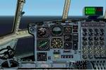
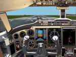
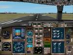
C-130/ EC-130V Hercules Panel FS2000/FS2002.
(Category: FS2002 > Panels)
5.08Mb (2641 downloads)
H
C-130/ EC-130V Hercules Panel FS2000/FS2002.
Designed by Clive Ryan. 5.2MB
Posted Jun 23, 2008 14:32 by archive
FS2000/fs2002
SAR Helicopter Panel
(Category: FS2002 > Panels)
0.94Mb (352 downloads)
FS2000/fs2002
SAR Helicopter Panel. Designed by Ian Standfast Improvements/Modifications
by RAdm Ray Brower, Capt Jordan Moore. 968K
Posted Jun 23, 2008 14:32 by archive
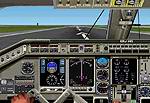
FS2002
Embraer ERJ-145 Panel.
(Category: FS2002 > Panels)
1.17Mb (1473 downloads)
FS2002
Embraer ERJ-145 Panel. Incorporates
a moving yoke and pax views. It is based on photos and diagrams
provided by a BA pilot. Extra gauges are included. By John
Rushby-Smith. 1.2MB
Update:
EMBRAER
ERJ-145 PANEL FIX Supplies the missing gear gauge in my
panel erjp2k2. Also supplied is a revised panel.cfg file.
Sorry for the error! John Rushby-Smith. 10K
Posted Jun 23, 2008 14:32 by archive
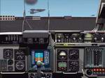
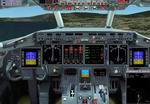
FS2002
Pro Cockpit for Boeing C-17
(Category: FS2002 > Panels)
4.40Mb (1786 downloads)
FS2002
Pro Cockpit for Boeing C-17
v 1.1 3D Studio MAX visualisation of Boeing C-17 Globemaster
III cockpit. This version includes captain's workspace only.
By: Igor Suprunov (SCDS Studio). 4.5MB
Posted Jun 23, 2008 14:32 by archive
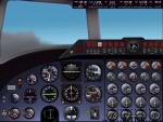
FS2002
Vickers Viscount 700's & 800's Series.
(Category: FS2002 > Panels)
5.85Mb (930 downloads)
FS2002
Vickers Viscount 700's & 800's Series. Photo realistic background
and sun light bright in the gauges. It works in 3DFX mode only
1024x768 and 1280x1024 resolutions for best results. Built by
Diego S Barreto. 6.1MB
Posted Jun 23, 2008 14:32 by archive
FS2002
and PRO BOMBARDIER CHALLENGE SERIES 600
(Category: FS2002 > Panels)
0.79Mb (647 downloads)
FS2002
and PRO BOMBARDIER CHALLENGE SERIES 600 FOTOREALISTIC
PANEL BASED ON REAL AIRCRAFT PANEL By Mario Coelho. 807K
Posted Jun 23, 2008 14:32 by archive
FS2002
B 717 jumpseat view.
(Category: FS2002 > Panels)
2.75Mb (228 downloads)
FS2002
B 717 jumpseat view. by Pasquale Rinaldi. 2.8MB
Posted Jun 23, 2008 14:32 by archive
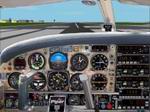
FS2002
Piper PA 28 Cherokee Arrow PANEL
(Category: FS2002 > Panels)
0.76Mb (1338 downloads)
FS2002
Piper PA 28 Cherokee Arrow PANEL NEW Fotorealistic "Arow
ORO" Panel. (default gauges) With full interiors fotoreal views
Versions FS02 and PRO By Mario Coelho. 796K
Posted Jun 23, 2008 14:32 by archive
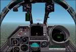
Mirage
F1CZ Panel (Upgraded) for FS2002
(Category: FS2002 > Panels)
0.73Mb (1812 downloads)
Mirage
F1CZ Panel (Upgraded) for FS2002 This is a Mirage F1CZ panel
upgraded to include the AIMap gauge in a smart way. This gauge
is a radar that indicates the position, heading, and altitude
of all the aircraft handled by FS2002 AI. The panel is now great
for making aircraft interceptions with the Mirage! by Eric Marciano.
748K
Posted Jun 23, 2008 14:32 by archive
767-300ER PANEL FOR FS2002
(Category: FS2002 > Panels)
(1030 downloads)
767-300ER
PANEL FOR FS2002 INCLUDES Panel and Gauges Version 1.
Requires FS2000 concorde gauge here.
By Tom Dennis. 1.8MB
Required files:
required file
Posted Jun 23, 2008 14:32 by archive