
3.17Mb (1591 downloads)
FSX
Omala Tanker off Holland.
This Tanker is based out of Rotterdam and uses default AI scenery.
3.2MB
Posted May 20, 2010 09:08 by archive

67.30Mb (6727 downloads)
FSX
Mount Everest, Nepal, high resolution scenery. By Frank Dainese.
Part
1 68.9MB
Part
2 70MB
Posted May 20, 2010 09:08 by archive
0.13Mb (917 downloads)
FSX
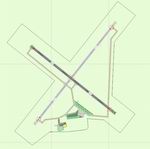
Improvements for Saratoga County Airport, New York (updated).
I have added almost every parking space I could count. A fuel
truck has been added to the airport along with a hanger. There
is no updated flight plans for the airport. Compiled in ADE.Designed
by Brandon Valvo. 474K
Update:
I have added almost every parking space I could count. A fuel
truck has been added to the airport along with a hanger. There
is no updated flight plans for the airport.Parking lot added.
Compiled in ADE.Designed by Brandon Valvo (Brando14100 on
Simviation forum). Based on the original stock airport. 136K
Update
: More added .74K
Posted May 20, 2010 09:08 by archive

0.72Mb (1494 downloads)
FSX
Brisbane Parts Scenery, Australia.
This is a small addon that will just add better scenery of Samford
(a small town north of Brisbane) and North Stradbroke Island.
(an island Near Brisbane INTL).. By Grant Clahsen. 740K
Posted May 20, 2010 09:08 by archive
0.32Mb (2480 downloads)
FSX
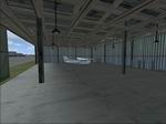
KISM airport, Orlando Florida.
It includes several building adjustments and parking adjustments.
I’ve tested it in free flight and online, it works very
well with both. 332K
Posted May 20, 2010 09:08 by archive

0.32Mb (4463 downloads)
FSX
USS Ranger CV-4. This
is a static scenery model of the USS Ranger, CV-4. The Ranger
was the first US ship designed as an aircraft carrier from the
start. The model is a true FSX project; it was compiled with
Xtomdl into FSX SP-2. It has an exact shape hard deck, rotating
radar dish, rotating beacon, dual smoke effects and a ship wake
effect. It has a night texture for night carrier ops. It is
located just south of Long Beach, Ca. harbor. The necessary
files needed to relocate it to other places are included. These
files work with Bglcomp which is not included. By Paul Clawson.
329K
Posted May 20, 2010 09:08 by archive

93.62Mb (3390 downloads)
FS2004/FSX
Rocky Mountains Scenery Package Part 4: Stevens (2V1), Colorado
(CO).
This is the fourth part of the Rockies project and it extends
the third part to the east. It contains the area around Pagosa
Springs, the San Juan Mountains and extends down to the northern
shores of Navajo Lake. All four parts provide a rectangular
area covering 14,000 sq km of beautiful soutwestern Colorado
landscape. By Gottfried Razek. 95.8MB
Posted May 20, 2010 09:08 by archive
0.41Mb (1182 downloads)
FSX
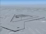
Terrain patch for CFB North Star - CYNS
(here). . Addresses ground flattening
problem evident when using FS Genesis, with alternate styles
of flatten plateaus included. Also features minor airport modifications,
although layout/3-D scenery remains unchanged. By Brian Sturton.
417K
Posted May 20, 2010 09:08 by archive
0.00Mb (985 downloads)
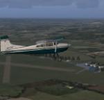
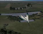
RAF Halton airfield. Situated just south of Aylesbury in Buckinghamshire, Halton airfield is home to RAFGSA Chilterns Gliding club, Halton AeroClub (HAC) and Halton Microlight Club (HMC). Brought to FSX by the new Virtual Flying Club. Future updates and more available from www.virtualflyingclub.co.uk
Posted May 19, 2010 19:15 by Jon Davidson
0.00Mb (818 downloads)
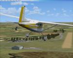
Husbos For FSX. Husbands Bosworth is located between Leicester and Northampton in the UK and is home to the UK gliding centre. Created by Virtual Flying Club team.
future updates and more available at www.virtualflyingclub.co.uk
Posted May 18, 2010 17:41 by Jon Davidson


