



All Time Popular > Page 3851
FS2004
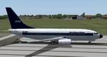
WAA (West African Airlines) Boeing 737-700 Textures only
(Category: FS2004 > Civil Jets)
2.43Mb (591 downloads)
FS2004
WAA (West African Airlines) Boeing 737-700 Textures only
- for the 737-700 Experience by Moach (required here)
. Painted in the colours of the fictional West African Airlines.
Repainted by Carlo van Erp aka Sir Crashalot. 2.5MB
Posted Jun 23, 2008 14:30 by archive
Shockwave Corsair Repaints for A2A
(Category: FSX > Payware)
20.38Mb (591 downloads)
Here are two textures for the Shockwave Corsair for FSX. One depicts the Breitling Fighters variant and the other shows the fighter Collection repaint based at Duxford.
Posted May 25, 2009 10:19 by Jeremy Shneebly

FS2002/2004 Columbia Airways Boeing 747 "American Beauty" Textures
(Category: FS2004 > Civil Jets)
1.32Mb (591 downloads)
A tribute to the Artist Charles Dana Gibson and his enduring creation, the "Gibson Girl". Textures for the default 747 repainted by Don Brynelsen.
Posted Apr 1, 2009 12:48 by Don Brynelsen
FSX/P3D Boeing 787-8 Uzbekistan Airways Package v2
(Category: FSX > Civil Jets)
132.21Mb (590 downloads)
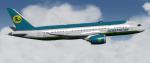
FSX/P3D Boeing 787-8 Uzbekistan Airways Package v2. Based at Tashkent International Airport, Uzbekistan flag carrier airline currently has 4 Boeing 787-8 with a further 3 on order and flies globally.
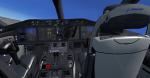
The high quality Boeing 787-8 from TDS. The VC is the Bender Erik great adaption of the X-plane Mariano Gonzalez (MagKnight)'s 787 VC. Cockpit textured lighter grey.
TDS high spec. native FSX Boeing 787-8 model. See Document to get the best out of the VC.
Textured, assembled and tested in P3D v5.3 by Chris Evans. Should also work in earlier P3D & FSX.
Posted Apr 11, 2023 06:01 by chris evans
55 castles in French Dordogne
(Category: MSFS > Scenery)
42.78Mb (590 downloads)
More than 3500 downloads on Flightsim.to (file withdrawn)
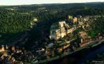
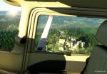
A lot of castles on the edge of Dordogne, because it was the frontier brtween France and England during the 100 years war ....
Posted Feb 23, 2023 08:42 by Laudey1
FSX/P3D Boeing 737 Max 10 Skyup package
(Category: FSX > Civil Jets)
83.32Mb (590 downloads)
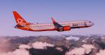
FSX/P3D Boeing 737 Max 10 Skyup package. Ukrainian low cost airline, Skyup, started operations in 2018 and currently have 3 Boeing 737 Max 10 on order.
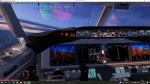
The high spec Boeing 737-Max 10 from TDS. The VC is the Microsoft/Alejandro Rojas Lucena/FSND base modified by Speedbird77 to resemble a Max cockpit, including gauges by G. Munro.
There are custom CFM eco sounds included for that extra realism. Use - Instrument panel - Util for ground vehicles, doors stairs, fuel truck, buses. New Utility allows Bus, fuel, doors and more. (Go to Views - Instrument panel - Utility). VC added and edited to allow correct VC views, correct jetways and wheel levels. Credits go to TDS fantastic native FSX Boeing Max 10 model. I added PDF B737 checklist.
Textured, packaged and prepared for FSX & P3D up to v5 by Chris Evans.
Posted Aug 15, 2021 03:49 by chris evans
![San Francisco Intl - [KSFO]](https://static.simviation.com/sfr1.jpg-thumb.jpg)
![San Francisco Intl - [KSFO]](https://static.simviation.com/sfr2.jpg-thumb.jpg)
San Francisco Intl - [KSFO]
(Category: MSFS > Scenery)
122.85Mb (590 downloads)
This is made with the google maps decoder. All the gates, runways and frequencies work like before. I also added some lightning so at night it looks nice.
Known downsides
-Google jetways are still here
(If anyone wants and can help I will share the file)
Unzip the file and drop desnses-sanfrancisco into your community folder
Want to request an airport? First check on google maps if it has 3d data and if there are no or very few planes parked at the gates/ramps
My current list from sonnest to last (it may change with new requests) Credits: Current Version 1.0 by desnses
Posted Nov 20, 2020 03:53 by gamr101
.jpg-thumb.jpg)
Alfs UK airfields - Volume 35 - Crosland Moor X4HD
(Category: FSX > Scenery)
6.38Mb (590 downloads)
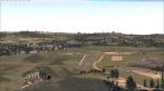
Crosland Moor (address Crossland Moor!) X4HD (previously EGND). An ashphalt runway with a grass extension and with three quarries around it. Situated on the outskirts of Huddersfield, the clubhouse is amusingly presented as "Huddersfield International Airport".
Posted Jun 3, 2016 05:48 by Alf Denham
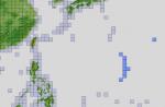
FSX ASTER_imp GDEMv2 30m mesh for Northern Mariana Islands
(Category: FSX > Terrain Mesh)
0.90Mb (590 downloads)
"imp" means imperfect, as other mesh I have already processed is of areas that have very little vegetation cover - over the land, or has large urban areas.
This "imp" mesh will include some slight discrepancies of altitude (in the case of forested areas - by a magnitude sometimes of +15 metres-depending on how tall the trees are, in the jungle or forest canopy) over urban areas, or areas with a lot of vegetation cover - due to the limitations of the ASTER satellites infra red scanning cameras, and the software used to process the DEM data.
Areas where there is little vegetation cover, or non urban areas, the terrain should have truer values.
But I feel this ASTER DEM data is so good - why let it all go to waste - especially flying over lovely Pacific islands?
So you FSX users out there will have to take all this into account when using this mesh.
Grateful thanks to ERSDAC, and NASA for making this data freely available to the public.
ASTER GDEM
Copyright (c) 2009 - 2011 Earth Remote Sensing Data Analysis Center (ERSDAC) All rights reserved.
ASTER GDEM is a product of METI and NASA.
Posted Aug 30, 2012 03:16 by Wayne Evans
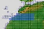
ASTER GDEMv2 30m mesh North Africa Pt14 incl Morocco, Algeria, W. Sahara, Mauritania.
(Category: FSX > Terrain Mesh)
209.04Mb (590 downloads)
There are Eighteen (18) parts of this mesh to download as separate files.
ASTER GDEM Version 2 is a 30 metre definition DEM, its better than the version 1 data that ERSDAC, of Japan and NASA originally released, but it does have its limitations.
GDEM has been obtained from a satellite that uses stereoscopic infrared scanning cameras, this brings with it problems in the resultant data.....where it sees the tops of trees, buildings etc, as the ground terrain.
If you look at the jpg image with the terrain type errors shown as a graph, you will see that the only 'safe' terrain to use this data with - in FSX - is scrubland, or desert terrain.
Its hopeless in defining the terrain in places like Europe - with all the artificial structures, (buildings) and different types of woodland, so any mesh I create from this data won't include areas like that....it will be more desert type terrain, and scrubland.
I won't be doing Greenland because something about the ice around Greenland, (or any other land mass with ice) it creates false data.
It does give enough fine data to reveal railway lines, and some roads though.
This mesh has been made for FSX only.
Grateful thanks to ERSDAC, and NASA for making this data freely available to the public.
ASTER GDEM
Copyright (c) 2009 - 2011 Earth Remote Sensing Data Analysis Center (ERSDAC) All rights reserved.
ASTER GDEM is a product of METI and NASA.
Posted Apr 22, 2012 02:53 by Wayne Evans