



All Time Popular > Page 4571
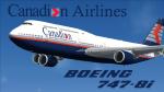
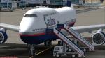
Canadian Airlines 747-8 Intercontinental
(Category: FSX > Civil Jets)
65.94Mb (356 downloads)
This is a repaint for the amazing SkySpirit 747-8i Series II. It includes the base model, high-quality textures, a VC, and custom ground service vehicles.
Canadian Airlines never flew the 747-8i, as by the time the company was absorbed by Air Canada in 1999 the aircraft did not exist. The largest aircraft flown by Canadian Airlines was the Boeing 747-427. However, in our new universe, Canadian Airlines has taken delivery of one single Boeing 747-8i, available to fly any route of your choice. It flies under the registration C-FCDN and the tail number 848.
The Rhys T. Eyton Memorial 747-8i
Canadian Airlines named all of their 747's, and this one is no different. Like the real-life 747-427 flown under registration C-FGHZ, this aircraft honors the late Rhys T. Eyton, Canadian Airlines CEO between 1989 and 1995. Rhys was a pioneer in Canadian Aviation. He passed away in 2023.
Livery Info
Upon its founding in 1987, Canadian Airlines revealed its new livery using the colours light grey, dark grey, navy blue, and red. The paint scheme was an adaptation of the recently introduced livery from its predecessor Canadian Pacific Airlines. The lower half of the aircraft's body was navy blue, topped with light grey and red stripes, while the tail was blue, with approximately one-third taken up by the carrier's new logo. The new Canadian Airlines logo was a combination of Canadian Pacific's five grey stripes, representing the five continents served by the carrier. Over these stripes was a thick, bright red chevron. The chevron was a simplification of the Pacific Western Airlines logo. The chevron was placed over the stripes, which then represented "Wings over 5 continents". It was also an ingenious and subtle way to represent the takeover of CP by PWA. The same logo, in a square form, became a clever alternative to a true bilingual name on the fuselage replacing the French "e", and the third "a" in English (Canadian/Canadien).
Posted Apr 18, 2024 21:01 by Julian Flight
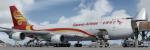
FSX/P3D Boeing 747-400F Suparna Airlines package v2
(Category: FSX > Civil Jets)
59.21Mb (356 downloads)
FSX/P3D Boeing 747-400F Suparna Airlines package v2. Suparna is a Chinese passenger and cargo airline based at Shanghai–Pudong International Airport and is part of the Hainan Airlines Group. Previously Yangtze River Airlines, Suparna now operate 4 Boeing 747-400F flying to destinations in Europe, the USA as well as Asia.
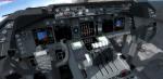
Project Opensky Boeing 747-400f FSX native model with the much improved Boeing 747 internal model (VC) from Alejandro Rojas Lucenda (Manual included). Model includes ground cargo servicing, stairs (FSX - Go to Views - Instrument Panel -Posky Utility. P3D go to Vehicle - Instrument Panel -).
I am updating many of my 1st repaints to fix or improve textures.
Skyspirit/Project Opensky native FSX Boeing 747-8F assembled and upgraded for FSX with the developed B747 VC (3d virtual cockpit) from Alejandro Rojas Lucenda (Manual included). This is the Project Opensky FSX native Boeing 747-800F model, and includes ground cargo servicing, stairs (FSX - Go to Views/P3D go to Vehicle - Instrument Panel -Posky Utility), opening nose section and more.
Custom GE sounds included.
Also includes the Boeing 747 VC textures upgrade. This give a much clearer 747 interior virtual cockpit look.
Textures and assembled for P3Dv 5.3 by Chris Evans. Should work in FSX and previous P3D versions.
Posted May 14, 2023 16:01 by chris evans
FSX/P3D Boeing 737 Max 8 Shanghai Airlines
(Category: FSX > Civil Jets)
88.04Mb (356 downloads)
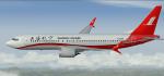
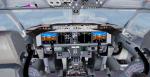
FSX/P3D Boeing 737 Max 8 Shanghai Airlines with Max VC. Based at Shanghai–Hongqiao and Shanghai–Pudong, Shanghai Airlines currently has 11 Boeing 737 Max 8 with 4 more on order.
The high spec Boeing 737-Max 8 and paintkit from TDS. Credits go to TDS fantastic native FSX Boeing Max8 model and paintkit. The VC is the Microsoft/Alejandro Rojas Lucena/FSND base modified by Speedbird77 to resemble a Max cockpit, including gauges by G. Munro.
There are custom CFM eco sounds included for that extra realism. Use - Instrument panel - Util for ground vehicles, doors stairs, fuel truck, buses. New Utility allows Bus, fuel, doors and more. (Go to Views - Instrument panel - Utility). VC added and edited to allow correct VC views, correct jetways and wheel levels. I added PDF B737 checklist.
Textured, packaged and prepared for FSX & P3D up to v5 by Chris Evans.
Posted Jul 3, 2022 12:33 by chris evans
.png.jpg-thumb.jpg)
FS2004 Boeing 757-200 AeroPeru
(Category: FS2004 > Civil Jets)
26.29Mb (356 downloads)
FS2004 TDS Aeroperu Boeing 757-200 Registrado N592KA. La Perre S.A. Air Transport Company AeroPeru, Peru's Banner Airline. Navigation of the Peruvian and American skies between 1973 and 1999. The inaugural flight of the new airline took place on October 3, 1973 in Lima to the city of Cuzco. Model by TDS
Posted Jun 7, 2021 10:30 by Farlaens123
FSX Level D Boeing 767-300ER SBA Airlines N979PG Textures
(Category: FSX > Payware)
31.78Mb (356 downloads)
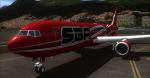
FSX SBA Airlines (Sky Holdings)Boeing 767-300ER Winglets, registration N979PG. textures for the payware Level-D Boeing 767 model. Available in UHD 4096x4096 DDS DXT5 Textures for FSX. Repaint by Jose Blanco.
Posted Dec 29, 2015 21:21 by Jose Blanco
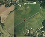
Denham aerodrome, EGLD, UK
(Category: X Plane > Scenery)
12.78Mb (356 downloads)
Denham aerodrome is a privately owned airfield for VFR only.It has one tarmac runway and two grass runways.
Posted Dec 22, 2013 11:39 by xplaner
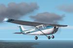
FS2002/2004 Skyhawk Textures
(Category: FS2004 > Props)
1.72Mb (356 downloads)
Repaint Textures for the default Cessna 172 to add variety to your flightline. Repaint by Don Brynelsen using the paintkit by Mark Rooks.
Posted Sep 10, 2011 13:19 by Don Brynelsen
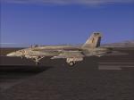
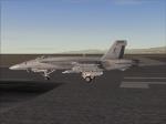
VRS Superbug NSAWC12 and 114 Tail Textures
(Category: FSX > Payware)
6.42Mb (356 downloads)
VRS Superbug repaint of NSAWC12 and the
114CONA updated tail logo textures Require
VRS Superbug repaints by Hornet202 Enjoy
Posted Aug 8, 2011 21:44 by Chris Hammons
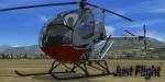
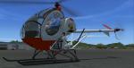
JustFlight Schweizer 300 ZK-ICB Textures
(Category: FSX > Payware)
9.42Mb (356 downloads)
Textures only for the payware Schweizer 300 by JustFlight in the colours of the ZK-ICB, a private owned heli. Made by Marius Krämer.
Posted Jul 26, 2011 18:36 by Marius Krämer
TRA B-57B AIR FILE TWEAK
(Category: CFS2 > Post WW2 Aircraft)
0.04Mb (356 downloads)
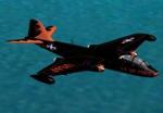
The enclosed AIR/CFG files are tweaked to eliminate some pitch instability (shaking) in certain flight circumstances. It also changes the display name of the aircraft to TRA B-57.
Required files:
required file
Posted Mar 16, 2011 13:43 by Tom Sanford, Tango_Romeo