



All Time Popular > Page 4634


TinMouse Boeing 737-200 - Private N370BC Textures
(Category: FSX > Civil Jets)
7.18Mb (339 downloads)
FS9/FSX TinMouse-II Boeing 737-200 Private N370BC livery. Texture only for freeware TinMouse model. Paint kit by Denis Minaev. Repaint by Sergey Gleba aka serg09.
Posted Oct 25, 2018 12:04 by Sergey Gleba aka serg09

Garry Smith archive files: Boeing 737 800
(Category: FS2004 > Civil Jets)
1.08Mb (339 downloads)
Garry Smith archive files: Boeing 737 800.
Liveries - Ryan Air
Includes Blank Texture Set.
These files are being posted so the community does not loose access to Garry Smith's files after his website went down.
Model by Mike Stone. Textures by Garry Smith
Posted Apr 12, 2018 04:11 by Ronald Falzon


SMS Overland Boeing 777-300ER - Cathay Pacific Textures
(Category: FSX > Payware)
5.25Mb (339 downloads)
FS9/FSX SMS Overland Boeing 777-300ER in Cathay Pacific livery. Texture only for payware Simmer`S Sky Overland model. Paint kit & Repaint by Sergey Gleba aka serg09. Link to my products on SimMarket: http://secure.simmarket.com/paintsim.mhtml
Posted Mar 28, 2018 11:52 by Sergey Gleba aka serg09

Juneyao Airlines Boeing 787-9 V5L
(Category: FS2004 > Civil Jets)
2.79Mb (339 downloads)
FS2004 Juneyao Airlines Boeing 787-9 V5L. Night lighting effects have been upgraded.
This CamSim model design and paint by Camil Valiquette.
Posted Mar 9, 2017 01:05 by Camil Valiquette
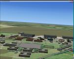
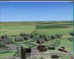
RAF Bircham Newton, UK
(Category: FSX > Scenery)
1.60Mb (339 downloads)
RAF Bircham Newton is a former Royal Air Force station located 2.1 miles (3.4 km) south east of Docking, Norfolk
and 13.4 miles (21.6 km) north east of King's Lynn, Norfolk, England.
The site was first used during the First World War and received the largest British bomber of the time, the Handley Page V/1500. They would have carried out bombing missions against Berlin but the Armistice was arranged before any missions were actually flown.
The airfield was equipped with one aircraft repair shed and three double bay general service sheds, although these had been demolished by 1937. It had two Belfast hangars, three C Type hangars, three Bellman hangars and ten Blister hangars.
It operated through the Second World War as part of No. 16 Group RAF as part of Coastal Command.
No. 206 Squadron RAF was one of the squadrons being based there, on maritime patrol duties. Two satellite airfields, RAF Docking and RAF Langham were opened to accommodate units.
In 1965 the airfield was used for evaluation trials of the Hawker Siddeley Kestrel V/STOL aircraft.
After closure as an operational airfield in 1966, the airfield became the home of the Construction Industry Training Board. The runways have gone, but the majority of buildings on the site, including some hangars and the control tower, remain in use by the CITB.The control tower was demolished in 2010 due to its poor condition.
Constructionarium is also based within the estate, providing a week's practical learning opportunity for undergraduates
Source: Wikipedia
Posted Dec 24, 2015 14:49 by Terry Boissel
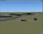
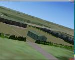
RAF Hooton Park, UK
(Category: FSX > Scenery)
1.47Mb (339 downloads)
RAF Hooton Park, on the Wirral Peninsula, Cheshire, was a Royal Air Force station originally built for the Royal Flying Corps in 1917 as a training aerodrome for pilots in World War I. During the early/mid-1930s, it was one of the two airfields (with Liverpool Speke) handling scheduled services for the Merseyside region. Hooton Park was home to No. 610 (County of Chester) Squadron and, post World War II, to No. 611 (West Lancashire) and No. 663 (AOP) Squadron.
The airfield closed in 1957 after the disbandment of the Royal Auxiliary Air Force, but the three pairs of Belfast Truss hangars erected in 1917 survived the closure. The site was bought by Vauxhall Motors, who built their Vauxhall Ellesmere Port plant there, which today produces the Vauxhall Astra. A small remaining section of the airfield site is now owned and managed by The Hooton Park Trust. The hangars are also home to The Griffin Trust and an aircraft preservation society named The Aeroplane Collection. Another part of the old airfield, including a length of the old paved runway, perimeter track and the apron used to park Meteor jet fighters, remains in the ownership of The Naylor Trust. A Second World War B1 hangar is also on this site.
Posted Dec 13, 2015 04:05 by Terry Boissel


Point Cook Aerodrome, Melbourne, Australia
(Category: FS2004 > Scenery)
0.01Mb (339 downloads)
Spike's Point Cook aerodrome, near Melbourne, Australia. Easy copy and paste install.
Posted Aug 7, 2014 19:34 by Spike
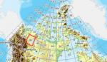
FSX Canadian CDED mesh above 60 degrees Lat 19 metre resolution Pt37, block 96.
(Category: FSX > Terrain Mesh)
132.91Mb (339 downloads)
As Raimondo Taburet hasn't processed the CDED files above 60 degrees latitude for Canada, well here are the ones I have processed.
There isn't any data available from geobase in some of the blocks above 60 degrees latitude, these are blocks: 15, 17, 18, 28, 108, 109, 118, 119.
See jpg for coverage.
Thanks go to Geobase (Copyright) Canada for the availability & public use of this data.
Posted May 19, 2012 06:23 by Wayne Evans
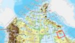
FSX Canadian CDED mesh above 60 degrees Lat 19 metre resolution Pt2, block 25.
(Category: FSX > Terrain Mesh)
112.54Mb (339 downloads)
As Raimondo Taburet hasn't processed the CDED files above 60 degrees latitude for Canada, well here are the ones I have processed.
There isn't any data available from geobase in some of the blocks above 60 degrees latitude, these are blocks: 15, 17, 18, 28, 108, 109, 118, 119.
See jpg for coverage.
Thanks go to Geobase (Copyright) Canada for the availability & public use of this data.
Posted May 16, 2012 07:29 by Wayne Evans
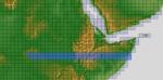
ASTER GDEMv2 30m mesh for Sudan & the Horn of Africa pt8
(Category: FSX > Terrain Mesh)
261.85Mb (339 downloads)
There are Eleven (11) parts of this mesh to download as separate files.
ASTER GDEM Version 2 is a 30 metre definition DEM, its better than the version 1 data that ERSDAC, of Japan and NASA originally released, but it does have its limitations.
GDEM has been obtained from a satellite that uses stereoscopic infrared scanning cameras, this brings with it problems in the resultant data.....where it sees the tops of trees, buildings etc, as the ground terrain.
If you look at the jpg image with the terrain type errors shown as a graph, you will see that the only 'safe' terrain to use this data with - in FSX - is scrubland, or desert terrain.
Its hopeless in defining the terrain in places like Europe - with all the artificial structures, (buildings) and different types of woodland, so any mesh I create from this data won't include areas like that....it will be more desert type terrain, and scrubland.
I won't be doing Greenland because something about the ice around Greenland, (or any other land mass with ice) it creates false data.
It does give enough fine data to reveal railway lines, and some roads though.
This mesh has been made for FSX only.
Grateful thanks to ERSDAC, and NASA for making this data freely available to the public.
ASTER GDEM
Copyright (c) 2009 - 2011 Earth Remote Sensing Data Analysis Center (ERSDAC) All rights reserved.
ASTER GDEM is a product of METI and NASA.
Posted Mar 17, 2012 11:38 by Wayne Evans