



All Time Popular > Page 4942

Garry Smith archive files: Airbus A320-200 with 5 Liveries
(Category: FS2004 > Civil Jets)
0.83Mb (256 downloads)
Garry Smith archive files: Airbus A320-200
Liveries - Air France - British Airways - Lufthansa - Northwest - US Air
Includes Blank Texture Set. These files are being posted so the community does not loose access to Garry Smith's files after his website went down. Model by Mike Stone. Textures by Garry Smith
Posted Mar 28, 2018 06:14 by Ronald Falzon
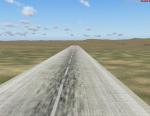
New Ulaanbaatar International Airport, Mongolia
(Category: FS2004 > Scenery)
0.11Mb (256 downloads)
New Ulaanbaatar International Airport
Mongolia.
FS2004
Posted Apr 26, 2017 10:52 by Alberto Thomas
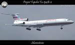
Project Tupolev Tu-154B-2 - Sibaviatrans Textures
(Category: FSX > Civil Jets)
23.89Mb (256 downloads)
Project Tupolev Tu-154B-2 in Sibaviatrans livery. Textures is Full HD format. Repaint by Sergey Gleba.
Required files:
required file
Posted Mar 31, 2017 10:40 by Sergey Gleba aka serg09
RAF North Witham, UK
(Category: FSX > Scenery)
0.01Mb (256 downloads)
RAF North Witham is a former World War II airfield in Lincolnshire, England. The airfield is located in Twyford
Wood, off the A1 between Stamford and Grantham about 104 miles (167 km) north-northwest of London
Opened in 1943, it was used by both the Royal Air Force and United States Army Air Forces. During the war it was
used primarily as a transport airfield. After the war it was closed in late 1945.
Today the remains of the airfield are mostly woodland maintained by the Forestry Commission with the old concrete
runways still accessible.
Souce: Wikipedia
Posted Dec 9, 2015 19:01 by Terry Boissel
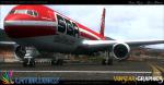
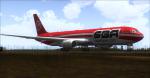
FS2004/FSX SMS Overland Boeing 767-300ER SBA Textures
(Category: FS2004 > Payware)
5.13Mb (256 downloads)
FS2004/FSX Santa Barbara Airlines (SBA) Boeing 767-300ER Registration YV528T. Textures for the payware SMS Overland Boeing 767. Textures by Trino Rojas Modified and Converted by Venstar Graphics (Jose Blanco)
Posted Jun 3, 2015 22:27 by Jose Blanco
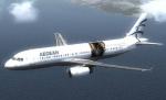
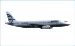
SMS Aegean A320 Textures
(Category: FSX > Payware)
6.84Mb (256 downloads)
This is one of the two Aegean aircraft having the characteristic logo an the left hand side of the fuselage, advertising the
Athens Acropolis museum.
For Overland SMS Airbus A320 iae model.
Posted Oct 17, 2014 11:38 by Dimitrios Moschos
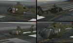
ND EC135 Lakota Textures
(Category: FSX > Payware)
27.60Mb (256 downloads)
A quick, representation of what an EC-135 would look like as a Lakota, since there aren't any available for FSX right now. Must have Nemeth Designs EC-135. Tested in FSX/accel.
By Steven Dean
Posted Oct 6, 2014 19:05 by Steven Dean
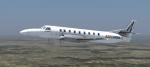
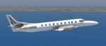
Razbam Metroliner Aeronova Textures
(Category: FSX > Payware)
10.92Mb (256 downloads)
Aeronova textures for the payware Razbam Metroliner. Repaint by Darryl Prime
Posted Jan 8, 2014 05:52 by Darryl Prime
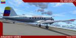
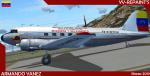
FS2004 MAAM Douglas Dc-3 YV-0-MTC12 "Ministerio de Transporte y Comunicaciones" Textures
(Category: FS2004 > Payware)
6.72Mb (256 downloads)
Douglas Dc-3 YV-0-MTC12 "Ministerio de Transporte y Comunicaciones" from Venezuelan. Texture only for the payware MAAM DOUGLAS R4D / DC-3 / C-47 Model(Fs2004/FsX). Textures By Jose Armando Yanez YV-REPAINT'S.
Posted Feb 27, 2013 16:53 by Jose Armando Yanez
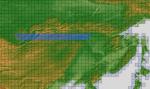
ASTER GDEMv2 30m mesh for Mongolia & surrounding areas Pt3.
(Category: FSX > Terrain Mesh)
172.36Mb (256 downloads)
There are Fourteen (14) parts of this mesh to download as separate files.
ASTER GDEM Version 2 is a 30 metre definition DEM, its better than the version 1 data that ERSDAC, of Japan and NASA originally released, but it does have its limitations.
GDEM has been obtained from a satellite that uses stereoscopic infrared scanning cameras, this brings with it problems in the resultant data.....where it sees the tops of trees, buildings etc, as the ground terrain.
If you look at the jpg image with the terrain type errors shown as a graph, you will see that the only 'safe' terrain to use this data with - in FSX - is scrubland, or desert terrain.
Its hopeless in defining the terrain in places like Europe - with all the artificial structures, (buildings) and different types of woodland, so any mesh I create from this data won't include areas like that....it will be more desert type terrain, and scrubland.
I won't be doing Greenland because something about the ice around Greenland, (or any other land mass with ice) it creates false data.
It does give enough fine data to reveal railway lines, and some roads though.
This mesh has been made for FSX only.
Grateful thanks to ERSDAC, and NASA for making this data freely available to the public.
ASTER GDEM
Copyright (c) 2009 - 2011 Earth Remote Sensing Data Analysis Center (ERSDAC) All rights reserved.
ASTER GDEM is a product of METI and NASA.
Posted Apr 3, 2012 07:23 by Wayne Evans