All Files > Page 1599

ICARO Eurocopter EC135 Base Pack Updated
(Category: FS2004 > Helicopters)
163.94Mb (18771 downloads)
ICARO Eurocopter EC135 Base Pack revised edition. The base package contains 4 models, custom airfiles, custom sound, fully workable 3D-VC with sound system, effects and much more. See also ICARO EC135 Extension Pack EXT1. Created by ICARO Group Development Team
Posted Sep 6, 2012 12:30 by Michael Jordan

FSX ASTER_imp GDEMv2 30m mesh for French Polynesia & Cook Islands
(Category: FSX > Terrain Mesh)
5.44Mb (919 downloads)
"imp" means imperfect, as other mesh I have already processed is of areas that have very little vegetation cover - over the land, or has large urban areas.
This "imp" mesh will include some slight discrepancies of altitude (in the case of forested areas - by a magnitude sometimes of +15 metres-depending on how tall the trees are, in the jungle or forest canopy) over urban areas, or areas with a lot of vegetation cover - due to the limitations of the ASTER satellites infra red scanning cameras, and the software used to process the DEM data.
Areas where there is little vegetation cover, or non urban areas, the terrain should have truer values.
But I feel this ASTER DEM data is so good - why let it all go to waste - especially flying over lovely Pacific islands?
So you FSX users out there will have to take all this into account when using this mesh.
Grateful thanks to ERSDAC, and NASA for making this data freely available to the public.
ASTER GDEM
Copyright (c) 2009 - 2011 Earth Remote Sensing Data Analysis Center (ERSDAC) All rights reserved.
ASTER GDEM is a product of METI and NASA.
Posted Sep 6, 2012 12:05 by Wayne Evans

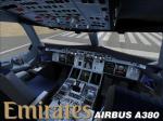
Airbus A380 Emirates Black Package
(Category: FSX > Civil Jets)
29.70Mb (31379 downloads)
Project Airbus A380 Emitares Black with VC for FSX.
To celebrate the Emirates A380 Dubai-Melbourne-Auckland route
launch in October they have created these livery
with the winning partnership AFL team Collingwood FC.
Repaint by Jim Fly in cooperation with FSRepaintsGermany, FSRG.
Posted Sep 6, 2012 10:22 by Jim Fly
Wilco EMB190 CVC Textures
(Category: FSX > Payware)
5.78Mb (572 downloads)
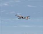
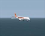
FSX EMB-190 Conviasa textures only for the payware Wilco E-Jets series pack EMB-190.
Posted Sep 6, 2012 08:40 by Francisco Ramirez Lecuna
Spike's Water Textures Mix
(Category: FS2004 > Scenery)
15.09Mb (2980 downloads)
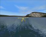
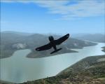
I made this because I wasn't 100% happy with any one complete seat of water textures currently about.
So I collected all the water textures and water add-ons made since 2004 and mixed them together to create a real-world-look water effect that looks nice at a distance or close range.
Credit to anyone who's made a water effect and put it online... chances are if it's been posted, its been used in here somewhere.
Although it uses much computing power I highly recommend your water display settings in FS2004 are set to it's highest.
~Backup original textures!~
Posted Sep 6, 2012 03:03 by Spike
FSX Utah Airfield Locator
(Category: FS Navigation > Flight Simulator Navigation)
2.71Mb (135 downloads)
Tested on Windows XP and Windows 7.
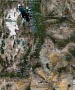
This download adds airfield markers and ICAO id's found in FSX, and overlays them on Google Earth.
This file is for Utah. USA.
There is also a seperate file with a list of basic airfield location details.
i.e: EGBB Birmingham Airport. Birmingham. N52* 27.23' W1* 44.88' alt325.
Also the tidying "My places" in Google Earth, file.
Other locator files to follow.
by Carl Vokes
Posted Sep 5, 2012 15:29 by carl vokes
FSX Vermont Airfield Locator
(Category: FS Navigation > Flight Simulator Navigation)
2.67Mb (103 downloads)
Tested on Windows XP and Windows 7.
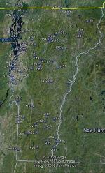
This download adds airfield markers and ICAO id's found in FSX, and overlays them on Google Earth.
This file is for Vermont.USA.
There is also a seperate file with a list of basic airfield location details.
i.e: EGBB Birmingham Airport. Birmingham. N52* 27.23' W1* 44.88' alt325.
Also the tidying "My places" in Google Earth, file.
Other locator files to follow.
by Carl Vokes
Posted Sep 5, 2012 15:25 by carl vokes
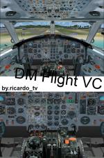
Bac 1-11 Multi Livery Package Updated for FSX
(Category: FSX > Civil Jets)
44.92Mb (19627 downloads)
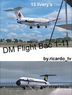
Special update from DM flight simulations Bac One-Eleven package to work in FSX. New lights, smoke effects, engine configurations, views, and HD textures. BAC 1-11 was the first british sucessful regional jet in Europe after the Sud Caravelle. The 1-11-475 is the best model to fly in a regional airline, has a maximum speed of M.82 at FL 370 and max range of 1.600nmi. Coming with AeroLingus, Bac Livery, Air France, American, British Airways, Braniff, Hapag-Lloyd, KLM, Lufthansa, Ryanair, Scandinavian, Swissair & White [paintkit]. Please read the IMPORTANT readme file for help or question. Textures and update by ricardo_tv. Model, VC and Livery's by DM Flight Sim. Enjoy
Posted Sep 5, 2012 14:45 by ricardo_tv


FSX Air Force One Boeing 747-8F Package with Advanced VC.
(Category: FSX > Civil Jets)
37.75Mb (14017 downloads)
FSX Air Force One Boeing 747-8F Package with Advanced VC.
with advanced VC upgraded using the vastly improved Boeing 747 VC from Alejandro Rojas Lucena/FSND (See panel docs for details). VC includes FMC, EICAS, MFD with control panel, GPWS, working wipers, cabin lights, fire suppression, avionics switch, fuel crossfeed, landing lights switches, taxi light switch, engine generators, APU generator, battery switch, starter switches, de-ice switch, general lights switches. Beautiful Skyspirit 747-400 cargo model with complex features and ground service vehicles (press shift e 2, shift e 3, etc. ). Textures by Project Opensky member. Also includes the Boeing 747 VC textures upgrade by Jason A. Lee. This give a much clearer 747 interior virtual cockpit look.
Air Force One Boeing 747-8F,the most acurate paintalong with realistic
shadow, shine and reflective effectsFeaturing 32bit Highly Detailed graphics
with night light effects,The model includes all the usual things as a steering
nosewheel, taxi and landing lights, dynamics shine and all moving parts,
including a fully animated landing gear animation. Some special things include
three opening doors, with visible interior. Flexing wings, wing views and
trim animation for the horizontal stabilisers.
Model, dynamics by: Project Opensky, Repaint By: Aziz Palas. Assembled and edited for FSX by Chris Evans.
Posted Sep 5, 2012 14:41 by chris evans
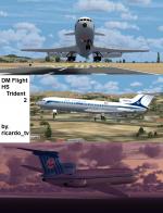
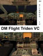
HS Trident 2 Multi Livery Package Updated for FSX
(Category: FSX > Civil Jets)
31.50Mb (14655 downloads)
Special update from DM flight simulations HS Trident 2 package to work in FSX. New lights, smoke effects, engine configurations, views, and HD textures. Trident was the first was the first full auto-land pilot in commercial on a plane and being the first T-Tail 3 engine before the 727, likely his brother. The Trident 2E is the best version of the Trident, having a range of 2.300nmi [for trans Atlantic flight's perfect] taking 115 pax at M.92 max in FL360 ft. Coming with Air France, American, British Airways,BEA, KLM, Lufthansa & White [paintkit]. Please read the IMPORTANT readme file for help or question. Textures and update by ricardo_tv. Model, VC and Livery's by DM Flight Sim. Enjoy
Posted Sep 5, 2012 14:31 by ricardo_tv


