


All Files > Page 1679
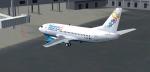
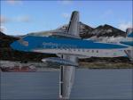
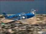
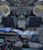
FSX Bahamasair/Xtra Boeing 737-500
(Category: FSX > Civil Jets)
86.32Mb (3647 downloads)
FSX 737-500 new Bahamas Air (C6-BFE) and New Xtra Airlines Bahamasair that has services to KBWI, KRDU, KRIC, KSDF. Painted by BahamasFlyers. Original model by Eric Cantu/FFX adapted for FSX. (No VC.)
Posted Jun 11, 2012 23:26 by Shawn Penn
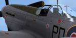
WoP3 P-51D '303' Sqn Textures
(Category: FSX > Payware)
11.94Mb (365 downloads)
This is a repaint for the payware Wings of Power 3 P-51D Mustang by A2A Simulations. The skin depicts personal plane of the last CO of 303 (Polish) Squadron, S/L Witold Lokuciewski. Repaint was done using superb paintkit by Martin Catney (A2A)
Posted Jun 11, 2012 15:17 by Lukasz Kubacki
SAAB 340 Aerolineas Argentinas Textures
(Category: FS2004 > Props)
2.83Mb (487 downloads)
FS2004 Aerolineas Argentinas textures only for the FFG Saab 340. Repaint by Jorge Selandari.
Required files:
required file
Posted Jun 11, 2012 15:00 by Jorge Selandari
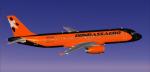
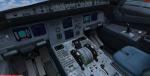
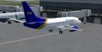
A320 Donbassaero Package
(Category: FSX > Civil Jets)
31.76Mb (1606 downloads)
Project Airbus Donbassaero A320 UR-DAB for FSX. Donbassaero is an airline with its head office in Donetsk International Airport in Donetsk, Ukraine.
Includes default VC, upgraded by Jim Fly and great custom Airbus A320 sounds.
Posted Jun 11, 2012 13:48 by Jim Fly
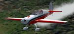
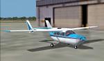
FS2004 Extra-300L SP/HA
(Category: FS2004 > Props)
1.38Mb (743 downloads)
FS2004 Extra-300L SP/HA
The Walter Extra Factory's tandem seater aerobatic plane.
The main gauges builted in the model V.C.
MSFS model designed by Michael Garbers.
Livery, fixed FD mods by George Csillag.
Posted Jun 11, 2012 12:46 by George Csillag
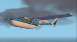
FS2004 Cessna Skymaster Alice Blue Textures
(Category: FS2004 > Props)
0.13Mb (441 downloads)
For use with the C337 by Mike Stone are these textures in a white with two tone blue scheme. These are the textures only, you need sc337.zip to use. Repaint by Don Brynelsen using Mike's paintkit.
Required files:
required file
Posted Jun 11, 2012 12:27 by Don Brynelsen
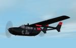
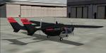
FS2004 Skymaster RNC "Sky Ninja" O-2 Textures
(Category: FS2004 > Props)
0.12Mb (412 downloads)
Inspired by the Ben Dunn comic book "Ninja High School" are these textures for the Cessna O-2 by Mike Stone. In the comic RNC is a Japanese Mega Corporation bent on world Dommination. To this end they employ a variety of equipment ranging from APCs to giant mecha. An aircraft such as this might be equiped with such things as Radar and Communications Disruption gear, Survailance equipment, even EM pulse generators! These are the textures only, you will need Mike's O-2 (Found in his Skymaster package sc337.zip) to use. Repaint by Don Brynelsen using Mike's paintkit.
Required files:
required file
Posted Jun 11, 2012 12:23 by Don Brynelsen
Beech Baron 58 Aerolineas Argentinas Textures
(Category: FS2004 > Props)
0.43Mb (576 downloads)
FS2004 Aerolineas Argentinas Beech BE58, registration LV-JHS. Aerolineas Argentinas new color (ficticial) textures only for the default Beechcraft 58. Repaint by Jorge Selandari.
Posted Jun 11, 2012 08:42 by Jorge Selandari
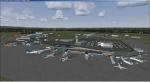
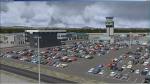
Quebec Jean Lesage International Airport Package
(Category: FSX > Scenery)
33.24Mb (4941 downloads)
Quebec Jean Lesage International Airport (CYQB), Canada, v3.0. Includes terminal building, very accurate AFCAD, les Ailes Quebecoises, hangar AeroPro, hangar Essor Helicopteres, main security gate, taxi station, Air Canada Cargo buildings, fire station, aerocenter, hangar PetroT FBO, lighting on apron 1 and 2, antennas with strobe lights and red lights on mount Belair, hangar Trans-Sol FBO, Avitair-Jazz, Service Aerien Gouvernement du Quebec buildings, hangar Canadian Helicopters, Exeltech, Navcanada installation including the control tower, Groupe Alta, hangar Heli Express, maintenance installation buildings, new hangar for Trans-Sol FBO, parking exit cashier, Aqta Association Quebecoise des Transporteurs Aerien, Batiment des Gens de l'Air, airport administration building, fuel depot, les Cuisine de l'Air catering, fuel pump PetroT, static aircraft, ambulance. By Gilles Boily.
Posted Jun 11, 2012 06:40 by uploader
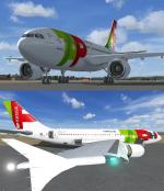
Airbus A310-300 TAP Package
(Category: FSX > Civil Jets)
15.03Mb (8823 downloads)
Model & VC by Thomas Ruth, textures & packed by ricardo_tv.
The Airbus A310 is a medium- to long-range twin-engined widebody jet airliner. Launched in July 1978, it was the second aircraft to enter production by Airbus Industrie, the consortium of European aerospace companies which is now owned by EADS.
Posted Jun 10, 2012 22:00 by ricardo_tv